Rogers, Arkansas
| Rogers, Arkansas | ||
|---|---|---|
| City | ||
|
Downtown Rogers during the 2012 Frisco Festival | ||
| ||
| Motto: "Where Possible Lives"[1] | ||
 Location in Benton County and the state of Arkansas | ||
 Rogers, Arkansas Location in the United States | ||
| Coordinates: 36°19′46″N 94°08′29″W / 36.32944°N 94.14139°WCoordinates: 36°19′46″N 94°08′29″W / 36.32944°N 94.14139°W | ||
| Country | United States | |
| State | Arkansas | |
| County | Benton | |
| Established | 1881 | |
| Incorporated | June 6, 1881[2] | |
| Named for | Captain Charles Warrington Rogers | |
| Government | ||
| • Mayor | Greg Hines (R)[1] | |
| Area | ||
| • City | 37.94 sq mi (98.27 km2) | |
| • Land | 37.89 sq mi (98.14 km2) | |
| • Water | 0.05 sq mi (0.12 km2) | |
| • Urban | 281.81 sq mi (108.81 km2) | |
| Elevation | 1,368 ft (417 m) | |
| Population (2011 census estimates) | ||
| • City | 57,539[3] | |
| • Density | 1,692.0/sq mi (653.28/km2) | |
| • Urban | 172,585 | |
| • Metro | 463,204 | |
| Time zone | Central (CST) (UTC-6) | |
| • Summer (DST) | CDT (UTC-5) | |
| ZIP codes | 72756-72757-72758 | |
| Area code(s) | 479 | |
| FIPS code | 05-60410 | |
| GNIS feature ID | 0054160 | |
| Website | www.rogersarkansas.gov | |


Rogers is a city in Benton County, Arkansas, United States. As of the 2010 census, the city has a population of 55,964 making the state's-eighth largest city. Rogers is located in the northwest portion of the state in the Fayetteville-Springdale-Rogers Metropolitan Area, which is one of the fastest growing areas in the nation and is ranked 109th in terms of population in the United States with 465,776 in 2010 according to the United States Census Bureau.
History

Rogers was named after Captain Charles Warrington Rogers, who was vice-president and general manager of the St. Louis and San Francisco Railway, also known as the Frisco.[4] The town was established in 1881, the year the Frisco line arrived; it was at this time the area residents honored Captain Rogers by naming it for him. The community was incorporated on June 6, 1881.[2]
Rogers was the location of the first Wal-Mart store, whose corporate headquarters is located in neighboring Bentonville, Arkansas. Daisy Outdoor Products, known for its air rifles, has both its headquarters and its Air Rifle Museum in Rogers. In June 2007, BusinessWeek magazine ranked Rogers as 18th in its list of the 25 best affordable suburbs in the American South.[5] And in 2010, CNN Money ranked Rogers # 10 on their list of 100 Best Places to Live.
Historic commerce
The first retail business owned by the Stroud family was a store in Pea Ridge, Arkansas, which was co-owned by Allen Bryant Stroud (1831–1914) and his son Harlan Lafayette (H.L.) Stroud (1858–1950).[6] That business was established prior to 1879 and Allen Stroud also served as postmaster at Pea Ridge for a time.[6] In 1884, H.L. Stroud sold his interest in the Stroud store in Pea Ridge and purchased a dry goods store at the corner of First and Walnut Streets in Rogers which he named Stroud's Mercantile.
In 1887 he brought in his brother Evan Giesen (1868–1952) to serve as manager of his new business.[7] In 1891 H.L. Stroud moved his business into a storefront on the north side of the 100 block of Walnut Street. Stroud's continued to prosper, and in 1899 H.L. built the brick building at 114–116 West Walnut Street.[7] Stroud's continued to be the leading retail business in Rogers up into the 1960s, when in 1962 Sam Walton opened the first location of what would become the retail giant Walmart just seven blocks away. Walton's new store combined with the nationwide movement of retail centers from aged downtowns to malls and shopping centers slowly eroded Stroud's customer base, leading the locally beloved retailer to permanently close in 1993 after 109 years in business. In 1912 the city council formed a commission of local businessmen to facilitate the paving of downtown Rogers. Despite the constant complaints of dusty and muddy streets, and the enthusiastic support of prominent citizens such as Coin Harvey, bickering over the cost and method of paving delayed the start of the project until July, 1924. The downtown area was paved with concrete and overlaid with bricks in rows, changing to a basket weave pattern at the intersections of streets. The work was completed in December, 1924, and the brick pavement remains today, with renovations done to the streets in 2010.[8]
Geography
Rogers is located at 36°19′46″N 94°8′29″W / 36.32944°N 94.14139°W (36.329388, −94.141372).[9] According to the United States Census Bureau, the city has a total area of 33.6 square miles (87 km2), of which 33.5 square miles (87 km2) is land and 0.1 square miles (0.26 km2) (0.15%) is water.
Climate
The climate in this area is characterized by warm, humid summers and generally mild to cool winters. According to the Köppen Climate Classification system, Rogers has a humid subtropical climate, abbreviated "Cfa" on climate maps.[10]
Demographics
| Historical population | |||
|---|---|---|---|
| Census | Pop. | %± | |
| 1890 | 1,265 | — | |
| 1900 | 2,158 | 70.6% | |
| 1910 | 2,820 | 30.7% | |
| 1920 | 3,318 | 17.7% | |
| 1930 | 3,554 | 7.1% | |
| 1940 | 3,550 | −0.1% | |
| 1950 | 4,962 | 39.8% | |
| 1960 | 5,700 | 14.9% | |
| 1970 | 11,050 | 93.9% | |
| 1980 | 17,429 | 57.7% | |
| 1990 | 24,692 | 41.7% | |
| 2000 | 38,829 | 57.3% | |
| 2010 | 55,964 | 44.1% | |
| Est. 2015 | 63,159 | [11] | 12.9% |

As of 2010 Rogers had a population of 55,964. The racial and ethnic composition of the population was 62.0% non-Hispanic white, 1.3% non-Hispanic black, 1.0% Native American, 1.0% Asian Indian, 1.6% other Asian, 0.3% Pacific Islander, 0.1% non-Hispanics of some other race, 3.0% from two or more races and 31.5% Hispanic or Latino.[13]
As of the census[14] of 2000, there were 38,829 people, 14,005 households, and 10,209 families residing in the city. The population density was 1,158.0 people per square mile (447.1/km²). There were 14,836 housing units at an average density of 442.4 per square mile (170.8/km²). The racial makeup of the city was 90.75% White, 0.47% Black or African American, 1.05% Native American, 1.43% Asian, 0.07% Pacific Islander, 9.43% from other races, and 1.80% from two or more races. 19.29% of the population are Hispanic or Latino of any race.
There were 14,005 households out of which 39.4% had children under the age of 18 living with them, 58.4% were married couples living together, 10.1% had a female householder with no husband present, and 27.1% were non-families. 22.2% of all households were made up of individuals and 8.9% had someone living alone who was 65 years of age or older. The average household size was 2.74 and the average family size was 3.21.
In the city the population was spread out with 29.4% under the age of 18, 9.0% from 18 to 24, 31.5% from 25 to 44, 18.3% from 45 to 64, and 11.8% who were 65 years of age or older. The median age was 32 years. For every 100 females there were 95.3 males. For every 100 females age 18 and over, there were 91.5 males.
The median income for a household in the city was $40,474, and the median income for a family was $45,876. Males had a median income of $30,911 versus $22,020 for females. The per capita income for the city was $19,761. About 9.4% of families and 12.8% of the population were below the poverty line, including 17.6% of those under age 18 and 10.1% of those age 65 or over.
Arts and culture

In addition to the Rogers Commercial Historic District, Rogers has numerous properties listed on the National Register of Historic Places with the oldest being the Pea Ridge National Military Park.
Retail
Rogers has two shopping malls: Frisco Station Mall and Pinnacle Hills Promenade.
Sports
Since 2007, Rogers has hosted the Walmart NW Arkansas Championship, a women's professional golf tournament on the LPGA Tour. The 54-hole event is held at Pinnacle Country Club in late June.[15]
Dock Wheeler Park in Rogers houses the largest softball program in the state of Arkansas,[16] while Foerester Park is home to the largest soccer program in the state.[17]
Rogers is also host to the Susan G. Komen Race for the Cure, the most widely known, largest and best-funded breast cancer organization in the United States.[18]
Parks and recreation

Rogers has five large sports parks, 14 neighborhood parks along with a swimming pool, a skateboard and splash park, 26 athletic fields, an activity center, a YMC, and two lakes, along with five golf courses and a trail system totaling over 23 miles (37 km). The NWA Razorback Regional Greenway is a 36-mile (58 km) primarily off-road shared-use trail that connects the region's trail systems to various community attractions. There is also the Rogers Family Aquatic Center.
Other recreational attractions in the surrounding area includes Beaver Lake, Hobbs State Park – Conservation Area and War Eagle Mill & Cavern to the east of Rogers, as well as historical Civil War battlefield, Pea Ridge National Military Park, about 10 miles outside of Rogers.
Government
The mayor of Rogers since 2011 is Greg Hines.[19] The previous mayor, Steve Womack, won election to the United States House of Representatives in 2010 for the seat vacated by John Boozman, now a U.S. senator.
Education
Secondary education
Rogers is home to several public and private school districts and schools including:
- Rogers School District - In 2012, 2013, & 2014, both Rogers and Rogers Heritage high schools were recognized with Silver awards from U.S. News & World Report Top 1,000 High Schools in America and were ranked among the top schools in the state.[20] Additionally, for many years, Rogers High School has been ranked by Newsweek magazine among the top 1,300 schools in the country.[21]
- Rogers High School[22] (Home of the Mountaineers) was the first of the Rogers School District's three high schools, which also includes Rogers Heritage High School and Rogers New Technology High School.[23] RHS and HHS, each with about 2,000 students, are in the state's largest classification (7A).
- Rogers Heritage High School (Home of the War Eagles) is Rogers' second high school that opened in August 2008.[24] The two traditional Rogers high schools offer the same courses and athletic opportunities. They both serve students in grades 9-12.
- Rogers New Technology High School[23] opened in 2013 and is part of the New Tech Network.[25] Like more than 120 New Tech schools around the country, the Rogers school features an instructional approach centered on project-based learning and integrated technology in the classroom.
- Arkansas Arts Academy High School is a public charter school supported by the Arkansas Arts Academy district.
- St. Vincent de Paul is a private Catholic school, the largest private school in Rogers.[26]
Postsecondary education
The city has local campuses of the University of Phoenix, Bryan College,[27] University of Arkansas,[28][29] Harding University,[30] and John Brown University.[31][32]
Other nearby schools and campuses include the University of Arkansas (Fayetteville), Northwest Arkansas Community College (Bentonville),[33] and John Brown University (a Christian school in Siloam Springs).
Media
Television
Rogers is served by the television market based out of Fort Smith and Fayetteville, Arkansas. The big four television stations are KFSM (CBS), KFTA (Fox), KHOG (ABC), and KNWA (NBC).
Radio
Radio stations in the city include:
- KAMO 94.3 FM[34]
- KDUA 96.5 FM[35]
- KHEL 97.3 FM
- KURM 790 AM & FM 100.3[36]
- KXNA 104.9 FM
- KFFK 1390 AM
The daily paper in Rogers is the Rogers Morning News, with a special "A section" dedicated to news just for Rogers and surrounding cities. The rest of the newspaper is the Northwest Arkansas edition of the Arkansas Democrat-Gazette (the "B section" is the regular Democrat-Gazette "A section," complete with front page and masthead).
Infrastructure
Highways
-
_Metric.svg.png) Interstate 49
Interstate 49 -
.svg.png) U.S. Route 62
U.S. Route 62 -
 U.S. Route 71 Business
 -
.svg.png) U.S. Route 71
U.S. Route 71 -
 Arkansas Highway 12
 -
 Arkansas Highway 94
Airports
Rogers Municipal Airport (ROG), also known as Carter Field, is home to Wal-Mart's air fleet. All commercial aviation, however, goes through the Northwest Arkansas Regional Airport (XNA), located about 15 miles west of Rogers in Highfill, Arkansas.
Notable people
- Cecile Bledsoe (b. 1944), Arkansas state senator from Rogers; former member of the Arkansas House of Representatives
- Fay Boozman (1946–2005), a former GOP state senator and thereafter the director of the Arkansas Department of Health during the administration of Governor Mike Huckabee, was also a resident of Rogers.
- Jim R. Caldwell (b. 1936), the first Republican member of the Arkansas State Senate in the 20th century; the minister at the Southside Church of Christ in Rogers during the 1970s.
- Jana Della Rosa (born 1976), Republican member of the Arkansas House of Representatives for Benton and Washington counties since 2015; homemaker in Rogers
- Ryan Hale (born 1975), American football player
- Grant Hodges (born c. 1991), Republican member of the Arkansas House of Representatives for Benton County since 2015[37]
- Robin Lundstrum (born c. 1962), Republican member of the Arkansas House of Representatives for Benton and Washington counties since 2015; former resident of Rogers[38]
- Stephanie Malone (b. 1978), Republican member of the Arkansas House of Representatives from Fort Smith; born in Rogers and graduated from Rogers High School
- Joe Nichols (b. 1976), Country music artist born in Rogers
- Vernon Oxford (b. 1941), Country singer born in Rogers
- Sue Scott (b. 1954), Republican member of the Arkansas House of Representatives from Rogers since 2013
- Titanic Thompson (1892-1974) World famous gambler, golfer, and hustler-grew up in Rogers.
- Sam Walton (1918-1992), founder of Wal-Mart started the first Wal-Mart in Rogers in 1962.
- Steve Womack, was mayor of Rogers before becoming U.S. Representative for Arkansas' 3rd congressional district.
See also
References
- 1 2 "City of Rogers Arkansas". City of Rogers Arkansas. Retrieved September 12, 2012.
- 1 2 "Rogers Arkansas". City-Data.com. Retrieved September 12, 2012.
- ↑ http://www.census.gov/popest/data/cities/totals/2011/files/SUB-EST2011_5.csv
- ↑ "The City of Rogers Arkansas". Rogersarkansas.com. Retrieved 2011-08-20.
- ↑ "The 25 Best Affordable Suburbs in the South". Images.businessweek.com. Retrieved 2011-08-20.
- 1 2 "HSApr04".
- 1 2 http://rogersarkansas.com/museum/photo/stroudhome.asp
- ↑ "Our Historic Brick Streets and New Intersections, by James F. Hales". friendsofrogersmuseum.com. Retrieved 2011-08-29.
- ↑ "US Gazetteer files: 2010, 2000, and 1990". United States Census Bureau. 2011-02-12. Retrieved 2011-04-23.
- ↑ "Rogers, Arkansas Kppen Climate Classification (Weatherbase)". Weatherbase.
- ↑ "Annual Estimates of the Resident Population for Incorporated Places: April 1, 2010 to July 1, 2015". Retrieved July 2, 2016.
- ↑ "Census of Population and Housing". Census.gov. Retrieved June 4, 2015.
- ↑ 2010 general profile of population and housing characteristics of Rogers from the US census
- ↑ "American FactFinder". United States Census Bureau. Retrieved 2008-01-31.
- ↑ "NW Arkansas Championship - #NWAChampionship".
- ↑ http://www.rogersarkansas.com/parks/docwheeler.asp
- ↑ http://www.rogersarkansas.com/parks/foresterpark.asp
- ↑ Gayle A. Sulik (2010). Pink Ribbon Blues: How Breast Cancer Culture Undermines Women's Health. Oxford University Press. pp. 146–150. ISBN 0-19-974045-3. OCLC 535493589.
- ↑ "The City of Rogers Arkansas". Rogersarkansas.com. Retrieved 2011-08-20.
- ↑ "Best High Schools, Arkansas". U.S. News & World Report. Retrieved Aug 20, 2012.
- ↑ http://www.thedailybeast.com/newsweek/2008/05/16/the-top-of-the-class-2008.html
- ↑ "Rogers High School".
- 1 2 "Rogers New Technology High School".
- ↑ "Rogers School District – Index" (PDF). Rogers.k12.ar.us. 2011-05-09. Retrieved 2011-08-20.
- ↑ "New Tech Network". New Tech Network.
- ↑ "St. Vincent de Paul Catholic School".
- ↑ http://www.bryancolleges.edu/
- ↑ "The YOU of A - University of Arkansas".
- ↑ "University of Arkansas".
- ↑ "Harding University - It's Great to be at Harding".
- ↑ "John Brown University - A Private Christian College".
- ↑ "'U.S. News' Ranks JBU No. 1 in the South". John Brown University.
- ↑ "Welcome - myCampus".
- ↑ "NASH FM 94.3".
- ↑ "Padua Media".
- ↑ kurm.net
- ↑ "Grant Hodges". arkansashouse.org. Retrieved April 11, 2015.
- ↑ "Robin Hall Lundstrum". intelius.com. Retrieved April 12, 2015.
External links
| Wikivoyage has a travel guide for Rogers (Arkansas). |
| Wikimedia Commons has media related to Rogers, Arkansas. |
- City of Rogers
- Rogers-Lowell Area Chamber of Commerce
- Benton County
- Rogers Convention & Visitors Bureau
- Encyclopedia of Arkansas History & Culture entry: Rogers (Benton County)
- City-Data.com Comprehensive Statistical Data and more about Rogers
Municipalities and communities of Benton County, Arkansas, United States | ||
|---|---|---|
| Cities | 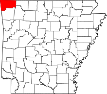 | |
| Towns | ||
| Townships | ||
| CDPs | ||
| Other communities |
| |
| Ghost town | ||
| Footnotes | ‡This populated place also has portions in an adjacent county or counties | |