Beaver, Arkansas
| Beaver, Arkansas | |
|---|---|
| Town | |
|
The "Little Golden Gate Bridge" | |
 Location in Carroll County and the state of Arkansas | |
| Coordinates: 36°28′32″N 93°46′16″W / 36.47556°N 93.77111°WCoordinates: 36°28′32″N 93°46′16″W / 36.47556°N 93.77111°W | |
| Country | United States |
| State | Arkansas |
| County | Carroll |
| Area | |
| • Total | 0.5 sq mi (1.4 km2) |
| • Land | 0.3 sq mi (0.9 km2) |
| • Water | 0.2 sq mi (0.5 km2) |
| Elevation | 932 ft (284 m) |
| Population (2010) | |
| • Total | 100 |
| • Density | 273/sq mi (105.4/km2) |
| Time zone | Central (CST) (UTC-6) |
| • Summer (DST) | CDT (UTC-5) |
| ZIP code | 72613 |
| Area code(s) | 479 |
| FIPS code | 05-04540 |
| GNIS feature ID | 0057351 |
| Website |
www |

Beaver is a town in Carroll County, Arkansas, United States. As of the 2010 census it had a population of 100.[1] The community is located on the White River at the western limits of Table Rock Lake deep in the Ozark Mountains. Located north of Eureka Springs, the small town has been featured in movies for its picturesque scenery. The town is known for the Beaver Bridge, a two-panel suspension bridge over the White River listed on the National Register of Historic Places.
Geography

Beaver is located in northwestern Carroll County at 36°28′32″N 93°46′16″W / 36.47556°N 93.77111°W (36.475495, -93.771170).[2]
According to the United States Census Bureau, the town has a total area of 0.54 square miles (1.4 km2), of which 0.35 square miles (0.9 km2) is land and 0.19 square miles (0.5 km2), or 33.16%, is water.[1]
Highway 187 is the only member of the Arkansas Highway System that serves Beaver. The route leads west 5 miles (8 km) to US Highway 62, which provides access to Eureka Springs to the southeast and Rogers to the west. The Arkansas Highway 23, the Pig Trail Scenic Byway, runs near the town as well, a popular route with tourists and motorcyclists.[3]
Demographics
| Historical population | |||
|---|---|---|---|
| Census | Pop. | %± | |
| 1960 | 24 | — | |
| 1990 | 57 | — | |
| 2000 | 95 | 66.7% | |
| 2010 | 100 | 5.3% | |
| Est. 2015 | 101 | [4] | 1.0% |
2014 Estimate[6] | |||
As of the census[7] of 2000, there were 95 people, 37 households, and 27 families residing in the town. The population density was 271.0 inhabitants per square mile (104.8/km²). There were 43 housing units at an average density of 122.7 per square mile (47.4/km²). The racial makeup of the town was 96.84% White, 2.11% from other races, and 1.05% from two or more races. 2.11% of the population were Hispanic or Latino of any race.
There were 37 households, of which 29.7% had children under the age of 18 living with them, 62.2% were married couples living together, 5.4% had a female householder with no husband present, and 27.0% were non-families. 21.6% of all households were made up of individuals and 8.1% had someone living alone who was 65 years of age or older. The average household size was 2.57 and the average family size was 2.81.
In the town, the population was spread out with 27.4% under the age of 18, 5.3% from 18 to 24, 23.2% from 25 to 44, 29.5% from 45 to 64, and 14.7% who were 65 years of age or older. The median age was 42 years. For every 100 females there were 97.9 males. For every 100 females age 18 and over, there were 97.1 males.
The median income for a household in the town was $23,438, and the median income for a family was $25,417. Males had a median income of $25,417 versus $26,250 for females. The per capita income for the town was $11,665. There were 13.0% of families and 16.2% of the population living below the poverty line, including no one under the age of eighteen and none of those over 64.
Tourism

Beaver contains the Beaver Store Inn, a bed and breakfast and general store, located next to the waterfront town-operated Beaver RV and Camping Park.
Several miles to the south from the town of Beaver was Dinosaur World, a theme park covering 65 acres (26 ha), which had 100 life-size sculptures of dinosaurs and cavemen. It also featured a 40-foot-tall (12 m) statue of King Kong known as the "World's Largest King Kong". The park has been closed since 2005 and is not open to the public
The Beaver Bridge was depicted in the 2005 film Elizabethtown, and a nearby train trestle was featured in The Blue and the Gray.
Climate
The climate is characterized by relatively high temperatures and evenly distributed precipitation throughout the year. The Köppen Climate Classification subtype for this climate is "Cfa" (Humid Subtropical Climate).[8]
| Climate data for Beaver, Arkansas | |||||||||||||
|---|---|---|---|---|---|---|---|---|---|---|---|---|---|
| Month | Jan | Feb | Mar | Apr | May | Jun | Jul | Aug | Sep | Oct | Nov | Dec | Year |
| Average high °C (°F) | 8 (46) |
11 (51) |
16 (61) |
22 (72) |
26 (78) |
29 (85) |
33 (91) |
32 (90) |
27 (81) |
22 (72) |
15 (59) |
9 (49) |
21 (70) |
| Average low °C (°F) | −4 (25) |
−2 (29) |
3 (38) |
9 (48) |
13 (55) |
17 (63) |
19 (67) |
18 (65) |
15 (59) |
9 (49) |
4 (39) |
−2 (29) |
8 (47) |
| Average precipitation cm (inches) | 5 (2) |
7.1 (2.8) |
10.4 (4.1) |
10.7 (4.2) |
12.4 (4.9) |
11.2 (4.4) |
8.4 (3.3) |
9.7 (3.8) |
10.4 (4.1) |
9.4 (3.7) |
9.7 (3.8) |
8.6 (3.4) |
112.8 (44.4) |
| Source: Weatherbase [9] | |||||||||||||
See also
-
 Arkansas portal
References
- 1 2 "Geographic Identifiers: 2010 Demographic Profile Data (G001): Beaver town, Arkansas". U.S. Census Bureau, American Factfinder. Retrieved June 13, 2014.
- ↑ "US Gazetteer files: 2010, 2000, and 1990". United States Census Bureau. 2011-02-12. Retrieved 2011-04-23.
- ↑ General Highway Map, Carroll County, Arkansas (PDF) (Map). 1:62500. Cartography by Planning and Research Division. Arkansas State Highway and Transportation Department. April 9, 2010. Retrieved June 29, 2013.
- ↑ "Annual Estimates of the Resident Population for Incorporated Places: April 1, 2010 to July 1, 2015". Retrieved July 2, 2016.
- ↑ "Census of Population and Housing". Census.gov. Archived from the original on May 11, 2015. Retrieved June 4, 2015.
- ↑ "Annual Estimates of the Resident Population for Incorporated Places: April 1, 2010 to July 1, 2014". Retrieved June 4, 2015.
- ↑ "American FactFinder". United States Census Bureau. Archived from the original on 2013-09-11. Retrieved 2008-01-31.
- ↑ Climate Summary for Beaver, Arkansas
- ↑ "Weatherbase.com". Weatherbase. 2013. Retrieved on August 16, 2013.
External links
Municipalities and communities of Carroll County, Arkansas, United States | ||
|---|---|---|
| Cities | 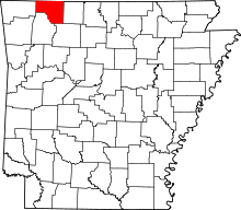 | |
| Towns | ||
| CDP | ||
| Unincorporated communities |
| |
| Ghost towns |
| |
| Townships | ||
| Footnotes | ‡This populated place also has portions in an adjacent county or counties | |