Alberta Highway 60

Alberta Highway 60 shield Alberta Highway 60 Devonian shield

Highway 60
Devonian Way
Route information
Length: 35 km[1] (22 mi)
Major junctions
South end: Hwy 39 east of Calmar
  Hwy 19 at Devon
Hwy 16A at Acheson
North end: Hwy 16 (TCH) (Yellowhead Highway) at Acheson
Location
Specialized
and rural
municipalities:
Leduc County, Parkland County
Towns: Devon
Highway system

Provincial highways in Alberta

Hwy 59Hwy 61

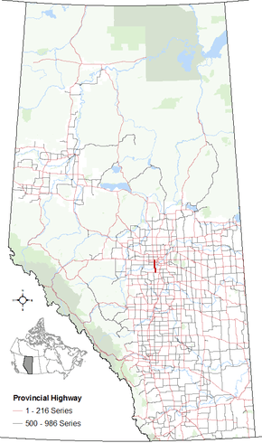
Alberta Provincial Highway No. 60, also named Devonian Way, is a north-south highway in central Alberta, Canada, west of the City of Edmonton. It is often used as a western bypass for travellers wishing to avoid the city. [2][3][1]

Major intersections

From south to north:

Rural/specialized municipalityLocationkmmiDestinationsNotes
Leduc County00.0 Hwy 39 Leduc, Calmar, Drayton ValleyHwy 60 begins
53°15′49.04″N 113°43′53.29″W / 53.2636222°N 113.7314694°W / 53.2636222; -113.7314694 (60 x 39)
Devon85.0 Hwy 19 east Nisku, Beaumont53°20′11.06″N 113°43′55.73″W / 53.3364056°N 113.7321472°W / 53.3364056; -113.7321472 (60 x 19)
116.8Athabasca Avenue53°21′55.9″N 113°44′07.3″W / 53.365528°N 113.735361°W / 53.365528; -113.735361 (60 x Athabasca Ave)
↑ / ↓127.5Devon Bridge across the North Saskatchewan River53°22′12.9″N 113°45′05.8″W / 53.370250°N 113.751611°W / 53.370250; -113.751611 (60 x North Sask River)
Parkland CountyStony Plain I.R. 1352214 Hwy 627 Keephills, EdmontonEnters the Enoch Cree Nation.
53°27′10.520″N 113°45′42.34″W / 53.45292222°N 113.7617611°W / 53.45292222; -113.7617611 (60 x 627)
2918 Hwy 628 Stony Plain, EdmontonLeaves the Enoch Cree Nation.
53°30′40.04″N 113°45′41.71″W / 53.5111222°N 113.7615861°W / 53.5111222; -113.7615861 (60 x 628)
Acheson3220 Hwy 16A Spruce Grove, Stony Plain, Edmonton53°32′25.91″N 113°45′41.84″W / 53.5405306°N 113.7616222°W / 53.5405306; -113.7616222 (60 x 16A)
3522 Hwy 16 (TCH) Spruce Grove, Jasper, EdmontonHwy 60 ends
53°34′07.92″N 113°45′44.42″W / 53.5688667°N 113.7623389°W / 53.5688667; -113.7623389 (60 x 16)
1.000 mi = 1.609 km; 1.000 km = 0.621 mi

References

  1. 1 2 Google (October 31, 2016). "Highway 60 in central Alberta" (Map). Google Maps. Google. Retrieved October 31, 2016.
  2. Provincial Highways Designation Order, Alberta Transportation, p. 9
  3. "2015 Provincial Highway 1-216 Progress Chart" (PDF). Alberta Transportation. March 2015. Archived (PDF) from the original on April 10, 2016. Retrieved October 31, 2016.


This article is issued from Wikipedia - version of the 11/29/2016. The text is available under the Creative Commons Attribution/Share Alike but additional terms may apply for the media files.