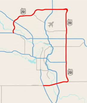
Stoney Trail
| ||||
|---|---|---|---|---|
| Alberta Highway 201 | ||||
 | ||||
| Route information | ||||
| Maintained by Alberta Transportation | ||||
| Length: |
69.4 km[1] (43.1 mi) Planned: 99 km (62 mi) | |||
| History: |
2009 (NW/NE legs open) 2013 (SE leg open) 2021 (SW leg scheduled opening) | |||
| Major junctions | ||||
| Ring road around Calgary | ||||
| North end: |
| |||
|
Glenmore Trail | ||||
| South end: |
| |||
| Location | ||||
| Major cities: | Calgary | |||
| Highway system | ||||
|
Provincial highways in Alberta
| ||||

Stoney Trail, also known by its official designation as Highway 201, is a 69-kilometre (43 mi) freeway in Calgary, Alberta, Canada. Construction of the ring road has been split into five separate segments; the northwest and northeast sections opened in 2009, followed by the southeast section in 2013. Work is currently underway on the second to last segment in southwest Calgary. The majority of this segment will be named Tsuut’ina Trail and must be opened to traffic by May 2022 as per an agreement Alberta signed with the Tsuu T'ina Nation from whom land was purchased for construction. A 5 km (3.1 mi) section of the already existing Glenmore Trail will be upgraded, renamed to Stoney Trail, and incorporated to Highway 201. A final short segment west of the city that will complete the ring still remains; Alberta has postponed construction until at least the early 2020s after completion of the southwest leg. Stoney Trail derives its name from one of the three tribes which make up the Nakoda First Nation - the other two being the Chiniki and the Wesley.
The already completed sections of Stoney Trail are heavily traveled by commuters, and serve as an important bypass around Calgary for the congested 16 Avenue N (Highway 1) and Deerfoot Trail (Highway 2). At its busiest point near Beddington Trail in north Calgary, the freeway carries nearly 80,000 vehicles per day.[2]
Route description
Stoney Trail currently consists of the northern and southeastern sections of the ring road, and, at its completion, will effectively be a freeway that encircles the entire city. The northern and southern sections create a northern and eastern bypass link between Highway 1 (Trans-Canada Highway) and Deerfoot Trail (Highway 2).[3]
History
Planning for the Calgary and Edmonton ring roads started in the 1970s when the province developed some restricted development areas in a corridor of land then mostly outside the developed civic areas for future infrastructure, including high-speed ring-road systems.[4] This land is also known as the Transportation and Utility Corridor (TUC), as land set aside for future road and utility purposes. Land acquisition started in 1974, and by the time the ring road projects were initiated, it had acquired 97% of the lands. The Calgary TUC failed to include a TUC corridor in southwest Calgary between Glenmore Trail and Highway 22X.[5] The City of Calgary is bounded along 37 Street SW by the Tsuu T'ina Nation. The developed areas of the City of Calgary had already reached 37 Street SW around the Glenmore Reservoir inhibiting the ability of the government to impose an RDA. The missing link in the TUC map created uncertainty in the future Southwest Ring Road network which until October 2013 complicated completion of the Southwest Ring Road. However, in 2013 the Tsuu T'ina had another agreement with the province, which was accepted by the nation.
Initial northwest construction

The northwest quadrant of the ring road was the first to be constructed. In the mid-1990s, the province of Alberta built the first segment around the Bow River Bridge connecting Highway 1 with Crowchild Trail. This was subsequently extended to Country Hill Boulevard. In 2003, the province announced finishing the quadrant by extending the ring road 17 km (11 mi) north to link up with Deerfoot Trail. The original design was limited in scope and incorporated two interchanges, one flyover and two signallized intersections with completion scheduled in 2007 at a cost of $250 million. In January 2005, the province announced an increase in scope of the project with the addition of three additional interchanges replacing the existing lights at Crowchild Trail, Country Hills Boulevard and Scenic Acres.[6] Along with increasing costs, the project was delayed and the full extension to Deerfoot Trail was not opened until November 2, 2009, although some sections were opened earlier. The portion of the ring road between Harvest Hills Boulevard and Deerfoot Trail opened to traffic on November 2, 2009. 30,000 to 40,000 vehicles were expected to use this segment daily.[7] Actual peak traffic volumes exceeded 40,000 vpd between Crowchild Trail and Country Hills Boulevard in 2010.[8]
Grading has been completed for a future interchange at 11 Street NE.[9] This road would service undeveloped industrial land bounded to the east by Deerfoot Trail, north by Stoney Trail, west by the CPR right-of-way and south by Country Hills Boulevard. No schedule has been set for the construction of this interchange. The interchange will also provide a road connection north of Stoney Trail.
The northwest ring road opened on November 2, 2009, with traffic signals at Harvest Hills Boulevard but grading was completed for a future possible interchange. On November 25, 2009, the province announced construction of the Harvest Hills Boulevard Interchange to be opening in fall 2010.[10] The cost of the interchange project was $14 million.[11] The interchange opened to traffic in 2010. Grading has been completed for a future interchange at 14 Street NW. At present, there is a right-in-right-out access south of Stoney Trail into the Panorama Hills neighbourhood.[9] No schedule had been set for the construction of this interchange. The interchange will also provide a road connection north of Stoney Trail. In summer 2014, grading began for westbound exit to 14th (northbound only) and southbound 14th entrance ramp to westbound Stoney.
A signalized intersection was initially constructed at Beddington Trail and Symons Valley Road, but it was upgraded to an interchange when the project was finished in 2009. This interchange opened in July 2009, when the segment from Sarcee Trail to Harvest Hills Boulevard was opened a few months ahead of the full extension to Deerfoot Trail.[12] Originally, Alberta Transportation intended only to construct a flyover at Shaganappi Trail, with no connections to the northwest ring road when the project was initiated but was upgraded to an interchange when the project was finished in 2009. This interchange opened in July 2009 when the segment from Sarcee Trail to Harvest Hills Boulevard was opened a few months ahead of the full extension to Deerfoot Trail.[12]
At Sarcee Trail a signalized intersection was initially constructed, but upgraded to an interchange when the project was completed. The segment from Country Hills Boulevard to Sarcee Trail was opened on November 25, 2008, a year ahead of the full extension to Deerfoot Trail.[13] An interchange at Country Hills Boulevard was added to the northwest ring road project in January 2005 to replace the original signallized intersection built when this segment of the ring road was built in the 1990s.[6] The original project scope had this remaining as a signallized intersection. The interchange opened to traffic in September 2008.
A new interchange was announced on January 28, 2005, for Crowchild Trail as part of an upgrade to the $250 million project. Plans to extend the CTrain resulted in changes to the design of the interchange.[6] The Crowchild Interchange was constructed along a pre-existing portion of Stoney Trail, at Crowchild Trail (Original completion Fall 2006). [14] The Crowchild interchange design was modified to include an LRT bridge to allow for the C-Train to be extended west to Tuscany station, and will be built as to not require signallized intersections for the ramps as was initially planned.[15] The Crowchild Interchange fully opened to traffic on September 28, 2011.[16]
In January 2005, an interchange at Tuscany Boulveard/Scenic Acres Link was added.[6][17] The full interchange opened to traffic in the fall of 2009. Following the completion of the Crowchild Trail interchange, the only remaining traffic signals were at the intersection with Nose Hill Drive. Aecom was retained in the spring of 2010 to plan, design and administer construction of this interchange to be open in the fall of 2012.[18] Design and public information delays caused Alberta Transportation to revise its expectations and it was announced that construction of the interchange would commence in early 2011 and be completed in the fall of 2013.[19] However, the tender process was slow to be initiated and it was not until November 17, 2011 that Alberta Transportation announced the Nose Hill Drive interchange would be built by Acciona Infrastructure Canada at a cost of $67 million and be opened to traffic in the fall of 2014.[20]
Northeast leg
The northeast portion of the Stoney Trail ring road, which was originally known as part of the East Freeway, opened to traffic on November 2, 2009, and links 17 Avenue SE (Highway 1A) to an interchange with Deerfoot Trail (Highway 2) on the northern side of Calgary.[21] The roadway runs in a nearly straight line approximately two-thirds of the way between 68 Street NE and 84 Street NE (city limits, Range Road 290) north from 17 Avenue SE, before turning west to the interchange with Deerfoot Trail. In December 2005, the City of Calgary announced it was in talks with the province to expedite construction, and on February 22, 2007 Alberta's Ministry of Infrastructure and Transportation awarded a contract to the Stoney Trail Group public-private partnership consortium (P3) to construct the first stage of the project, as well as to maintain the northwest and northeast sections of the ring road for 30 years following completion. This initial stage of construction began in 2007 and extends Stoney Trail by a length of 21 km (13 mi) from Deerfoot Trail to 17 Avenue SE.[22]
Major interchanges along the northeast route include Métis Trail (which serves as an alternate link to the CrossIron Mills shopping area north of the city, Country Hills Boulevard, McKnight Boulevard, and 16 Avenue NE (Highway 1). A partial cloverleaf interchange was built for the connection to Métis Trail north to Highway 566 and a south road towards the City of Calgary.[23] The City of Calgary opened the extension of Métis Trail between 80 and 96 Avenues NE on October 29, 2011.[24] Grading was completed for a future interchange at 60 Street NE.[25] This interchange is to be completed by others in the future when required, and may also be future right of way for a CTrain extension.[23] On October 12, 2011, 96 Avenue was opened from Stoney Trail west to 60 Street NE, accessible only from the south.[26] McKnight Boulevard currently has an diamond interchange with Stoney Trail. In the future, this will be upgraded into a partial cloverleaf interchange. The project included a large cloverstack interchange at 16 Avenue NE (Highway 1).
Southeast leg
_Interchange_as_of_February_2013.JPG)

_Interchange_February_2013.JPG)

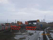


On March 2, 2009, the Alberta Government announced the proceeding with construction of the remaining portion of the East Freeway from 17 Avenue SE to Highway 22X (Marquis of Lorne Trail), as well as improvements to the existing Highway 22X roadway between that location and just east of the Macleod Trail (Highway 2A) interchange. This portion, like the northeastern portion, will be built as a P3.[27] Three firms bid on the contract: Chinook Partnership, SEConnect and SE Calgary Connector Group.[28] The winning bid for the project was submitted by Chinook Roads Partnership for 769 million dollars.[29] Chinook Roads Partnership will also be responsible for maintenance of this portion of the Ring Road, as well as maintenance of Deerfoot Trail (Highway 2) between Highway 22X and Highway 2A for 30 years after construction completion.
Construction on the southeast leg began in the spring of 2010, and was opened on November 22, 2013, almost two months behind schedule.[30] The southeast extension of Stoney Trail also resulted in upgrades to Highway 22X, also known as Marquis of Lorne Trail, between Stoney and Macleod Trail. When the extension opened in 2013, the City officially renamed this portion of 22X as part of Stoney Trail, and the province designated it as part of Highway 201. 22X continues west of Macleod Trail (under the name Spruce Meadows Trail), while the 22X numbering and Marquis of Lorne Trail name have been retained for the roadway that continues east of where Stoney Trail turns north.
An interchange was constructed at Sun Valley Boulevard / Chaparral Boulevard, upgraded from the existing intersection.[31] The original project schedule from June 2010 had interchange construction starting in 2010 with construction of the bridge structure in 2011 towards a phased opening in 2012-2013.[32][33]
The McKenzie Lake Boulevard / Cranston Boulevard intersection was upgraded to a modified diamond interchange; work on this interchange got underway in 2010 and by fall 2011 the bridge structure had already been erected.[34] The interchange design is a modified diamond as this interchange is proximal to the full systems interchange upgrade for the 22X / Deerfoot Trail Interchange.
The interchange design also brings complaints to some commuters and Cranston residents due to the interchange having no access from westbound Stoney Trail to the interchange or the Cranston Avenue / Seton Boulevard interchange on Deerfoot Trail. Commuters also cannot go on to the ramp to Deerfoot Trail southbound and can go only northbound when on the ramp to the highway. The commuters are forced to use the 52 Street interchange to the east. As for the commuters heading to northbound Deerfoot, they have to head to the McKenzie Towne / McKenzie Lake Boulevard interchange or the Seton Boulevard / Cranston Avenue interchange, which both lead to Deerfoot Trail northbound. A large cloverstack interchange was constructed at Deerfoot Trail.[35]
Phase 1 construction involves relocating the existing westbound 22X to northbound Deerfoot and eastbound 22X to southbound Deerfoot access ramps, which will open to traffic in Phase 2. Perhaps the biggest construction detour disruption of the project is the construction of a new temporary eastbound 22X to northbound Deerfoot traffic signalized intersection and access ramp. Opening to traffic in Phase 2, the existing cloverleaf access ramp will be closed. This will add an additional set of lights on 22X on the east side of the existing interchange. This closure is necessary to construct the mainline Deerfoot Trail southbound to 22X eastbound flyover ramps where the existing cloverleaf ramp exists. Phase 2 construction has involved further realignment of access ramps, including the southbound Deerfoot to westbound 22X ramp including tie-in to the new Cranston / Lake Mackenzie Boulevard interchange and related access ramps. Construction of the Deerfoot/22X mainline flyover will also be undertaken. Phase 3 construction completes the revised interchange design with construction of the eastbound 22X to northbound Deerfoot flyover ramp with structures over 22X and Deerfoot Trail as well as completing the new southbound Deerfoot to eastbound 22X cloverleaf ramp connection.
A partial cloverleaf interchange was constructed at 52 Street SE.[36] The original project schedule from June 2010 had this interchange fully opening in the fall of 2013 with traffic on the new structure in the summer of 2012 with construction starting in 2011.[32] The revised project schedule of June 2011 still indicated a fall 2013 opening, the only significant difference is the temporary constructions detour road has been shifted to the east side of the bridge structure from the west side.[33] As of December 2011, construction of the interchange had started with grading of the interchange ramps and piling installation. 52 Street interchange was completed with the rest of the project on November 22, 2013. At 88 Street SE, Stoney Trail intersects with 22X with a full systems interchange now under construction. An existing intersection with 88 Street SE will be removed as it is too close to the proposed interchange.[37]
Heading north on the new East Freeway alignment which is a few hundred meters west of the existing 88 Street SE, at the junction of Highway 22X, the scope of the interchange infringes on the existing 88 Street roadway, necessitating its closure. Grading was also completed for a future interchange at 130 Avenue.[38] A similar partial cloverleaf interchange was constructed at 114 Avenue SE. During construction, 114 Avenue was also re-aligned. The interchange fully opened on November 22, 2013.
Heading north, the ring road will intersect existing Glenmore Trail with a full cloverstack interchange.[39] East- and westbound Glenmore Trail will both have left-turn flyover ramps, whereas this turning movement on the ring road will have cloverleaf ramps. It will be a full systems interchange with no signal lights.
The Southeast Ring Road will then have a partial cloverleaf interchange with Peigan Trail. Peigan Trail will also be extended from 52 Street to Stoney Trail as a result. The road will directly connect to the existing Northeast Ring Road at 17 Avenue SE will be upgraded to a partial cloverleaf interchange.[40]

Similar to 106 Avenue, there are provisions for a future flyover of 61 Avenue to be built by others at a future date. There is no connections to the ring road.
In the fall of 2011, the province held a community consultation meeting on upgrading the Macleod Trail / 22X interchange, which was not included in the southeast ring road project. Pending funding, this will open in the fall of 2014 which includes twinning the bridge over Macleod Trail and twinning an additional bridge structure over the CPR right-of-way. The existing interchange is also only an undivided single lane in each direction along 22X on the bridge structure over Macleod Trail. This is the only single-lane segment of 22X between Deerfoot Trail and the junction with Highway 22 at 15 km (9.3 mi) west of Calgary. This will upgrade the interchange to a full cloverleaf and remove the lights on 22X west of Macleod Trail. This will become an interim full systems interchange with no signallized intersections on the access ramps. The ultimate interchange design includes a stacked interchange with flyovers from westbound 22X to southbound Macleod Trail and northbound Macleod to westbound 22X.[41] The ultimate interchange design was predicated on the traffic volumes associated with the Southwest Calgary Ring Road and was to have been built as part of the Southwest Calgary Ring Road project. With the Tsuu T'ina vote of June 30, 2009 rejecting the ring road agreement putting uncertainty back in the Southwest Ring Road project, the construction of the ultimate interchange configuration has been deferred.
This interchange is further complicated by the fact it contains a right in right out access into the adjacent Shawnessy Town Center regional commercial area. At present, traffic can exit onto the interchange access ramps allowing egress to eastbound and westbound Highway 22X. Reduced access from the Shawnessy Town Center will be maintained but only onto the southbound Macleod to westbound 22X ramp.[42]
Southwest leg
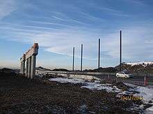
The final leg of the freeway is currently under construction following a land transfer agreement[43] with the Tsuu T'ina First Nation. Plans call for the road to be initially built as a 4-6 lane expressway to be completed by October 1, 2021.[44] with the ability to easily upgrade the corridor to the 'ultimate' stage (to be completed by 2035) as a 16 lane freeway with express and collector lanes.
Planned upgrades for the Highway 22X or Spruce Meadows Trail SW portion of the Southwest Calgary Ring Road include upgrading Highway 22X west of Macleod Trail to freeway status. These three interchange upgrades along with the Highway 22X / Macleod Trail Interchange upgrades were part of the Southwest Calgary Ring Road project which was to be completed with the successful agreement with the Tsuu T'ina Nation on the contentious Anderson Road to Glenmore Trail segment. With the acceptance of the agreement on October 24, 2013, the 22X interchange upgrades will be constructed with the rest of the Southwest Ring Road Project. Highway 22X/Southwest Calgary Ring Road will retain connectivity with 6 Street SW which will be upgraded to partial cloverleaf interchanges. The close proximity of 6 Street SW to Macleod Trail will necessitate some shared access ramps.[42] Highway 22X/Southwest Calgary Ring Road will also retain connectivity with James McKevitt Road upgrading to a partial cloverleaf interchange.[42]
The existing intersection of 24 Street with 22X will be removed when the Southwest Calgary Ring Road is constructed as this road is just east of the future junction of 22X and the future north-south alignment of the Southwest Calgary Ring Road.[45] A new full systems interchange built at 22X and the new alignment for the northwest-southeast segment of the Southwest Ring Road (Sarcee Trail Extension) to Anderson Road.[45]
The existing intersection and 37 Street would be removed when the Southwest Calgary Ring Road is constructed as this road is just west of the future junction of 22X and the future north-south alignment of the Southwest Calgary Ring Road (Sarcee Trail Extension).[45]At present 162 Avenue does not connect with either the future Southwest Ring Road ROW or 37 Street SW. When the Southwest Ring Road is built, 162 Avenue will be extended west to connect up with the Ring Road. The future interchange will be a partial cloverleaf.[46]
Future
West leg
Planning for construction of the final segment of Stoney Trail, which will link from the current southern terminus at Highway 1 to Highway 8 is currently in progress. Construction will likely not begin until the early 2020s after all construction on the southwest segment is completed in 2022.[47] This portion of the freeway will require additional bridge structures to be constructed on the 16 Avenue interchange, in addition to new overpasses and flyovers built at Old Banff Coach Road, Bow Trail (12 Avenue SW), 17 Avenue SW, and Glenmore Trail (Highway 8). The proposed alignment for this portion of the expressway will run south from its current terminus through the Paskapoo slopes on the west side of Canada Olympic Park, then adjacent to the communities of Cougar Ridge, West Springs, Aspen Woods, and Springbank Hill to the east of 101 Street SW, and ending with an interchange at Highway 8.[48][49]
Exit list
Going clockwise:
| Location | km[1] | mi | Exit | Destinations | Notes | ||
|---|---|---|---|---|---|---|---|
| Calgary | 0.0 | 0.0 | 99 | Cloverstack interchange Continuation of Hwy 22X unsigned concurrency 50°54′0″N 113°58′31″W / 50.90000°N 113.97528°W | |||
| 1.2 | 0.75 | 1 | McKenzie Lake Boulevard / Cranston Boulevard | Diamond interchange Eastbound exit, westbound entrance Southbound exit, northbound entrance from Deerfoot Trail 50°53′50″N 113°59′31″W / 50.89722°N 113.99194°W | |||
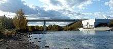
| 2.5 | 1.6 | Crosses the Bow River — 50°53′40″N 114°0′35″W / 50.89444°N 114.00972°W | |||||
| 3.6 | 2.2 | 3 | Sun Valley Boulevard / Chaparral Boulevard | Diamond interchange Future partial cloverleaf interchange 50°53′34″N 114°1′33″W / 50.89278°N 114.02583°W | |||
| 5.7 | 3.5 | 5 | Partial cloverleaf interchange with traffic signals West end of Hwy 22X unsigned concurrency Future cloverstack[50] 50°53′33″N 114°4′43″W / 50.89250°N 114.07861°W | ||||
| South terminus of Stoney Trial • Becomes South end of future Southwest leg | |||||||
| 6.9 | 4.3 | 6 Street SW / Sheriff King Street | At grade; traffic signals Future partial cloverleaf interchange[50] (eastbound exit; westbound entrance) 50°53′33″N 114°4′21″W / 50.89250°N 114.07250°W | ||||
| 8.4 | 5.2 | James Mckevitt Road / Spruce Meadows Way – Spruce Meadows | At-grade; split intersection (westbound traffic signals) Future partial cloverleaf interchange[51] 50°53′35″N 114°5′38″W / 50.89306°N 114.09389°W | ||||
| 9.2 | 5.7 | Tournament Lane – Spruce Meadows | At-grade; split intersection Future intersection closure[51] 50°53′36″N 114°6′19″W / 50.89333°N 114.10528°W | ||||
| 10.1 | 6.3 | 24 Street SW | At-grade; split intersection Future intersection closure[51] 50°53′37″N 114°7′2″W / 50.89361°N 114.11722°W | ||||
| 10.7 | 6.6 | Future stack interchange[51] Future Stoney Trail will turn north 50°53′37″N 114°7′16″W / 50.89361°N 114.12111°W | |||||
| Roadway currently follows Hwy 22X west • No present access | |||||||
| 12.1 | 7.5 | 162 Avenue SW | Future partial cloverleaf interchange[52] 50°54′23″N 114°7′35″W / 50.90639°N 114.12639°W | ||||
| 13.7 | 8.5 | Becomes 37 Street SW | |||||
| Fish Creek Boulevard | At grade; traffic signals Future partial cloverleaf interchange[52] 50°55′15″N 114°7′55″W / 50.92083°N 114.13194°W | ||||||
| 14.8 | 9.2 | Crosses Fish Creek — 50°55′44″N 114°8′25″W / 50.92889°N 114.14028°W | |||||
| 15.6 | 9.7 | 130 Avenue SW | At grade; traffic signals Future half-diamond interchange[53] (northbound exit; southbound entrance) 50°56′9″N 114°8′24″W / 50.93583°N 114.14000°W | ||||
| 17.2 | 10.7 | Anderson Road / Bull Head Road | At grade; traffic signals Future stack interchange[53] 50°57′1″N 114°8′21″W / 50.95028°N 114.13917°W | ||||
| Roadway currently follows Anderson Road east • No present access | |||||||
| Tsuu T'ina Nation No. 145 | 20.4 | 12.7 | 90 Avenue SW / Southland Drive | Future partial cloverleaf interchange[54] 50°58′33″N 114°9′28″W / 50.97583°N 114.15778°W | |||
| 22.4 | 13.9 | Crosses the Elbow River — 50°59′33″N 114°10′1″W / 50.99250°N 114.16694°W | |||||
| 23.4 | 14.5 | Strathcona Street | Future half-diamond interchange[55] (northbound exit; southbound entrance) 51°0′4″N 114°9′53″W / 51.00111°N 114.16472°W | ||||
| Calgary | 24.0 | 14.9 | Glenmore Trail / Sarcee Trail | At grade; traffic signals Future stack interchange[55] Future Stoney Trail turns west 51°0′21″N 114°9′59″W / 51.00583°N 114.16639°W | |||
| Becomes | |||||||
| 24.7 | 15.3 | Westhills Way | Future half-diamond interchange[55] (eastbound exit; westbound entrance) 51°0′32″N 114°10′26″W / 51.00889°N 114.17389°W | ||||
| 26.3 | 16.3 | 69 Street SW / Discovery Ridge Boulevard | At grade; traffic signals Future partial cloverleaf interchange[56] 51°0′51″N 114°11′43″W / 51.01417°N 114.19528°W | ||||
| 27.0 | 16.8 | Lower Springbank Road | At grade Future intersection closure[56] 51°1′2″N 114°12′13″W / 51.01722°N 114.20361°W | ||||
| 29.3 | 18.2 | Future stack interchange[57] Future Stoney Trail will turn north 51°1′23″N 114°13′30″W / 51.02306°N 114.22500°W | |||||
| Roadway currently follows Hwy 8 west • No present access North end of future Southwest leg • South end of future West leg | |||||||
| 31.3 | 19.4 | 17 Avenue SW | Future half-diamond interchange[57] (northbound exit; southbound entrance) 51°2′16″N 114°13′56″W / 51.03778°N 114.23222°W | ||||
| 32.9 | 20.4 | Bow Trail | Future partial cloverleaf interchange[58] 51°3′7″N 114°13′39″W / 51.05194°N 114.22750°W | ||||
| 34.5 | 21.4 | Old Banff Coach Road to | Future partial cloverleaf interchange[58] (southbound exit; northbound entrance) 51°4′1″N 114°13′40″W / 51.06694°N 114.22778°W | ||||
| 36.0 | 22.4 | North terminus of Stoney Trial • North end of future West leg | |||||
| 36 | Semi-directional T interchange Future Cloverstack interchange[59] 51°5′19″N 114°13′55″W / 51.08861°N 114.23194°W | ||||||
| 37.1 | 23.1 | Crosses the Bow River — 51°5′53″N 114°13′56″W / 51.09806°N 114.23222°W | |||||
| 38.2 | 23.7 | 38 | Nose Hill Drive | Partial cloverleaf interchange 51°6′22″N 114°13′28″W / 51.10611°N 114.22444°W | |||
| 39.6 | 24.6 | 40 | Scenic Acres Link / Tuscany Boulevard | Partial cloverleaf interchange 51°7′6″N 114°13′50″W / 51.11833°N 114.23056°W | |||
| 41.1 | 25.5 | 41 | Cloverstack interchange 51°7′52″N 114°13′40″W / 51.13111°N 114.22778°W | ||||
| 43.4 | 27.0 | 43 | Country Hills Boulevard | Partial cloverleaf interchange Stoney Trail turns east 51°8′41″N 114°12′12″W / 51.14472°N 114.20333°W | |||
| 46.3 | 28.8 | 46 | Sarcee Trail | Diamond cloverleaf interchange 51°9′7″N 114°9′56″W / 51.15194°N 114.16556°W | |||
| 48.1 | 29.9 | 48 | Shaganappi Trail | Partial cloverleaf interchange 51°9′10″N 114°8′26″W / 51.15278°N 114.14056°W | |||
| 49.9 | 31.0 | 50 | Beddington Trail / Symons Valley Road to | Partial cloverleaf interchange 51°9′24″N 114°6′58″W / 51.15667°N 114.11611°W | |||
| 52.5 | 32.6 | 52 | 14 Street NW | Right-in/right-out Future partial cloverleaf interchange 51°10′26″N 114°5′33″W / 51.17389°N 114.09250°W | |||
| 54.2 | 33.7 | 54 | Harvest Hills Boulevard / Centre Street N | Partial cloverleaf interchange 51°10′25″N 114°4′8″W / 51.17361°N 114.06889°W | |||
| 56.5 | 35.1 | 11 Street NE | Grading only Future partial cloverleaf interchange 51°10′32″N 114°2′11″W / 51.17556°N 114.03639°W | ||||
| 59.0 | 36.7 | 60 | Cloverstack interchange 51°10′33″N 114°0′3″W / 51.17583°N 114.00083°W | ||||
| 61.2 | 38.0 | 62 | Métis Trail | Partial cloverleaf interchange 51°10′32″N 113°58′10″W / 51.17556°N 113.96944°W | |||
| 63.0 | 39.1 | 60 Street NE | Grading only Future diamond interchange Stoney Trail turns south 51°10′32″N 113°56′40″W / 51.17556°N 113.94444°W | ||||
| 67.2 | 41.8 | 68 | Country Hills Boulevard to | Partial cloverleaf interchange 51°9′16″N 113°55′16″W / 51.15444°N 113.92111°W | |||
| 69.2 | 43.0 | 70 | 96 Avenue NE (future Airport Trail) | Partial diamond interchange (northbound exit; southbound entrance) Future partial cloverleaf interchange 51°8′11″N 113°55′17″W / 51.13639°N 113.92139°W | |||
| 73.6 | 45.7 | 74 | McKnight Boulevard | Diamond interchange Future partial cloverleaf interchange 51°5′48″N 113°55′7″W / 51.09667°N 113.91861°W | |||
| 76.9 | 47.8 | 78 | Cloverstack 51°4′1″N 113°55′14″W / 51.06694°N 113.92056°W | ||||
| 80.1 | 49.8 | 81 | 17 Avenue SE (Former Hwy 1A) | Partial cloverleaf interchange 51°2′16″N 113°55′16″W / 51.03778°N 113.92111°W | |||
| 82.6 | 51.3 | 84 | Peigan Trail | Partial cloverleaf interchange 51°0′49″N 113°55′18″W / 51.01361°N 113.92167°W | |||
| 86.6 | 53.8 | 88 | Glenmore Trail to | Partial cloverleaf interchange Future cloverstack interchange 50°58′47″N 113°55′18″W / 50.97972°N 113.92167°W | |||
| 90.1 | 56.0 | 90 | 114 Avenue SE | Partial cloverleaf interchange 50°57′2″N 113°55′18″W / 50.95056°N 113.92167°W | |||
| 92.4 | 57.4 | 130 Avenue SE | Grading only Future half diamond interchange (southbound exit; northbound entrance) 50°55′43″N 113°55′13″W / 50.92861°N 113.92028°W | ||||
| 94.6 | 58.8 | 96 | Cloverstack interchange Stoney Trail turns west East end of Hwy 22X unsigned concurrency 50°54′32″N 113°54′38″W / 50.90889°N 113.91056°W | ||||
| 97.3 | 60.5 | 97 | Westbound access to Cranston and Auburn Bay Partial cloverleaf interchange 50°54′18″N 113°56′48″W / 50.90500°N 113.94667°W | ||||
| 99.3 0.0 | 61.7 0.0 | 99 | Cloverstack interchange 50°54′0″N 113°58′31″W / 50.90000°N 113.97528°W | ||||
1.000 mi = 1.609 km; 1.000 km = 0.621 mi
| |||||||
See also
References
- 1 2 Google (December 1, 2016). "Length of Stoney Trail" (Map). Google Maps. Google. Retrieved December 1, 2016.
- ↑ "Alberta Highways 1 to 986 - Traffic Volume History 2006 - 2015" (PDF). Alberta Transportation. February 19, 2016. p. 100. Retrieved October 8, 2016.
- ↑ "Deerfoot Trail construction wraps up busy year". Alberta Transportation. November 3, 2010. Archived from the original on March 26, 2015. Retrieved December 19, 2010.
- ↑ Government of Alberta (2009-11-02). "Transportation and Utilities Corridor - Introduction". Retrieved December 11, 2011.
- ↑ Government of Alberta (2009-11-02). "Transportation and Utilities Corridor - Calgary TUC Map". Retrieved December 11, 2011.
- 1 2 3 4 Alberta Transportation (2005). "Innovative Planning means new Interchanges to Stoney Trail". Retrieved November 27, 2010.
- ↑ CBC News (2009-11-02). "Northern leg of Calgary ring road opens". Retrieved November 2, 2009.
- ↑ Alberta Transportation (2010). "Alberta Highways 1 to 986 - Traffic Volume Statistic Report 2010" (PDF). Retrieved November 27, 2010.
- 1 2 Alberta Transportation (2010). "Stoney Trail Corridor - Trans Canada Highway to Deerfoot Trail" (PDF). Retrieved December 5, 2011.
- ↑ Alberta Transportation News Release (2009). "Lights go out at Harvest Hills Boulevard in Calgary". Retrieved December 5, 2011.
- ↑ Alberta Transportation News Release (2010). "Road Work rolls out in Calgary and Area". Retrieved December 5, 2011.
- 1 2 Alberta Transportation News Release (2009). "Portion of Stoney Trail NW Opens in Calgary". Retrieved December 10, 2011.
- ↑ Alberta Transportation News Release (2008). "Portion of Stoney Trail NW Opens in Calgary". Retrieved December 10, 2011.
- ↑ Alberta Transportation (2008). "Stoney Trail/Crowchild Trail Interchange Spring 2008 Project Update" (PDF). Retrieved November 27, 2010.
- ↑ Alberta Transportation (2010). "Stoney Trail / Crowchild Trail Interchange". Retrieved November 27, 2010.
- ↑ Alberta Transportation Travellors Advisory (2011). "Signal lights removed from Stoney Trail-Crowchild Trail interchange in Calgary". Retrieved November 17, 2011.
- ↑ Alberta Transportation News Release (2008). "Scenic Acres Link NW Re-opens to traffic". Retrieved December 10, 2011.
- ↑ Alberta Transportation Project Update (2010). "Stoney Trail/Nose Hill Drive Interchange Spring 2010 Project Update" (PDF). Retrieved November 23, 2011.
- ↑ Alberta Transportation (2010). "Stoney Trail / Nose Hill Drive Interchange". Retrieved November 27, 2010.
- ↑ Alberta Transportation News Release (2011). "Interchange Replaces last set of lights on Calgary Ring Road". Retrieved November 17, 2011.
- ↑ Alberta Transportation: Stony Trail Extension Northeast Freeway
- ↑ Alberta Transportation (2007). "Northeast Calgary ring road construction starts in spring".
- 1 2 Alberta Transportation. "Northeast Stoney Trail - 60 Street NE to Deerfoot Trail" (PDF). Retrieved November 28, 2011.
- ↑ City of Calgary (2011). "Métis Trail Extension 80 Avenue NE to 96 Avenue NE". Retrieved November 25, 2011.
- ↑ Alberta Transportation. "Northeast Stoney Trail - 60 Street NE to Deerfoot Trail" (PDF). Retrieved November 28, 2011.
- ↑ City of Calgary (2011). "96 Avenue NE 60 St NE. to Stoney Trail". Retrieved November 28, 2011.
- ↑ Alberta Transportation (2009). "Southeast Calgary ring road drives out of the starting blocks". Retrieved March 21, 2009.
- ↑ Alberta Transportation (2009). "Three Firms to bid for Southeast Calgary Ring Road". Retrieved November 22, 2011.
- ↑ Alberta Transportation (2010). "Stoney Trail in Calgary Drives Forward". Retrieved November 22, 2011.
- ↑ City of Calgary (2007). "City of Calgary: Mahogany Community Plan June 2007" (PDF). Retrieved January 27, 2008.
- ↑ Government of Alberta (2008). "Government of Alberta: 6th St SW to Deerfoot Trail SE - Recommended Stage 1 Roadway Alignments and Interchange Configuration" (PDF). Retrieved November 10, 2011.
- 1 2 Chinook Roads Partnership/Government of Alberta Infrastructure and Transportation (2010). "Chinook Roads Partnership: Mackenzie Lake Boulevard/Cranston Boulevard SE" (PDF). Retrieved December 17, 2011.
- 1 2 Chinook Roads Partnership/Government of Alberta Infrastructure and Transportation (2011). "Chinook Roads Partnership: Mackenzie Lake Boulevard/Cranston Boulevard SE" (PDF). Retrieved December 17, 2011.
- ↑ Government of Alberta Infrastructure and Transportation (2006). "Government of Alberta: Marquis of Lorne Trail between Mackenzie Lake Boulevard to Deerfoot Trail SE" (PDF). Retrieved November 10, 2011.
- ↑ Alberta Transportation (2006). "Government of Alberta: Marquis of Lorne Trail between Mackenzie Lake Boulevard to Deerfoot Trail SE." (PDF). Retrieved November 10, 2011.
- ↑ Government of Alberta Infrastructure and Transportation (2006). "Government of Alberta: Calgary East Ring Road between Marquis of Lorne Trail and 52nd St. SE." (PDF). Retrieved November 10, 2011.
- ↑ Government of Alberta Infrastructure and Transportation (2006). "Government of Alberta: Calgary East Ring Road between 52 Street SE and 88 Street SE" (PDF). Retrieved November 16, 2011.
- ↑ Government of Alberta Infrastructure and Transportation (2006). "Government of Alberta: Calgary East Ring Road between 130 Avenue SE and Marquis of Lorne Trail" (PDF). Retrieved 2011-11-16.
- ↑ Government of Alberta Infrastructure and Transportation (2006). "Government of Alberta: Calgary East Ring Road between 61 Avenue SE and 130 Avenue SE" (PDF). Retrieved November 16, 2011.
- ↑ Government of Alberta Infrastructure and Transportation (2006). "Government of Alberta: Calgary East Ring Road between Peigan Trail SE and Memorial Drive SE" (PDF). Retrieved November 16, 2011.
- ↑ Government of Alberta (2009). "Government of Alberta: Southwest Calgary Ring Road to Macleod Trail Interchange Plan - Recommended Stage 1 Roadway Alignment and Interchange Configuration" (PDF). Retrieved December 18, 2011.
- 1 2 3 Government of Alberta (2011). "Government of Alberta: Stoney Trail (Highway 22X) and Macleod Trail Interchange Plan" (PDF). Retrieved November 10, 2011.
- ↑ "2013 Agreement". Ministry of Transportation. Government of Alberta. Retrieved 19 August 2016.
- ↑ "Calgary Ring Road Update". Government of Alberta. Retrieved 19 August 2016.
- 1 2 3 "Southwest Calgary Ring Road to Macleod Trail - Recommended Stage 1 Roadway Alignment and Interchange Configuration to 2035 Time Horizon" (PDF). Government of Alberta. May 2009. Retrieved 2011-11-14.
- ↑ "Southwest Calgary Ring Road to Macleod Trail - Recommended Stage 1 Roadway Alignment and Interchange Configuration to 2035 Time Horizon" (PDF). Government of Alberta. May 2009. Retrieved 2011-12-09.
- ↑ Alberta Transportation (2008). "Stoney Trail Extension - Highway 8 to Highway 1". Retrieved December 15, 2008.
- ↑ Alberta Transportation (2008). "Trans Canada Highway to Bow Trail" (PDF). Retrieved December 15, 2008.
- ↑ Alberta Transportation (2008). "Bow Trail SE to Highway 8" (PDF). Retrieved December 15, 2008.
- 1 2 "6 Street SW / Macleod Trail Interchanges" (PDF). Southwest Calgary Ring Road. Alberta Transportation. October 2015. Retrieved December 1, 2016.
- 1 2 3 4 "Highway 22X / James McKevitt Road SW Interchanges" (PDF). Southwest Calgary Ring Road. Alberta Transportation. October 2015. Retrieved December 1, 2016.
- 1 2 "Fish Creek Boulevard SW / 162 Avenue SW Interchanges" (PDF). Southwest Calgary Ring Road. Alberta Transportation. October 2015. Retrieved December 1, 2016.
- 1 2 "Anderson Road SW / 130 Avenue SW Interchanges" (PDF). Southwest Calgary Ring Road. Alberta Transportation. October 2015. Retrieved December 1, 2016.
- ↑ "90 Avenue SW Interchange" (PDF). Southwest Calgary Ring Road. Alberta Transportation. October 2015. Retrieved December 1, 2016.
- 1 2 3 "Sarcee Trail SW / Glenmore Trail SW / Strathcona Street Interchanges" (PDF). Southwest Calgary Ring Road. Alberta Transportation. October 2015. Retrieved December 1, 2016.
- 1 2 "69 Street SW / Discovery Ridge Boulevard SW Interchange" (PDF). Southwest Calgary Ring Road. Alberta Transportation. October 2015. Retrieved December 1, 2016.
- 1 2 "17 Avenue SW / Highway 8 Interchanges" (PDF). West Calgary Ring Road. Alberta Transportation. October 2015. Retrieved December 1, 2016.
- 1 2 "Old Banff Coach Road SW / Bow Trail SW Interchanges" (PDF). West Calgary Ring Road. Alberta Transportation. October 2015. Retrieved December 1, 2016.
- ↑ "TransCanada Highway / Valley Ridge Boulevard NW Interchanges" (PDF). West Calgary Ring Road. Alberta Transportation. October 2015. Retrieved December 1, 2016.
External links
- West Calgary Ring Road
- Southwest Calgary Ring Road
- South Calgary Ring Road
- 2010 Provincial Highways 1 - 216 Series Progress Chart (map, 8 MB) by Alberta Transportation.