Alberta Highway 23
| ||||
|---|---|---|---|---|
 | ||||
| Route information | ||||
| Length: | 138 km (86 mi) | |||
| Major junctions | ||||
| South end: |
| |||
|
| ||||
| North end: |
| |||
| Location | ||||
| Specialized and rural municipalities: | Lethbridge County, Vulcan County, Foothills No. 31 M.D. | |||
| Towns: | Vulcan, High River | |||
| Villages: | Barons, Carmangay, Champion | |||
| Highway system | ||||
|
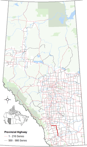
Provincial highways in Alberta
| ||||

Alberta Provincial Highway No. 23 is a highway in southern Alberta, Canada, east of Highway 2 and serves as an alternate route between the Cities of Calgary and Lethbridge.[1]
It begins at the Crowsnest Highway (Highway 3) 21 km (13 mi)[1] west of the City of Lethbridge near the Hamlet of Monarch and shares a short concurrency with Highway 3A. It continues north and passes by the Villages of Nobleford, Barons, and Carmangay before it crosses the Little Bow River. It continues north, passing through the Hamlet of Kirkcaldy and Town of Vulcan before it meets the junction of Highway 24 and Highway 542.[1] From there, the highway turns west and passes near just north of the Hamlet of Brant and just south of the Hamlet of Blackie before skirting Frank Lake. It intersects Highway 2 and enters the Town of High River along 12 Avenue SE before becoming Highway 2A at 10 Street SE.[2][3]
Major intersections
| Rural/specialized municipality | Location | km[1] | mi | Destinations | Notes | ||
|---|---|---|---|---|---|---|---|
| Lethbridge County | Monarch | 0 | 0.0 | Hwy 3A concurrency begins Westbound exit, eastbound entrance | |||
| 2 | 1.2 | Interchange Hwy 3A concurrency ends Hwy 23 southbound access to Hwy 3 | |||||
| Nobleford | 11 | 6.8 | Roundabout | ||||
| Barons | 24 | 15 | Hwy 520 concurrency begins | ||||
| | 29 | 18 | Hwy 520 concurrency ends | ||||
| Vulcan County | Carmangay | 40 | 25 | Urban Approach Road 161 east | Carmangay access road. | ||
| | 42 | 26 | Crosses Little Bow River | ||||
| Champion | 54 | 34 | 2 Avenue N | ||||
| | 56 | 35 | |||||
| Kirkcaldy | 67 | 42 | Township Road 162 | Kirkcaldy access road. | |||
| Vulcan | 73 | 45 | |||||
| 75 | 47 | Centre Street | |||||
| | 93 | 58 | Hwy 23 branches west. | ||||
| M.D. of Foothills No. 31 | | 111 | 69 | ||||
| | 119 | 74 | |||||
| Town of High River | 136 | 85 | Interchange | ||||
| Becomes 12 Avenue SE | |||||||
| 138 | 86 | 10 Street SE | Hwy 23 ends | ||||
| Continues as | |||||||
1.000 mi = 1.609 km; 1.000 km = 0.621 mi
| |||||||
References
- 1 2 3 4 Google (November 4, 2016). "Highway 23 in Alberta" (Map). Google Maps. Google. Retrieved November 4, 2016.
- ↑ "2015 Provincial Highway 1-216 Progress Chart" (PDF). Alberta Transportation. March 2015. Archived (PDF) from the original on April 10, 2016. Retrieved October 12, 2016.
- ↑ Alberta Official Road Map (Map) (2016 ed.). Alberta Culture and Tourism. § M–5, M–6, N–6.