Alberta Highway 8
| ||||
|---|---|---|---|---|
|
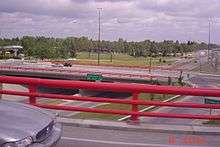
Highway 8 in south Calgary. The blue segment of Glenmore Trail is not signed as Highway 8. | ||||
| Highway 8 | ||||
| Length: | 31.4 km[1] (19.5 mi) | |||
| West end: |
| |||
| East end: |
| |||
| Glenmore Trail | ||||
| Length: | 24.4 km[2] (15.2 mi) | |||
| West end: | 101 Street SW, Calgary | |||
| Major junctions: |
Sarcee Trail Crowchild Trail Macleod Trail | |||
| East end: |
| |||
| Location | ||||
| Specialized and rural municipalities: | Rocky View County | |||
| Major cities: | Calgary | |||
| Highway system | ||||
|
Provincial highways in Alberta
| ||||


Highway 8 is an east-west route in southern Alberta, Canada which connects Highway 22 in Rocky View County just north of the Townsite of Redwood Meadows to Deerfoot Trail (Highway 2) in Calgary. In Rocky View County, the highway initially parallels the Elbow River before entering Calgary where it becomes a heavily travelled expressway known as Glenmore Trail, named after the reservoir which it crosses. Glenmore Trail is a busy freeway between Richard Street in southwest Calgary to Ogden Road in the southeast, carrying nearly 160,000 vehicles per weekday at its busiest point placing it second only to Deerfoot Trail as the busiest road in Western Canada. East of Deerfoot Trail, Glenmore Trail continues east providing a key link to Stoney Trail, after which traffic levels decrease and it becomes Highway 560 enroute to Langdon.
Route description
Rocky View County
Highway 8 begins west of Calgary in a rural area of Rocky View County.[3] Its terminus is a roundabout with Highway 22 in the Elbow River valley after which it proceeds east, paralleling the Elbow River through agricultural lands as a two-lane rural highway with a posted speed limit of 100 km/h (62 mph).[4][5] In Rocky View County the highway is alternately designated as Township Road 241, and after it crosses Range Road 32 the speed limit reduces to 80 km/h (50 mph) as the highway bisects a suburban residential area. After a signalized intersection at Clearwater Drive / Lott Creek Boulevard, the highway then descends into the Elbow River valley before veering slightly north to crosses the river, entering Calgary city limits almost immediately thereafter at 101 Street SW.[3]
Glenmore Trail
In Calgary, Highway 8 is designated as Glenmore Trail and retains this designation, at a speed limit of 80 km/h, until Deerfoot Trail. It first passes between the communities of Discovery Ridge and Springbank Hill. South of Signal Hill it meets Sarcee Trail and becomes a major divided arterial road, doubling to two lanes of traffic each way. In 2010, an interchange with two roundabouts opened at Glenmore's intersection with 37 Street SW.[6] The bridge was built to potentially be reused, depending on Alberta's firm plans for construction of the southwest portion of the Stoney Trail ring road. East of 37 Street traffic levels continue to increase and Glenmore Trail curves back to the south as a freeway toward its major interchange with Crowchild Trail.[7] Traffic levels double to nearly 160,000 vehicles per day,[7] and Glenmore Trail carries four lanes of traffic each way toward the Glenmore Reservoir.[8]
The causeway carrying Glenmore Trail over the reservoir was extensively upgraded beginning in 2005, as part of a $57 million project that was completed in 2008.[9] Prior to the improvements, seven lanes (three eastbound and four westbound) crossed the reservoir.[10] The improvements saw construction of a new bridge carrying two lanes from northbound 14 Street SW to westbound Glenmore Trail, and reconstruction of the existing bridge carrying westbound Glenmore Trail. Construction was staggered and planned to minimize disruption to existing traffic. Nine total lanes now cross the reservoir.
East of the reservoir, the freeway passes under the major north-south arterial of 14 Street SW. It then descends into a trough constructed beneath Elbow Drive and 5 Street SW; a single interchange complex links the two north-south routes with braided ramps to Glenmore Trail and the existing single-point urban interchange at Macleod Trail just south of Chinook Centre.[11][12] Construction of the $170 million complex began in 2005 and was a massive undertaking, the largest road project in the history of Calgary. It included lowering Glenmore Trail 9 m (30 ft) beneath the existing terrain by excavating 500,000 m3 (18,000,000 cu ft) of earth, and the extensive use of mechanically stabilized earth walls to maintain the trough.[13] The retaining walls are adorned with 144 coloured concrete trout which serve as aesthetic design elements.[14] East of Macleod Trail, Glenmore continues as a six lane freeway across the south leg of CTrain route 201 into primarily commercial developments of southeast Calgary, where it meets Blackfoot Trail in a partial cloverleaf interchange, and continues to the terminus of the Highway 8 designation at Deerfoot Trail. The interchange at Deerfoot Trail is often congested, particularly for traffic travelling north-south on Deerfoot as the road squeezes to two lanes from three in each direction.[15]
East of Deerfoot, the freeway curves to the southeast and traffic levels decrease by approximately one half, to less than 70,000 vehicles per weekday in 2015.[7] Glenmore Trail passes to the north of Calgary Auto Mall before crossing the Bow River on the Graves Bridge, which was twinned in 2009 and now carries three lanes westbound and four lanes eastbound on two separate structures.[16] East of the river, Glenmore Trail passes between the residential areas of Ogden and Calgary before a partial cloverleaf interchange at 18 Street SE. The freeway ends shortly after at Ogden Road, and the four lane expressway continues east through commercial and light industrial development across at-grade intersections with Barlow Trail and 52 Street SE, before its east terminus at a partial cloverleaf interchange at Stoney Trail.[17] Beyond Stoney Trail, Glenmore becomes Highway 560 and continues to Langdon at 80 km/h as a rural two-lane highway.
History
In the late 1800s, Calgary was a small town at the confluence of the Elbow and Bow Rivers. A lightly travelled road led away from the town to the southwest, following the alignment of present day Richmond Road.[18] In the early 20th century it was called South Morley Road before being renamed to Richmond Road, and eventually led west to Springbank, Alberta remaining north of the Elbow River.[19] A spur from the road at 101 Street SW proceeding due south across the river had been constructed by the mid‑1920s.[20] South of the river, it veered west following the present day alignment of Highway 8 to its current terminus, where it turned south to Bragg Creek on the alignment of present day Highway 22.
In 1933, construction of a dam across the Elbow River was completed in south Calgary. The reservoir it created was named Glenmore (Gaelic for "big valley"), a name given to the area by 19th century explorer Sam Livingston.[21] The first segment of Glenmore Trail was built in the 1960s and stretched from Sarcee Trail to Blackfoot Trail.[22] It was then extended across the Bow River on the Graves Bridge to the eastern city limit by the 1970s.[23] Interchanges at Macleod and Blackfoot Trails had also been constructed, and others at Crowchild Trail and 14 Street SW by the mid 1980s.[23] By 1993, Glenmore Trail had been extended from Sarcee Trail west to 69 Street.[24]
Future
Construction is underway by the province of Alberta to significantly upgrade Glenmore Trail from 101 Street SW to 37 Street SW as part of the southwest Stoney Trail project, after which Glenmore will be re-designated as Stoney Trail from Sarcee Trail to 101 Street.[25] A large cloverstack interchange will be constructed at Sarcee Trail, extending Sarcee south to Highway 22X as Tsuu'tina Trail. Glenmore will be widened to 10 lanes from Sarcee past a pair of new interchanges at Westhills Way and 69 Street, eventually narrowing to four lanes before reaching the city limit at 101 Street.[25] The current temporary bridge carrying 37 Street over Glenmore Trail will be dismantled, and a new diamond interchange will be built eliminating the current roundabouts.

In 2015, work began on a $125 million project to construct a diamond interchange at Glenmore Trail and Ogden Road SE. It is scheduled to open in late 2017.[26] In 2016, Calgary began developing plans for the widening of Glenmore Trail from four to six lanes between 37 Street SW and Crowchild Trail.[27] In 2015, this busy section carried nearly 80,000 vehicles each weekday.[7] Construction is anticipated to begin in 2018.
In 2008, Alberta completed a functional planning study to determine the best course of action for upgrades to the incomplete interchange of Glenmore Trail and Deerfoot Trail.[28] The interchange carries 130,000 vehicles per day on Deerfoot Trail and 100,000 vehicles on Glenmore making it one of the busiest interchanges in Alberta, but there is no direct access for traffic turning from northbound Deerfoot to westbound Glenmore.[28] Traffic must first exit to the east, proceed through a traffic light behind Calgary Auto Mall, and enter Glenmore Trail from the north side. Stage 1 of the proposed improvements would not remedy this problem, but rather correct a pinch point on Deerfoot Trail by constructing a new three lane bridge to carry the northbound lanes over Glenmore.[29] Ultimately, a large cloverstack interchange is planned with north-west and east-north flyovers to provide free-flowing access to and from Deerfoot Trail, but it will require acquisition of land from adjacent properties.[30] The plans also call for widening of Glenmore Trail to as many as 10 lanes between Blackfoot and Deerfoot, modifications of the interchange at Blackfoot Trail, and braided ramps.[30]
Major intersections
Highway 8 runs from Highway 22 in Rocky View County to the eastern Calgary city limit where it becomes Highway 560.[31] All exits are unnumbered.
| Rural/specialized municipality | Location | km[32] | mi | Destinations | Notes | ||
|---|---|---|---|---|---|---|---|
| Rocky View County | | 0.0 | 0.0 | Roundabout Hwy 8 begins | |||
| Elbow Valley | 11.4 | 7.1 | Range Road 31 | ||||
| 14.7 | 9.1 | Lott Creek Boulevard / Clearwater Drive | |||||
| 15.9 | 9.9 | Crosses Elbow River | |||||
| City of Calgary | 0.0 16.5 | 0.0 10.3 | 101 Street SW | Calgary City Limits | |||
| Glenmore Trail begins | |||||||
| 2.3 18.8 | 1.4 11.7 | Lower Springbank Road | |||||
| 3.0 19.5 | 1.9 12.1 | 69 Street SW / Discovery Ridge Boulevard | Interchange under construction[33] | ||||
| 4.6 21.1 | 2.9 13.1 | Future Westhills Way / Strathcona Street | Interchange under construction[34] | ||||
| 5.4 21.9 | 3.4 13.6 | Sarcee Trail | T-intersection; Glenmore Trail branches east Hwy 8 becomes unsigned | ||||
| Future | Cloverstack interchange under construction[34] | ||||||
| 6.1 22.6 | 3.8 14.0 | 45 Street SW | Westbound right-in/right-out | ||||
| 6.9 23.4 | 4.3 14.5 | 37 Street SW | Dumbbell interchange Diamond interchange under construction[34] Access to Mount Royal University | ||||
| 7.9 24.4 | 4.9 15.2 | Richard Road | Westbound right-in/right-out Access to Mount Royal University | ||||
| 9.0 25.5 | 5.6 15.8 | Crowchild Trail | Diamond interchange with flyover | ||||
| 10.3 26.8 | 6.4 16.7 | Glenmore Causeway over Glenmore Reservoir (Elbow River) | |||||
| 10.6 27.1 | 6.6 16.8 | Semi-directional-T interchange Access to Heritage Park | |||||
| 11.5 28.0 | 7.1 17.4 | Elbow Drive | Diamond interchange | ||||
| 12.0 28.5 | 7.5 17.7 | 5 Street SW – Chinook Centre | Diamond interchange, no westbound exit | ||||
| 12.4 28.9 | 7.7 18.0 | Macleod Trail – Chinook Centre, City Centre | Single-point urban interchange (SPUI) | ||||
| 12.9 29.4 | 8.0 18.3 | Centre Street S / Fairmont Drive – Chinook Centre | Half diamond interchange Eastbound exit, westbound entrance | ||||
| 13.7 30.2 | 8.5 18.8 | Blackfoot Trail | Partial cloverleaf interchange | ||||
| 14.9 31.4 | 9.3 19.5 | Partial cloverleaf interchange | |||||
| Hwy 8 ends • Glenmore Trail continues | |||||||
| 15.6 | 9.7 | Heritage Drive / Glendeer Circle | Parclo AB2 interchange | ||||
| 16.0 | 9.9 | Graves Bridge over Bow River | |||||
| 16.9 | 10.5 | 18 Street SE | Parclo AB4 interchange | ||||
| 18.2 | 11.3 | Ogden Road / 24 Street SE | Diamond interchange under construction[35] Access to Shepard Road closed. | ||||
| 19.5 | 12.1 | Barlow Trail | Split intersection under construction[35] | ||||
| 21.2 | 13.2 | 52 Street SE | |||||
| 22.8 | 14.2 | 68 Street SE | |||||
| 23.8 | 14.8 | Parclo B4 interchange with signals on Glenmore Trail | |||||
| 24.4 | 15.2 | 84 Street SE | Intersection permanently closed Calgary City Limits | ||||
| Continues as | |||||||
1.000 mi = 1.609 km; 1.000 km = 0.621 mi
| |||||||
See also
References
- ↑ Google (November 12, 2016). "Length of Highway 8" (Map). Google Maps. Google. Retrieved November 12, 2016.
- ↑ Google (November 12, 2016). "Length of Glenmore Trail in Calgary" (Map). Google Maps. Google. Retrieved November 12, 2016.
- 1 2 "2016 Provincial Highway 1-216 Progress Chart" (PDF). Alberta Transportation. March 2016. Archived (PDF) from the original on November 12, 2016. Retrieved November 12, 2016.
- ↑ Google (May 2016). "Highway 8 and Highway 22 Roundabout". Google Street View. Retrieved October 23, 2016.
- ↑ Google (June 2016). "Highway 8 in Rocky View County". Google Street View. Retrieved October 23, 2016.
- ↑ "Glenmore Trail and 37 Street overpass complete". CTV News. November 15, 2010. Archived from the original on October 24, 2016. Retrieved October 23, 2016.
- 1 2 3 4 "The City of Calgary - 2015 Average Daily (24hr) Weekday Traffic Volume" (PDF). The City of Calgary. March 24, 2016. Retrieved October 23, 2016.
- ↑ Google (June 2016). "Glenmore Trail east of Crowchild Trail". Google Street View. Retrieved October 23, 2016.
- ↑ "Glenmore construction almost complete". CTV News. Archived from the original on October 23, 2016. Retrieved October 23, 2016.
- ↑ "Glenmore Causeway Upgrades Project" (PDF). ISL Engineering and Land Services Ltd. Retrieved October 23, 2016.
[The project included] removal and reconstruction of the existing causeway bridge, and construction of a new bridge for the NB-WB Ramp at 14 Street SW... widening the existing channel with removal and replacement of the existing bridge and adding a new bridge for the NB-WB Ramp was the preferred option.
- ↑ Halford, Jon (2006). "Glenmore Trail/Elbow Drive/5 Street SW Interchange – Managing Traffic on Calgary's Largest Interchange Project" (PDF). City of Calgary. Retrieved October 23, 2016.
The [interchange] has been on The City of Calgary’s transportation improvements list for nearly 30 years... In the fall of 2001, The City of Calgary undertook a study to determine the long-term design and right-of-way requirements for the Glenmore Trail corridor between the west city limits and Deerfoot Trail (Provincial Highway #2) based on a future city population of 1.5 million.
- ↑ Google (August 2015). "Glenmore Trail trough at Elbow Drive". Google Street View. Retrieved October 23, 2016.
- ↑ Luty, Jason; Kerr, John (2008). "Mechanically Stabilized Earth Retaining Walls, Glenmore Trail, Calgary" (PDF). Archived (PDF) from the original on September 9, 2015. Retrieved October 23, 2016.
- ↑ Google (August 2015). "Glenmore Trail aesthetic elements". Google Street View. Retrieved October 23, 2016.
- ↑ Labby, Bryan (July 13, 2015). "Deerfoot Trail traffic fix delayed indefinitely". CBC News. Archived from the original on February 12, 2016. Retrieved October 23, 2016.
- ↑ "Glenmore Trail Improves - Graves Bridge Twinned". City of Calgary. October 14, 2009. Archived from the original on October 24, 2016. Retrieved October 23, 2016.
- ↑ Google (May 2016). "Glenmore Trail at-grade intersection at 52 Street SE". Google Street View. Retrieved October 23, 2016.
- ↑ Wheeler, Arthur O.; Ridgeway, Jas. H. (1894). "Preliminary map of a portion of the District of Alberta showing Canadian irrigation surveys during 1894". Peel's Prairie Provinces - University of Alberta. Department of the Interior. Retrieved October 26, 2016.
- ↑ Harrison, Edward; Ponton, Gerald M. (1912). "Harrison and Ponton's map of the City of Calgary and environs". Peel's Prairie Provinces - University of Alberta. Calgary: Great West Drafting and Blue Print Co. Retrieved October 26, 2016.
- ↑ "Calgary District, Alberta". Peel's Prairie Provinces - University of Alberta. Ottawa: Topographical Survey of Canada, Department of the Interior. February 1926. Retrieved October 26, 2016.
- ↑ Bullick, Terry (May 22, 2007). Calgary Parks and Pathways: A City's Treasures. Rocky Mountain Books Ltd. p. 136. ISBN 978-1-894739-08-5.
- ↑ "Calgary and Vicinity". Shell Canada. Rolph Clark Stone Ltd. 1966. Retrieved November 1, 2016.
- 1 2 "Calgary - Community Association Boundaries". Calgary Public Library - Digital Library. Calgary - Potential Heritage Conservation Sites. 1977. Retrieved October 27, 2016.
- ↑ "1992/1993 Annual Report" (PDF). Edmonton: Alberta Transportation and Utilities. 1993. p. 27. Retrieved November 17, 2016 – via University of Alberta Libraries.
- 1 2 "Southwest Stoney Trail - Schedule 18 (Technical Requirements) - Appendix A (Drawings)" (PDF). Alberta Transportation. 2016. Retrieved October 23, 2016.
- ↑ Gilligan, Melissa (August 4, 2015). "Glenmore Trail construction set to slow southeast Calgary commute". Global News. Archived from the original on October 27, 2015. Retrieved October 23, 2016.
- ↑ City of Calgary. "Glenmore Trail Widening and Interchange Upgrade". Retrieved 2016-10-23.
The City is widening Glenmore Trail to six lanes between 37 Street and Crowchild Trail S.W. and modifying the Glenmore Trail/Crowchild Trail S.W. interchange.
- 1 2 "Deerfoot Trail / Glenmore Trail Interchange". Alberta Transportation. 2016. Archived from the original on March 25, 2016. Retrieved October 23, 2016.
- ↑ "Stage 1 Design" (PDF). Alberta Transportation. Archived from the original (PDF) on March 26, 2016. Retrieved October 23, 2016.
- 1 2 "Blackfoot Trail Connection to Deerfoot Trail Interchange Ultimate Plan" (PDF). Alberta Transportation. 2008. Archived from the original (PDF) on March 26, 2016. Retrieved October 23, 2016.
- ↑ Sherlock's Map of Calgary (16th ed.). Langdon, Alberta: Sherlock Publishing Ltd. 2014. pp. 32, 33, 34, 40, 41, 42, 43, 44, 67, 82. ISBN 1-895229-80-4.
- ↑ Google (November 12, 2016). "Highway 8 Overview" (Map). Google Maps. Google. Retrieved November 12, 2016.
- ↑ "69 Street SW / Discovery Ridge Boulevard SW Interchange" (PDF). Alberta Transportation. Southwest Calgary Ring Road. October 2015. Retrieved August 25, 2016.
- 1 2 3 "Glenmore Trail SW / Westhills Way SW / Sarcee Trail SW / 37 Street SW Interchanges" (PDF). Southwest Calgary Ring Road. Alberta Transportation. October 2015. Retrieved August 25, 2016.
- 1 2 "18th Street to Barlow Trail SE" (PDF). Glenmore Trail SE / Ogden Road Interchange. City of Calgary. Retrieved August 25, 2016.