Drayton Valley
| Drayton Valley | |
|---|---|
| Town | |
| Town of Drayton Valley | |
|
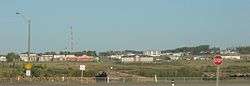
Drayton Valley panorama | |
| Motto: Pulling together | |
 Drayton Valley Location of Drayton Valley in Alberta | |
| Coordinates: 53°13′20″N 114°58′37″W / 53.22222°N 114.97694°WCoordinates: 53°13′20″N 114°58′37″W / 53.22222°N 114.97694°W | |
| Country |
|
| Province |
|
| Region | Central Alberta |
| Census division | 11 |
| Municipal district | Brazeau County |
| Incorporated[1] | |
| • Village | January 1, 1956 |
| • New town | June 1, 1956 |
| • Town | February 1, 1957 |
| Government[2] | |
| • Mayor | Glenn McLean |
| • Governing body | Drayton Valley Town Council |
| • CAO | Dwight Dibben |
| • MP | Jim Eglinski (Yellowhead) |
| • MLA | Mark Smith (Drayton Valley-Calmar) |
| Area (2011)[3] | |
| • Total | 12.27 km2 (4.74 sq mi) |
| Elevation[4] | 869 m (2,851 ft) |
| Population (2011)[3] | |
| • Total | 7,049 |
| • Density | 574.3/km2 (1,487/sq mi) |
| Time zone | MST (UTC-7) |
| • Summer (DST) | MDT (UTC-6) |
| Postal code span | T7A |
| Area code(s) | +1-780, +1-587 |
| Highways | Highway 22 |
| Waterways | North Saskatchewan River |
| Website | Official website |
Drayton Valley is a town in central Alberta, Canada. It is located on Highway 22 (Cowboy Trail), approximately 133 kilometres (83 mi) southwest of Edmonton. It is surrounded by Brazeau County, which is known for its vast oil fields. The town is located in between the North Saskatchewan River and the Pembina River.
History
Prior to the 1953 oil boom, the community of Drayton Valley was sparsely populated. The main economic activities were farming and logging. Drayton Valley was incorporated as a village in 1956 and officially became a town in 1957. In 1955 a ferry was built to cross the North Saskatchewan River.[5] The original bridge that replaced the ferry was eventually replaced by a new bridge in 2014.[6]
Demographics
In the 2011 Census, the Town of Drayton Valley had a population of 7,049 living in 2,740 of its 2,899 total dwellings, a 2.3% change from its 2006 population of 6,893. With a land area of 12.27 km2 (4.74 sq mi), it had a population density of 574.5/km2 (1,487.9/sq mi) in 2011.[3] Following its 2011 and 2012 annexations, Statistics Canada adjusted Drayton Valley's 2011 population by an additional 69 people to 7,118.[7][8]
In 2006, Drayton Valley had a population of 6,893 living in 2,619 dwellings, a 13.2% increase from 2001. The town has a land area of 12.27 km2 (4.74 sq mi) and a population density of 561.6/km2 (1,455/sq mi).[9]
Economy
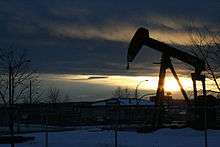
Oil and gas is the primary driver of Drayton Valley's economy. Agriculture and forestry also play roles in the local economy. A pulp mill is located in the town.[10]
Attractions
Drayton Valley's main attraction is the Omniplex, a community sports centre that hosts ice hockey, ringette, and curling. The sports centre complex also hosts soccer, baseball and rodeo. The town also has a public swimming pool, a ski hill and the Drayton Valley Golf and Country Club.
Sports
Drayton Valley is the home of the Drayton Valley Thunder of the Alberta Junior Hockey League.
Education
Drayton Valley has six public schools, two Catholic schools, and one outreach school. The public schools and outreach school are operated by the Wild Rose School Division[11] while the Catholic schools are operated by the St. Thomas Aquinas Catholic School Division.
- Wild Rose School Division
- Aurora Elementary School
- Drayton Christian School
- Eldorado Elementary School
- Evergreen Elementary School
- Frank Maddock High School
- Frank Maddock Outreach School
- H.W. Pickup Junior High School
- St. Thomas Aquinas Catholic School Division
- St. Anthony School
- Holy Trinity Academy
Media
Drayton Valley is served by two weekly newspapers, the Drayton Valley Western Review[12] and the Community Voice[13] and one radio station, CIBW-FM, mainly playing country music. A Christian radio station, CIDV-FM, was launched in 2009.
See also
References
- ↑ "Location and History Profile: Town of Drayton Valley" (PDF). Alberta Municipal Affairs. June 17, 2016. p. 204. Retrieved June 20, 2016.
- ↑ "Municipal Officials Search". Alberta Municipal Affairs. November 18, 2016. Retrieved November 21, 2016.
- 1 2 3 "Population and dwelling counts, for Canada, provinces and territories, and census subdivisions (municipalities), 2011 and 2006 censuses (Alberta)". Statistics Canada. 2012-02-08. Retrieved 2012-02-08.
- ↑ "Alberta Private Sewage Systems 2009 Standard of Practice Handbook: Appendix A.3 Alberta Design Data (A.3.A. Alberta Climate Design Data by Town)" (PDF) (PDF). Safety Codes Council. January 2012. pp. 212–215 (PDF pages 226–229). Retrieved October 8, 2013.
- ↑ Martin, Isobel (1977). Forests to Grainfields. Berrymoor, Alberta: Berrymoor/Carnwood Historical Society. p. 133. ISBN 0-919213-36-7.
- ↑ http://bigwestcountry.ca/2015/06/bridge-open-to-traffic/
- ↑ "Interim List of Changes to Municipal Boundaries, Status, and Names From January 2, 2011 to January 1, 2012 (Table 1 – Changes to census subdivisions in alphabetical order by province and territory)" (XLSX). Statistics Canada. November 14, 2012. Retrieved August 17, 2013.
- ↑ "Interim List of Changes to Municipal Boundaries, Status, and Names From January 2, 2012 to January 1, 2013 (Table 1 – Changes to census subdivisions in alphabetical order by province and territory)" (XLSX). Statistics Canada. August 18, 2012. Retrieved August 17, 2013.
- ↑ Statistics Canada. "Canada 2006 Census: Drayton Valley - Community Profile". Retrieved 2007-06-11.
- ↑ http://www.csaregistries.ca/registry/out/C123-WEYERER-RPT.PDF
- ↑ Wild Rose Schools Archived June 16, 2009, at the Wayback Machine.
- ↑ Drayton Valley Western Review
- ↑ "Circulation Areas". Community Voice. Retrieved 2012-06-06.
External links
 |
Edson | Entwistle | Rocky Rapids | |
| Pembina River | |
Warburg | ||
| ||||
| | ||||
| Brazeau Reservoir | Rocky Mountain House | Breton |