Alberta Highway 58
| ||||
|---|---|---|---|---|
 | ||||
| Route information | ||||
| Length: | 325.5 km[1] (202.3 mi) | |||
| Location | ||||
| Specialized and rural municipalities: | Mackenzie County | |||
| Towns: | Rainbow Lake, High Level | |||
| Highway system | ||||
|
Provincial highways in Alberta
| ||||

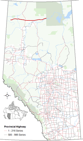
Alberta Provincial Highway No. 58 is an east–west highway in northwest Alberta, Canada.[2] It starts west of the Rainbow Lake Airport (IATA: YOP, ICAO: CYOP) and passes through the towns of Rainbow Lake and High Level before it ends at the Wood Buffalo National Park boundary west of Garden River.[1][3]
As of 2010, the highway was 283 km (176 mi) in length.[4] An extension to Wood Buffalo National Park opened on November 8, 2011 under a joint project between Government of Alberta, the Government of Canada, and the Little Red River Cree Nation (LRRCN) to construct 58 km (36 mi) of all weather roads to provide access to the LRRCN communities of Garden River and Fox Lake.[5] The project included the 42 km (26 mi) extension of Highway 58 to its current length of 325 km (202 mi).[6]
At its western extremity, Highway 58 continues as a winter road (commonly referred to as Border Road/Powerline Road/Sierra Road), which connects to Highway 97 (Alaska Highway) in British Columbia at Fort Nelson. At its eastern extremity, Highway 58 continues as a Garden River Road within Wood Buffalo National Park to Garden River.[3]
The highway is designated as a Northern/Remote Route within Canada's National Highway System.
Major intersections
From west to east:
| Municipality | km | Description | |||
|---|---|---|---|---|---|
| Mackenzie County | 0 | Starts east of the Town of Rainbow Lake | |||
| High Level | 140 | 1.5 km (0.9 mi) concurrency begins | |||
1.5 km (0.9 mi) concurrency ends | |||||
| Mackenzie County | 197 | ||||
| 325 | Ends at Wood Buffalo National Park boundary Succeeded by Garden River Road to Garden River | ||||
1.000 mi = 1.609 km; 1.000 km = 0.621 mi
| |||||
References
- 1 2 "2015 Provincial Highway 1-216 Progress Chart" (PDF). Alberta Transportation. March 2015. Archived (PDF) from the original on April 10, 2016. Retrieved October 31, 2016.
- ↑ Provincial Highways Designation Order, Alberta Transportation, p. 9
- 1 2 Google (October 31, 2016). "Highway 58 in northern Alberta" (Map). Google Maps. Google. Retrieved October 31, 2016.
- ↑ "2010 Provincial Highways 1 - 216 Progress Chart" (PDF). Alberta Transportation. March 2010. Retrieved 2010-12-31.
- ↑ "Through Federal, Provincial and First Nation collaboration Garden River all weather access road opens". Aboriginal Affairs and Northern Development Canada. 2011-11-08. Retrieved 2012-02-04.
- ↑ "2012 Provincial Highways 1 - 216 Progress Chart" (PDF). Alberta Transportation. March 2010. Retrieved 2010-12-31.