Alberta Highway 93
| ||||
|---|---|---|---|---|
| Banff-Windermere Parkway, Icefields Parkway | ||||
 | ||||
| Route information | ||||
| Length: | 268 km (167 mi) | |||
| Existed: | 1940 – present | |||
| Major junctions | ||||
| South end: |
B.C. border at Vermilion Pass continues as | |||
|
| ||||
| North end: |
| |||
| Location | ||||
| Specialized and rural municipalities: | I.D. No. 9, I.D. No. 12, Jasper | |||
| Highway system | ||||
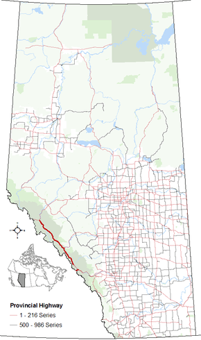
|
Provincial highways in Alberta
| ||||

Highway 93 is a north-south highway in the province of Alberta, Canada. This highway is also known the Banff-Windermere Parkway south of the Trans-Canada Highway (Highway 1) and the Icefields Parkway north of the Trans-Canada Highway. It travels through Banff National Park and Jasper National Park and maintained by Parks Canada for its entire length.[1] It runs from British Columbia border at Vermilion Pass in the south, where it becomes British Columbia Highway 93, to its terminus at the junction with the Yellowhead Highway (Highway 16) at Jasper.[2] The route takes its number from U.S. Route 93 and was initially designated as ‘93’ in 1959.
Route description
Banff-Windermere Parkway
The southern portion of the route is part of the Banff-Windermere Parkway, a 104 km (65 mi) highway that travels from British Columbia Highway 95 at Radium Hot Springs, through Kootenay National Park and Vermilion Pass across the Continental Divide, to the junction of the Trans-Canada Highway (Highway 1) at Castle Junction.[3] The final 10 km (6.2 mi) of the parkway are in Alberta and Banff National Park. Prior to 1959, the highway was designated as Highway 1B.[4]
Trans-Canada Highway
Highway 93 connects with the Trans-Canada Highway (Highway 1) at Castle Junction, midway between Banff and Lake Louise.[3] Highway 93 follows the Trans-Canada Highway for 28 km (17 mi) northwest, diverging from highway west of Lake Louise. Highway 1 continues west to Yoho National Park. The Bow Valley Parkway (Highway 1A) also links Lake Louise and Banff. This road parallels Highway 1 and, at the midpoint, passes Castle junction where links with Highway 93.[3]
Icefields Parkway
The Icefields Parkway (French: Promenade des Glaciers), is a scenic road in Alberta, Canada. It parallels the Continental Divide, traversing the rugged landscape of the Canadian Rockies, travelling through Banff National Park and Jasper National Park. It links Lake Louise with Jasper to the north. At its southern end, the Icefields Parkway terminates at the Trans-Canada Highway (Highway 1). Highway 1 west goes to Yoho National Park in British Columbia and Highway 1 east to Lake Louise and the Town of Banff. A second parkway, the Bow Valley Parkway also links Lake Louise and the Town of Banff. Known as Highway 1A, this road parallels Highway 1 and, at the midpoint, passes the Castle Mountain junction where Highway 93 south, or the Banff-Windermere Highway, branches southwest into Kootenay National Park in British Columbia.[3]
The Icefields Parkway, 230 km (140 mi) long, was completed in 1940. It is named for features such as the Columbia Icefield, visible from the parkway.
The parkway is busy in July and August with up to 100,000 vehicles a month. The parkway is mainly two lanes with occasional passing lanes. It minimizes grades and hairpin turns but travellers must look out for wildlife, and vehicles stopped on the shoulder. Snow can be expected at any time of year and extreme weather is common in winter.
A Canadian national parks permit is required to travel on the Icefields Parkway; stations near Lake Louise and Jasper enforce the law. Commercial trucks are prohibited.[5] The speed limit is 90 km/h (56 mph) although the limit is reduced at Saskatchewan River Crossing and the Columbia Icefield area. In winter, chains or winter-rated radial tires are required by law and road closures are not uncommon.
Major intersections
Starting from the south end of Highway 93:

Highway 93A
Just south of Jasper, a short spur of the parkway branches off as Highway 93A, providing access to businesses on the south side of Jasper and providing an alternative route into the community. Another Highway 93A spur farther south along the parkway provides alternative access to viewpoints and other attractions within Jasper National Park.
Highway 93A south of Jasper is narrow and the pavement uneven, with an average limit of 60 km/h. Brush grows up to the side of the highway so animals can be difficult to see.
References
- ↑ "Internal Audit and Evaluation Documents: Evaluation of Parks Canada's Through Highway Management". Parks Canada. November 22, 2010. Retrieved June 22, 2016.
- ↑ Alberta Official Road Map (Map) (2015 ed.). City of Edmonton Transportation Services for Alberta Culture and Tourism. § J–2, K–3, L–3, and L–4.
- 1 2 3 4 Google (November 5, 2016). "Highway 93 in Alberta" (Map). Google Maps. Google. Retrieved November 5, 2016.
- ↑ "Shell British Columbia-Alberta Highway Map". David Rumsey Map Collection. The H.M. Gousha Company. 1956. Retrieved June 23, 2016.
- ↑ Canada. "Banff National Park - Park Passes". Parks Canada. Retrieved April 26, 2016.
External links
| Wikimedia Commons has media related to Icefields Parkway. |
| Wikivoyage has a travel guide for Icefields Parkway. |