Alberta Highway 10
| ||||
|---|---|---|---|---|
| Hoo Doo Trail | ||||
 | ||||
| Route information | ||||
| Length: | 22 km[1] (14 mi) | |||
| Major junctions | ||||
| West end: |
| |||
|
| ||||
| East end: |
| |||
| Location | ||||
| Towns: | Drumheller | |||
| Highway system | ||||
|
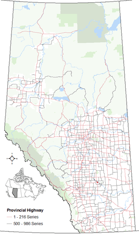
Provincial highways in Alberta
| ||||

Alberta Provincial Highway No. 10 is a 22 km (14 mi) highway in southern Alberta, Canada that also forms a part of Hoo Doo Trail. It is located wholly within the Town of Drumheller[2] as a result of the former City of Drumheller's amalgamation with the Municipal District of Badlands No. 7 on January 1, 1998.[3] It begins at Highway 9 in the heart of Drumheller and extends southeast along the Red Deer River where it passes through Rosedale, then crosses Highway 56 and travels through East Coulee. It ends by splitting off into Highways 570, 564, and 569.
Route description
Highway 10 is 22 km long. The route begins at a signalized intersection with Highway 9 in central Drumheller approximately 400 m (1,300 ft) south of the Red Deer River. Continuing as four-lane Railway Avenue southeast through the river valley concurrent with Highway 56 at a speed limit of 50 km/h (31 mph), the highway exits Drumheller. It becomes to a two-lane rural highway with a speed limit of 100 km/h (62 mph) as it passes the Drumheller Regional Landfill and jogs to within 100 m (330 ft) of the Red Deer River. The highway continues for another 4 km (2.5 mi) and enters Rosedale where the limit again reduces to 50 km/h.[4] Just prior to crossing the Red Deer River, Highway 10X spilts to the southwest from the combined Highway 10/56, paralleling the Rosebud River.[5]
Highway 10/56 continues across the Rosebud River, exiting Rosedale where the speed limit again increases to 100 km/h.[6] East of Rosedale, Highway 56 splits due south toward Dalum and Hussar, while Highway 10 continues to the southeast to Cambria after which it crosses the Red Deer River.[7] Highway 849 then splits to the north enroute to Michichi and Highway 10 continues east paralleling the river, now on its north bank. Highway 573 is the next to split from Highway 10. It proceeds due east while Highway 10 continues southeast through the scenic river valley to Lehigh and East Coulee.[8] East of Lehigh, the road continues east along the north river bank to Dorothy as Highway 570, while Highway 10 veers to the south concurrent with Highway 569 to cross the river.[9] Less than 2 km (1.2 mi) south of the river, the combined highway meets Highway 564 and the Highway 10 designation ends.[2]
Major intersections

Highway 10X
Alberta Provincial Highway No. 10X is a spur of Highway 10 that runs for 5.6 km (3.5 mi), connecting Wayne with Highway 10.[1] Following the amalgamation of the former City of Drumheller with the Municipal District of Badlands No. 7 on January 1, 1998,[3] the entire highway falls within the Town of Drumheller.[2] The road follows the course of the Rosebud River through a 100–150 m deep canyon. Nine bridges lead the road from one side of the river to the other, and most of the bridges are paralleled by railroad bridges of a presently abandoned track that used to cart coal from the Wayne mine. At its end, Highway 10X continues as Excelsior Avenue, which crosses the Rosebud River twice more, before splitting into Range Road 195A and Township Road 280A.

Major intersections
| Location | km | Description | Notes | Coordinates | |
|---|---|---|---|---|---|
| Rosedale | 0 | Highway 10 | 51°25′02″N 112°37′52″W / 51.41726°N 112.63115°W | ||
| Wayne | 5.6 | Excelsior Avenue | 51°23′07″N 112°39′29″W / 51.38529°N 112.65793°W | ||
| 1.000 mi = 1.609 km; 1.000 km = 0.621 mi | |||||
References
- 1 2 "Provincial Highway 1-216 Progress Chart" (PDF). Alberta Transportation. March 2015. Archived (PDF) from the original on April 10, 2016. Retrieved October 12, 2016.
- 1 2 3 "Town of Drumheller maps" (PDF). Town of Drumheller. 2006. Archived (PDF) from the original on January 25, 2011. Retrieved 2010-12-29.
- 1 2 "Town of Drumheller – Location and History Profile". Alberta Municipal Affairs. December 24, 2010. Retrieved December 29, 2010.
- ↑ Google (October 2014). "Highway 10/56 enters Rosedale". Google Street View. Retrieved October 24, 2016.
- ↑ Google (October 25, 2016). "Highways 10, 56, and 10X in Rosedale, Alberta" (Map). Google Maps. Google. Retrieved October 25, 2016.
- ↑ Google (October 2014). "Highway 10/56 crosses the Rosebud River in Rosedale". Google Street View. Retrieved October 25, 2016.
- ↑ Google (October 2014). "Highway 10 crossing the Red Deer River east of Cambria". Google Street View. Retrieved October 25, 2016.
- ↑ Google (May 2014). "Highway 10 in Lehigh". Google Street View. Retrieved October 25, 2016.
- ↑ Google (May 2014). "Highway 10/570 Split". Google Street View. Retrieved October 25, 2016.