Mackenzie County
| Mackenzie County | ||
|---|---|---|
| Specialized municipality | ||
| ||
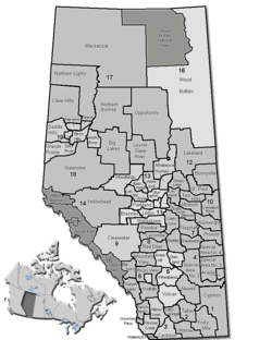 Location of Mackenzie County in Alberta | ||
| Coordinates: 58°22′39″N 116°00′21″W / 58.37750°N 116.00583°WCoordinates: 58°22′39″N 116°00′21″W / 58.37750°N 116.00583°W | ||
| Country |
| |
| Province |
| |
| Region | Northern Alberta | |
| Census division | No. 17 | |
| Incorporated [1] - Municipal district |
January 1, 1995 | |
| - Specialized municipality | June 23, 1999 | |
| Name change [1] | March 8, 2007 | |
| Government[2] | ||
| • Reeve | Bill Neufeld | |
| • Governing body |
Mackenzie County Council
| |
| • CAO | Lenard Racher | |
| • Office location | Fort Vermilion | |
| Area (2011)[3] | ||
| • Total | 80,478.12 km2 (31,072.78 sq mi) | |
| Population (2011)[3] | ||
| • Total | 10,927 | |
| • Density | 0.14/km2 (0.35/sq mi) | |
| • Dwellings | 2,892 | |
| Time zone | MST (UTC−7) | |
| • Summer (DST) | MDT (UTC−6) | |
| Website | Official website | |

Mackenzie County is a specialized municipality in northern Alberta, Canada. It is located in Census Division 17, along the Mackenzie Highway. Incorporated as a municipal district in 1995 from the former Improvement District No. 23., its status was changed to specialized municipality in 1999 to address the particularities of managing such a large territory. Mackenzie County municipal office is located in the Hamlet of Fort Vermilion. The name was changed from the Municipal District of Mackenzie No. 23 to Mackenzie County in 2007.[1]

Demographics
The population of Mackenzie County according to its 2015 municipal census is 11,750,[6] a 21.3% change from its 2003 municipal census population of 9,687.[7]
In the 2011 Census, Mackenzie County had a population of 10,927 living in 2,900 of its 3,123 total dwellings, a 9.2% change from its 2006 population of 10,002. With a land area of 80,478.12 km2 (31,072.78 sq mi), it had a population density of 0.1/km2 (0.4/sq mi) in 2011.[3]
In 2006, Mackenzie County had a population of 10,002 living in 2,892 dwellings, a 13.3% increase from 2001. It has a land area of 80,484.42 km2 (31,075.21 sq mi) and a population density of 0.1/km2 (0.26/sq mi).[5]
In 2001, Mackenzie County had a population of 8,829 in 2,395 dwellings, a 10.6% increase from 7,980 in 1996. On a surface of 80,526.79 square kilometres (31,091.57 sq mi), it had a density of 0.1 inhabitants/km2 (0.26/sq mi).[4]
Communities and localities
|
The following urban municipalities are surrounded by Mackenzie County.[8]
|
The following hamlets are located within Mackenzie County.[8] |
The following localities are located within Mackenzie County.[9]
- Localities
|
|
|
|
See also
References
- 1 2 3 Alberta Municipal Affairs (2010-09-17). "Municipal Profile – Mackenzie County". Retrieved 2010-10-02.
- ↑ "Municipal Officials Search". Alberta Municipal Affairs. November 18, 2016. Retrieved November 21, 2016.
- 1 2 3 4 "Population and dwelling counts, for Canada, provinces and territories, and census subdivisions (municipalities), 2011 and 2006 censuses (Alberta)". Statistics Canada. February 8, 2012. Retrieved February 8, 2012.
- 1 2 "Community Highlights for Mackenzie No. 23". Statistics Canada. August 26, 2013. Retrieved September 11, 2015.
- 1 2 "Canada 2006 Census: Mackenzie No. 23 - Community Profile". Statistics Canada. Retrieved June 11, 2007.
- ↑ "Request for Decision: 2015 Census Results" (PDF). Mackenzie County. August 26, 2015. Retrieved August 21, 2015.
- ↑ "2006 Official Population List" (PDF). Alberta Municipal Affairs. February 5, 2007. ISBN 0-7785-4994-1. Retrieved September 11, 2015.
- 1 2 "Specialized and Rural Municipalities and Their Communities" (PDF). Alberta Municipal Affairs. 2012-03-01. Retrieved 2012-08-11.
- ↑ "Standard Geographical Classification (SGC) 2006, Economic Regions: 4817095 - Mackenzie No. 23, geographical codes and localities, 2006". Statistics Canada. 2010-03-05. Retrieved 2012-08-11.
External links

| Subdivisions | |||||||||||
|---|---|---|---|---|---|---|---|---|---|---|---|
| Communities | |||||||||||
| Cities and urban service areas | |||||||||||
| Rural municipalities |
| ||||||||||
| Specialized municipalities | |||||||||||
| |||||||||||