Upper Norwood
| Upper Norwood | |
 Upper Norwood from the Air |
|
 Upper Norwood |
|
| Population | 16,082 (2011 Census.Ward)[1] |
|---|---|
| OS grid reference | TQ329707 |
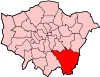
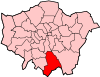
| London borough | Bromley |
| Croydon | |
| Lambeth | |
| Southwark | |
| Ceremonial county | Greater London |
| Region | London |
| Country | England |
| Sovereign state | United Kingdom |
| Post town | LONDON |
| Postcode district | SE19 |
| Dialling code | 020 |
| Police | Metropolitan |
| Fire | London |
| Ambulance | London |
| EU Parliament | London |
| UK Parliament | Croydon North |
| Dulwich and West Norwood | |
| London Assembly | Bexley and Bromley |
| Croydon and Sutton | |
| Lambeth and Southwark | |
Coordinates: 51°25′11″N 0°05′16″W / 51.4196°N 0.0877°W
Upper Norwood is an area of south-east London within the London Boroughs of Bromley, Croydon, Lambeth and Southwark. It is located north of Croydon and is synonymous with the Crystal Palace area.
Upper Norwood is situated along the London clay ridge known as Beulah Hill. Most housing dates from the 19th and 20th centuries, with large detached properties along the ridge and smaller, semi-detached and terraced dwellings on the slopes. There are some more modern areas of social housing that date from the 1970s. The hill offers panoramic views northward to central London and southward to central Croydon and the North Downs.
History


The area is one of the highest in the London area, and for centuries was occupied by the Great North Wood, an extensive area of natural oak forest which formed a wilderness close to the southern edge of the ever-expanding city of London. The name "Norwood" is a contraction of "North Wood". Local legend has it that Sir Francis Drake's ship, The Golden Hind, was made from timber cut from trees in this area. The forest was a popular area for Londoners' recreation until the 19th century, when it began to be built over. It was also a haunt of Gypsies, with many local street names and pubs recording the link, notably Gipsy Hill. The area still retains woodland in large amounts for an urban area.
The Beulah Hill ridge was used as a sighting-point for the Anglo-French Survey (1784–1790), which measured the precise distance between the Royal Greenwich Observatory and the Paris Observatory, using trigonometry. It was particularly useful for this purpose on account of both its height and its relative proximity to Greenwich.
In 1831, one of England's most prominent architects, Decimus Burton, designed a spa and pleasure gardens below Beulah Hill and off what is now Spa Hill in a bowl of land on the south facing side of the hill around a spring of chalybeate water. Burton was responsible for the Beulah Spa Hotel (demolished c1935) and the layout of the grounds.[2] Its official title was The Royal Beulah Spa and Gardens. It became a popular society venue attracting large crowds to its fêtes. One widely publicized event was a "Grand Scottish Fete" on 16 September 1834 "with a tightrope performance by Pablo Fanque," the black circus performer who would later dominate the Victorian circus and achieve immortality in The Beatles song, Being for the Benefit of Mr. Kite![3] The spa closed in 1856 soon after the opening nearby of The Crystal Palace.[4]
The Crystal Palace was rebuilt nearby on Sydenham Hill in 1854, following its success at The Great Exhibition of 1851 in Hyde Park. It was destroyed in a spectacular fire in 1936. The importance of this building led to the area immediately around the Crystal Palace becoming known as Crystal Palace.
The most easterly district of Upper Norwood is now also known as Crystal Palace and is the commercial hub of Upper Norwood known locally as the 'Triangle'. The most westerly district is also known as Crown Point. The central district was once known as Norwood New Town but this is only seen on older maps.
St Joseph's College is a Roman Catholic boys' secondary school which was first established in Upper Norwood in 1855. The school operates a coeducational sixth form. Harris Academy Upper Norwood is a girls' school that was established in the area as Westwood High School in 1958.
Virgo Fidelis Convent Senior School is a Roman Catholic girls school located on Central Hill and was founded in 1848. It occupies an eighteenth century grand house once the home of the notable socialite and courtesan Mary Nesbitt.

The Church of England Parish Church of St John the Evangelist on Sylvan Road, completed in 1887, is a notable example of the work of the architect John Loughborough Pearson. Designed in the Gothic Revival style, this Grade II* listed red brick building features some significant interior stone decoration and a stained glass window by Ninian Comper, who lived in the area.[5]
Upper Norwood Library in Westow Hill, the only independent public library in the UK, was built in 1899 by joint agreement of the London Borough of Croydon and the London Borough of Lambeth. The library holds a Local History Collection of the Upper Norwood district and the Crystal Palace.
A notable park in the area is Upper Norwood Recreation Ground. Its 19-acre (77,000 m2) site is part of the Harold Road Conservation Area. Its boundary is defined by Chevening Road, Hermitage Road, Eversley Road and Harold Road. One of London's hidden rivers, River Effra flows under the park and at the Harold Road end a well head exists. It was covered in the 1940s.
The Croydon Transmitter, a TV transmitter tower stands on the hill at Upper Norwood and a second larger TV transmitter, the Crystal Palace Transmitter, stands in Crystal Palace Park, making the district a landmark location, visible from any part of the London area.
In March 1966, shortly before the World Cup tournament, the Jules Rimet trophy was stolen from an exhibition at Central Hall Westminster. It was found seven days later in Beulah Hill by a dog named "Pickles". The story made national headlines.[6][7]
In 1985 a Safeway supermarket opened on Westow Street. In 1990 the exterior of this branch featured in a clip of the television drama series Grange Hill.[8] The store was acquired by Morrisons in March 2004, who closed it in November 2005. The lease of the vacant store was purchased by Sainsbury's in August 2006.[9]
Transport
The hilly nature of the land has restricted the construction of railways through the district. The former branch line terminus at Crystal Palace High Level railway station which opened in 1865 closed in 1954, and the remaining Crystal Palace railway station is situated some distance below Upper Norwood and approached by many steps. However, Crystal Palace Parade remains an important bus interchange and many residents instead use plentiful local bus routes to travel to West Norwood, Tulse Hill, Streatham, West Dulwich or Norbury railway stations. The disconnection from the capital's rail/tube network has led to it having lower house prices than other areas possessing scenic views of London.
Notable people

- Thomas Attwood, pupil of Mozart and organist at St Paul's Cathedral, lived in Roselawn, a large house on Beulah Hill near the junction with Hermitage Road. He played host to the composer Felix Mendelssohn in 1829 and 1832.
- Admiral Sir Robert Lambert Baynes KCB (1796–1869), Royal Navy officer; Commander-in-Chief, Pacific Station; credited with adopting a policy of non-intervention that helped defuse the San Juan Boundary Dispute of 1859 between Britain and the United States of America.
- Raymond Chandler the author of American noir detective novels lived as a boy in the area especially at Mount Cyra, 110, Auckland Road, from 1900 to 1905. The house now has a Blue Plaque.[10]
- Sir John Ninian Comper (1864–1960), one of the great Gothic Revival architects of the 20th century, lived at The Priory, 67 Beulah Hill (now demolished). His son Nicholas Comper (1897–1939) was an aviator who designed the Comper Swift monoplane in the back garden.[11]
- Edward Elgar (1857–1934), composer, and his wife Caroline Alice Elgar (1848-1920) lived at Oaklands, Fountain Road in 1889, soon after they were married, so that they could be near the Crystal Palace concerts.
- Bernard Fagg (1915–1987), archaeologist and museum curator, was born in Upper Norwood.
- Sir Theodore Ford (1829–1920), chief justice of the Straits Settlements, lived in Upper Norwood from his retirement in 1896 to his death in 1920.
- Robert FitzRoy (1805–1865), captain of HMS Beagle, first governor of New Zealand, and inventor of the weather forecast, lived in Church Road and is buried in front of All Saints' Church.
- Walter Franklin (1891–1968), cricketer.
- Simon Friend, multi-instrumentalist in the alternative rock band The Levellers founded in 1988.
- Anthony Ludovici (1882–1971), philosopher, and his wife the writer Elsie Finnimore Buckley (1882-1959) lived at 35 Central Hill, soon after they were married in 1920.
- G. E. Moore (1873–1958), philosopher, who was the father (with Bertrand Russell) of analytic philosophy.
- Mary Nesbitt (1742/3–1825), an 18th-century courtesan who became involved in political intrigue, lived at Norwood House off Central Hill. The house is now part of Virgo Fidelis Convent and School.
- Charlotte Carmichael Stopes (1840–1929), feminist and Shakespearean scholar, organized cultural groups in Upper Norwood in the 1880s.
- Marie Stopes (1880–1958), a botanist and birth-control advocate who opened the first birth control clinic in Britain.
- Émile Zola (1840–1902), French novelist, lived in exile at the Queen's Hotel here from October 1898 to June 1899.
Nearest places
- Anerley
- Croydon
- Crystal Palace
- Dulwich
- Elmers End
- Gipsy Hill
- Penge
- South Norwood
- Sydenham
- West Norwood
- Thornton Heath
Nearest stations
- Crystal Palace railway station (East London Line services from 2010)
- Gipsy Hill railway station
- West Norwood railway station
References
- ↑ "Croydon ward population 2011". Neighbourhood Statistics. Office for National Statistics. Retrieved 10 October 2016.
- ↑ The Changing Face Of Norwood Norwood Society, 27 February 2008. Accessed April 2011
- ↑ "London Borough of Croydon: The Lawns - The Lawns History". Croydon.gov.uk. Retrieved 2011-07-17.
- ↑ Alan R. Warwick; The Phoenix Suburb: A South London Social History;chapter 5, Publisher: Crystal Palace Foundation; ISBN 0-904034-01-1 / 0904034011
- ↑ Pevsner, Bridget Cherry & Nikolaus (2002). London. (New ed.). New Haven, Conn.: Yale University Press. ISBN 9780300096514.
- ↑ How Pickles the dog dug up the accursed World Cup By Paul Fleckney, London Evening Standard, This is London , 10 June 2006 , Accessed June 2007.
- ↑ BBC world cup photo gallery Pickles the dog . accessed June 2007
- ↑ Grange Hill - Series 13 - Episode 12 at 4:20 mins Accessed 24 August 2014
- ↑ Londoners cheer supermarket's arrival Accessed 24 August 2014
- ↑ Kennedy, Maev (7 October 2014). "Raymond Chandler given blue plaque in mean streets of Upper Norwood". The Guardian. Retrieved 31 January 2016.
- ↑ Sir Ninian Comper in Norwood, The Norwood Society
Sources
- Alan R. Warwick; The Phoenix Suburb: A South London Social History; Publisher: Crystal Palace Foundation; ISBN 0-904034-01-1 / 0904034011
- Brewer's Britain and Ireland, compiled by John Ayto and Ian Crofton, Weidenfeld & Nicolson, 2005, ISBN 0-304-35385-X
External links
| Wikimedia Commons has media related to Upper Norwood. |
- Upper Norwood Library - Independent Public Library
- Virtual Norwood
- Norwood Society
- www.uppernorwood.com
| Districts | 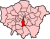 | |
|---|---|---|
| Attractions |
| |
| Bridges | ||
| Parks and open spaces |
| |
| Constituencies | ||
| Tube, rail and riverboat stations | ||
| Other topics | ||
| Districts | 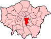 | |
|---|---|---|
| Attractions |
| |
| Markets | ||
| Bridges and tunnels | ||
| Parks and open spaces |
| |
| Constituencies | ||
| Tube and rail stations | ||
| Other topics | ||