Severance, Colorado
| Town of Severance, Colorado | |
|---|---|
| Town | |
|
Severance Post office | |
| Motto: Where the geese fly and the bulls cry | |
 Location in Weld County and the state of Colorado | |
| Coordinates: 40°32′7″N 104°51′3″W / 40.53528°N 104.85083°WCoordinates: 40°32′7″N 104°51′3″W / 40.53528°N 104.85083°W | |
| Country |
|
| State |
|
| County[1] | Weld County |
| Incorporated | November 20, 1920[2] |
| Government | |
| • Type | Statutory Town[1] |
| Area | |
| • Total | 2.2 sq mi (5.6 km2) |
| • Land | 2.1 sq mi (5.4 km2) |
| • Water | 0.1 sq mi (0.2 km2) |
| Elevation[3] | 4,888 ft (1,490 m) |
| Population (2013) | |
| • Total | 3,396 |
| • Density | 271.4/sq mi (106.6/km2) |
| Time zone | Mountain (MST) (UTC-7) |
| • Summer (DST) | MDT (UTC-6) |
| ZIP code[4] | 80546 (PO Box) |
| Area code(s) | 970 |
| FIPS code | 08-69150 |
| GNIS feature ID | 0180531 |


Severance is a Statutory Town in Weld County, Colorado, United States. The population was 597 at the 2000 census. The town is located on the Colorado Eastern Plains, northwest of Greeley, a crossroads of county roads.
A post office in Severance has been in operation since 1894.[5] The community was named after David Severance, a pioneer settler.[6]
Rocky Mountain oysters, a regional dish, is served at Bruce's Bar, a local landmark.[7]
Severance is also the home of KRKA radio, an Air 1 station with a far-reaching signal which can be heard as far away as Denver.
Geography
Severance is located at 40°32′07″N 104°51′03″W / 40.535208°N 104.850761°W.[8]
According to the United States Census Bureau, the town has a total area of 2.1 square miles (5.4 km2), of which, 2.1 square miles (5.4 km2) of it is land and 0.1 square miles (0.26 km2) of it (3.27%) is water.
Demographics
| Historical population | |||
|---|---|---|---|
| Census | Pop. | %± | |
| 1940 | 138 | — | |
| 1950 | 108 | −21.7% | |
| 1960 | 70 | −35.2% | |
| 1970 | 59 | −15.7% | |
| 1980 | 102 | 72.9% | |
| 1990 | 106 | 3.9% | |
| 2000 | 597 | 463.2% | |
| 2010 | 3,165 | 430.2% | |
| Est. 2015 | 3,697 | [9] | 16.8% |
As of the census[11] of 2000, there were 597 people, 201 households, and 162 families residing in the town. The population density was 288.5 people per square mile (111.4/km²). There were 207 housing units at an average density of 100.0 per square mile (38.6/km²). The racial makeup of the town was 91.46% White, 0.34% African American, 0.67% Native American, 0.34% Asian, 5.19% from other races, and 2.01% from two or more races. Hispanic or Latino of any race were 11.39% of the population.
There were 201 households out of which 52.2% had children under the age of 18 living with them, 69.7% were married couples living together, 8.5% had a female householder with no husband present, and 19.4% were non-families. 12.9% of all households were made up of individuals and 1.5% had someone living alone who was 65 years of age or older. The average household size was 2.97 and the average family size was 3.31.
In the town the population was spread out with 35.0% under the age of 18, 5.5% from 18 to 24, 41.4% from 25 to 44, 14.7% from 45 to 64, and 3.4% who were 65 years of age or older. The median age was 30 years. For every 100 females there were 105.9 males. For every 100 females age 18 and over, there were 100.0 males.
The median income for a household in the town was $50,625, and the median income for a family was $55,781. Males had a median income of $40,375 versus $26,645 for females. The per capita income for the town was $17,625. About 2.8% of families and 7.5% of the population were below the poverty line, including 7.7% of those under age 18 and none of those age 65 or over.
See also

References
- 1 2 "Active Colorado Municipalities". State of Colorado, Department of Local Affairs. Retrieved 2007-09-01.
- ↑ "Colorado Municipal Incorporations". State of Colorado, Department of Personnel & Administration, Colorado State Archives. 2004-12-01. Retrieved 2007-09-02.
- ↑ "US Board on Geographic Names". United States Geological Survey. 2007-10-25. Retrieved 2008-01-31.
- ↑ "ZIP Code Lookup" (JavaScript/HTML). United States Postal Service. Retrieved January 1, 2008.
- ↑ "Post offices". Jim Forte Postal History. Retrieved 9 July 2016.
- ↑ Dawson, John Frank. Place names in Colorado: why 700 communities were so named, 150 of Spanish or Indian origin. Denver, CO: The J. Frank Dawson Publishing Co. p. 46.
- ↑ Pohlen, Jerome (2002). Oddball Colorado: A Guide to Some Really Strange Places. Chicago Review Press. p. 75. ISBN 978-1-55652-460-8.
- ↑ "US Gazetteer files: 2010, 2000, and 1990". United States Census Bureau. 2011-02-12. Retrieved 2011-04-23.
- ↑ "Annual Estimates of the Resident Population for Incorporated Places: April 1, 2010 to July 1, 2015". Retrieved July 2, 2016.
- ↑ "Census of Population and Housing". Census.gov. Retrieved June 4, 2015.
- ↑ "American FactFinder". United States Census Bureau. Retrieved 2008-01-31.
External links
- Town of Severance website
- CDOT map of the Town of Severance
- Windsor Beacon oldest newspaper in Severance
Municipalities and communities of Weld County, Colorado, United States | ||
|---|---|---|
| Cities | 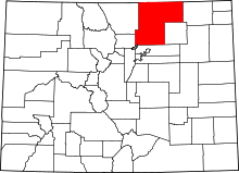 | |
| Towns | ||
| CDP | ||
| Unincorporated communities | ||
| Ghost towns | ||
| Footnotes | ‡This populated place also has portions in an adjacent county or counties | |
