Wattenburg, Colorado
This article is about the community. For the gas field, see Wattenberg Gas Field.
| Wattenburg, Colorado Wattenberg, Colorado | |
|---|---|
| Unincorporated community | |
  Location in Weld County and the state of Colorado | |
| Coordinates: 40°06′59″N 104°47′53″W / 40.11639°N 104.79806°WCoordinates: 40°06′59″N 104°47′53″W / 40.11639°N 104.79806°W | |
| Country |
|
| State |
|
| County | Weld County[1] |
| Elevation[1] | 4,938 ft (1,505 m) |
| Time zone | MST (UTC-7) |
| • Summer (DST) | MDT (UTC-6) |
| ZIP code[2] | 80621 (Fort Lupton) |
| GNIS feature ID | 0180850 |
Wattenburg or Wattenberg is an unincorporated community located in Weld County, Colorado, United States. The U.S. Post Office at Fort Lupton (ZIP Code 80621) now serves Wattenburg postal addresses.[2]
Geography
Wattenburg is located at 40°06′59″N 104°47′53″W / 40.11639°N 104.79806°W (40.116284,-104.798069).
References
- 1 2 "US Board on Geographic Names". United States Geological Survey. 2007-10-25. Retrieved 2008-01-31.
- 1 2 "ZIP Code Lookup" (JavaScript/HTML). United States Postal Service. January 3, 2007. Retrieved January 3, 2007.
Municipalities and communities of Weld County, Colorado, United States | ||
|---|---|---|
| Cities | 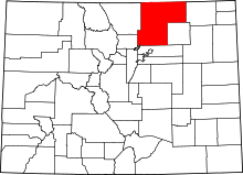 | |
| Towns | ||
| CDP | ||
| Unincorporated communities | ||
| Ghost towns | ||
| Footnotes | ‡This populated place also has portions in an adjacent county or counties | |
This article is issued from Wikipedia - version of the 7/31/2016. The text is available under the Creative Commons Attribution/Share Alike but additional terms may apply for the media files.