Ault, Colorado
| Town of Ault, Colorado | |
|---|---|
| Statutory Town | |
 | |
| Nickname(s): A Unique Little Town | |
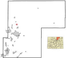 Location within Weld County and the State of Colorado | |
 Town of Ault, Colorado Location in the United States | |
| Coordinates: 40°35′00″N 104°44′02″W / 40.583454°N 104.733962°WCoordinates: 40°35′00″N 104°44′02″W / 40.583454°N 104.733962°W[1] | |
| Country |
|
| State |
|
| County | Weld County[2] |
| Incorporated | 1904-04-11, as the Town of Bergdorf[3] |
| Government | |
| • Type | Statutory Town[2] |
| • Mayor | Brad Bayne |
| • Mayor Pro Tem | Troy Osborne |
| Area | |
| • Total | 0.7 sq mi (1.7 km2) |
| • Land | 0.7 sq mi (1.7 km2) |
| • Water | 0.0 sq mi (0.0 km2) 0.0% |
| Elevation[4] | 4,938 ft (1,505 m) |
| Population (2010) | |
| • Total | 1,519 |
| • Density | 2,200/sq mi (890/km2) |
| Time zone | MST (UTC-7) |
| • Summer (DST) | MDT (UTC-6) |
| ZIP Code | 80610[5] |
| Area code(s) | 970 |
| INCITS place code | 0803950 |
| GNIS feature ID | 0180544 |
| Highways |
|
| Website | www.townofault.org |
The Town of Ault is a Statutory Town located in Weld County, Colorado, United States. The town population was 1519 at the 2010 United States Census.
History
First called High Land, the town's name was changed to Burgdorff Siding, sometimes called Bergdorf Switch (after a railroad worker who had been killed in an accident), before it acquired its current name in 1897. The town was named after Alexander Ault, a Fort Collins, Colorado resident and owner of a flour mill. Mr. Ault had helped to avert financial disaster to the agricultural base by purchasing the entire grain harvest during a year of severe economic hardship. The town was incorporated in 1904.
Much of the residential area of the town, as well as surrounding farmland, is on land given by the United States government to the Union Pacific Railroad, to be sold to finance railroad construction. A north-south segment of the railroad connecting Denver, Colorado, and Cheyenne, Wyoming, passes through the town, parallel to U.S. Highway 85. On February 21, 1910, Rabbi I. Idleson of Denver, Colorado, purchased 640 acres (2.6 km2) for farming purposes near Ault, proposing "to employ Jewish farmers and devote land to practical philanthropy".[6] Little came of this venture, and within a few decades there were apparently no Jewish residents in the town.
Ault Public Emergency Radio Tower, a former emergency transmission facility, was located here.
Geography
Ault is located at 40°35′2″N 104°44′1″W / 40.58389°N 104.73361°W (40.583999, -104.733648),[7] at the intersection of U.S. Highway 85 and State Highway 14.
According to the United States Census Bureau, the town has a total area of 0.7 square miles (1.8 km2), all of it land.
Demographics
| Historical population | |||
|---|---|---|---|
| Census | Pop. | %± | |
| 1910 | 569 | — | |
| 1920 | 769 | 35.1% | |
| 1930 | 737 | −4.2% | |
| 1940 | 761 | 3.3% | |
| 1950 | 866 | 13.8% | |
| 1960 | 799 | −7.7% | |
| 1970 | 841 | 5.3% | |
| 1980 | 1,056 | 25.6% | |
| 1990 | 1,107 | 4.8% | |
| 2000 | 1,432 | 29.4% | |
| 2010 | 1,519 | 6.1% | |
| Est. 2015 | 1,622 | [8] | 6.8% |
As of the census[10] of 2000, there were 1,432 people, 540 households, and 381 families residing in the town. The population density was 2,123.7 people per square mile (825.2/km²). There were 560 housing units at an average density of 830.5 per square mile (322.7/km²). The racial makeup of the town was 79.47% White, 0.07% African American, 0.91% Native American, 0.42% Asian, 16.76% from other races, and 2.37% from two or more races. Hispanic or Latino of any race were 30.24% of the population.
There were 540 households out of which 38.5% had children under the age of 18 living with them, 55.0% were married couples living together, 10.6% have a female householder with no husband present, and 29.4% were non-families. 26.1% of all households were made up of individuals and 13.0% had someone living alone who was 65 years of age or older. The average household size was 2.65 and the average family size was 3.20.
In the town the population was spread out with 30.6% under the age of 18, 8.8% from 18 to 24, 29.1% from 25 to 44, 19.6% from 45 to 64, and 11.9% who were 65 years of age or older. The median age was 34 years. For every 100 females there were 100.8 males. For every 100 females age 18 and over, there were 92.6 males.
The median income for a household in the town was $33,846, and the median income for a family was $43,304. Males had a median income of $32,270 versus $23,482 for females. The per capita income for the town was $15,570. About 5.9% of families and 9.1% of the population were below the poverty line, including 10.4% of those under age 18 and 9.5% of those age 65 or over.
Other
- "AULT" is sometimes used as an acronym - "A Unique Little Town."
- Ault hosts two annual town festivals. The ironically-named Fall Festival, which takes place in August, features food, booths, contests and a street dance. The theme of the 2006 Fall Festival was "It's Your Fault if You're Not in Ault!" The theme of the 2007 Fall Festival was "Remembering Not To Forget." Every October, the International Food Fest allows local residents to show off their cultural roots.
- Scenes from the 1977 film "One on One", starring Robby Benson and featuring a young Melanie Griffith, were filmed in various Ault locations.
- Ault's only high school is named "Highland High School", which was changed from "Ault High School" when it combined with schools in nearby towns Pierce, Nunn and Carr, Colorado, in 1963. The Highland School District name comes from the high plains location, rather than the earlier name of the town of Ault, and there is no indication that the early name played any part in the naming decision. Highland High School's mascot is the Husky.
See also
References
- ↑ "2014 U.S. Gazetteer Files: Places". United States Census Bureau. July 1, 2014. Retrieved January 5, 2015.
- 1 2 "Active Colorado Municipalities". State of Colorado, Department of Local Affairs. 2007-02-27. Archived from the original on 2010-11-23. Retrieved 2007-02-27.
- ↑ "Colorado Municipal Incorporations". State of Colorado, Department of Personnel & Administration, Colorado State Archives. 2004-12-01. Archived from the original on 27 September 2007. Retrieved 2007-08-18.
- ↑ "US Board on Geographic Names". United States Geological Survey. 2007-10-25. Retrieved 2008-01-31.
- ↑ "ZIP Code Lookup" (JavaScript/HTML). United States Postal Service. August 19, 2007. Archived from the original on 18 August 2007. Retrieved August 19, 2007.
- ↑ American Jewish Yearbook (PDF) (1910-1911) http://www.ajcarchives.org/ajc_data/files/1910_1911_4_yearreview.pdf. Missing or empty
|title=(help) - ↑ "US Gazetteer files: 2010, 2000, and 1990". United States Census Bureau. 2011-02-12. Retrieved 2011-04-23.
- ↑ "Annual Estimates of the Resident Population for Incorporated Places: April 1, 2010 to July 1, 2015". Retrieved July 2, 2016.
- ↑ "Census of Population and Housing". Census.gov. Archived from the original on May 11, 2015. Retrieved June 4, 2015.
- ↑ "American FactFinder". United States Census Bureau. Archived from the original on 2013-09-11. Retrieved 2008-01-31.
External links
| Wikimedia Commons has media related to Ault, Colorado. |
Municipalities and communities of Weld County, Colorado, United States | ||
|---|---|---|
| Cities | 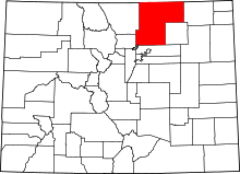 | |
| Towns | ||
| CDP | ||
| Unincorporated communities | ||
| Ghost towns | ||
| Footnotes | ‡This populated place also has portions in an adjacent county or counties | |
