Milliken, Colorado
| Town of Milliken, Colorado | |
|---|---|
| Statutory Town | |
|
Broad Street in Milliken. | |
| Nickname(s): The hub of northern Colorado | |
 Location in Weld County and the state of Colorado | |
| Coordinates: 40°19′52″N 104°51′36″W / 40.33111°N 104.86000°WCoordinates: 40°19′52″N 104°51′36″W / 40.33111°N 104.86000°W | |
| Country |
|
| State |
|
| County[1] | Weld |
| Incorporated (town) | October 1, 1910[2] |
| Government | |
| • Type | Statutory Town[1] |
| Area | |
| • Total | 5.7 sq mi (14.8 km2) |
| • Land | 5.7 sq mi (14.8 km2) |
| • Water | 0 sq mi (0 km2) |
| Elevation[3] | 4,751 ft (1,448 m) |
| Population (2010)[4] | |
| • Total | 5,610 |
| • Density | 505.5/sq mi (195.2/km2) |
| Time zone | Mountain (MST) (UTC-7) |
| • Summer (DST) | MDT (UTC-6) |
| ZIP code[5] | 80543 |
| Area code(s) | 970 |
| FIPS code | 08-50480 |
| GNIS feature ID | 0180708 |
| Website | Town of Milliken |

The Town of Milliken is a Statutory Town in Weld County, Colorado, United States. The town population was 5610 at the 2010 United States Census.
History
The town was named for John D. Milliken, a railroad official.[6]
The first community located near the Milliken townsite was initially known as Hillsboro. The community began as a trading post on the Denver, Laramie and Northwestern Railroad for agricultural goods in the 1860s. By 1908 the town of Milliken had grown up nearby Hillsboro, and in 1910 Hillsboro was annexed by Milliken.
Fires in the 1910s destroyed much of the town, and in 1917 the Denver, Laramie and Northwestern Railroad was abandoned.
Milliken continued as a primarily farming community through the depression and world wars. In the 1950s two large potato decks were constructed. The late 1960s and early 1970s brought a housing boom.
In 1985 and 1986 the town roads were paved. The town continued to grow, causing the town government to move their facilities, in 1996, into the Milliken Community Complex. Additional facilities were added, including the Milliken Public Work Facility in 2004, and a new police station in 2009.[7]
Geography
Milliken is located at 40°19′52″N 104°51′36″W / 40.33111°N 104.86000°W (40.331073, -104.859878).[8]
According to the United States Census Bureau, the town has a total area of 5.7 square miles (15 km2), all of it land.
Demographics
| Historical population | |||
|---|---|---|---|
| Census | Pop. | %± | |
| 1920 | 372 | — | |
| 1930 | 483 | 29.8% | |
| 1940 | 531 | 9.9% | |
| 1950 | 510 | −4.0% | |
| 1960 | 630 | 23.5% | |
| 1970 | 702 | 11.4% | |
| 1980 | 1,506 | 114.5% | |
| 1990 | 1,605 | 6.6% | |
| 2000 | 2,888 | 79.9% | |
| 2010 | 5,610 | 94.3% | |
| Est. 2015 | 6,388 | [9] | 13.9% |
As of the census[4] of 2000, there were 2,888 people, 866 households, and 717 families residing in the town. The population density was 505.5 people per square mile (195.3/km²). There were 903 housing units at an average density of 158.0 per square mile (61.1/km²). The racial makeup of the town was 73.89% White, 0.31% African American, 1.18% Native American, 0.48% Asian, 21.61% from other races, and 2.53% from two or more races. Hispanic or Latino of any race were 40.75% of the population.
There were 866 households out of which 48.5% had children under the age of 18 living with them, 69.4% were married couples living together, 9.7% had a female householder with no husband present, and 17.2% were non-families. 12.0% of all households were made up of individuals and 3.0% had someone living alone who was 65 years of age or older. The average household size was 3.33 and the average family size was 3.63.
In the town the population was spread out with 35.1% under the age of 18, 10.7% from 18 to 24, 32.3% from 25 to 44, 16.4% from 45 to 64, and 5.4% who were 65 years of age or older. The median age was 27 years. For every 100 females there were 96.3 males. For every 100 females age 18 and over, there were 99.0 males.
The median income for a household in the town was $43,603, and the median income for a family was $47,188. Males had a median income of $33,646 versus $22,417 for females. The per capita income for the town was $14,484. About 9.1% of families and 12.2% of the population were below the poverty line, including 14.9% of those under age 18 and 8.8% of those age 65 or over.
See also
- Outline of Colorado
- State of Colorado
- Dent Site, near Milliken, the first site to provide evidence that men hunted mammoth
References
- 1 2 "Active Colorado Municipalities". State of Colorado, Department of Local Affairs. Retrieved 2007-09-01.
- ↑ "Colorado Municipal Incorporations". State of Colorado, Department of Personnel & Administration, Colorado State Archives. 2004-12-01. Retrieved 2007-09-02.
- ↑ "US Board on Geographic Names". United States Geological Survey. 2007-10-25. Retrieved 2008-01-31.
- 1 2 "American FactFinder". United States Census Bureau. Retrieved 2008-01-31.
- ↑ "ZIP Code Lookup" (JavaScript/HTML). United States Postal Service. Retrieved November 22, 2007.
- ↑ Dawson, John Frank. Place names in Colorado: why 700 communities were so named, 150 of Spanish or Indian origin. Denver, CO: The J. Frank Dawson Publishing Co. p. 35.
- ↑ "History of Milliken". Retrieved 2015-05-10.
- ↑ "US Gazetteer files: 2010, 2000, and 1990". United States Census Bureau. 2011-02-12. Retrieved 2011-04-23.
- ↑ "Annual Estimates of the Resident Population for Incorporated Places: April 1, 2010 to July 1, 2015". Retrieved July 2, 2016.
- ↑ "Census of Population and Housing". Census.gov. Retrieved June 4, 2015.
External links
| Wikimedia Commons has media related to Milliken, Colorado. |
Municipalities and communities of Weld County, Colorado, United States | ||
|---|---|---|
| Cities | 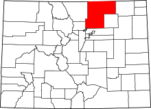 | |
| Towns | ||
| CDP | ||
| Unincorporated communities | ||
| Ghost towns | ||
| Footnotes | ‡This populated place also has portions in an adjacent county or counties | |
