Seaside, California
| Seaside, California | |
|---|---|
| City | |
| City of Seaside | |
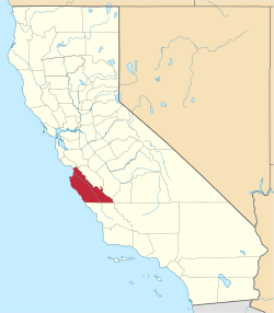
 Location in Monterey County and the state of California | |
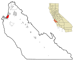
 Seaside, California Location in the United States | |
| Coordinates: 36°36′40″N 121°50′41″W / 36.61111°N 121.84472°WCoordinates: 36°36′40″N 121°50′41″W / 36.61111°N 121.84472°W | |
| Country | United States |
| State | California |
| County | Monterey |
| Incorporated | October 13, 1954[1] |
| Government | |
| • Mayor | Ralph Rubio[2] |
| • Senate | Bill Monning (D) |
| • Assembly | Mark Stone (D) |
| • U. S. Congress | Sam Farr (D)[3] |
| Area[4] | |
| • Total | 9.376 sq mi (24.282 km2) |
| • Land | 9.237 sq mi (23.923 km2) |
| • Water | 0.139 sq mi (0.359 km2) 1.48% |
| Elevation[5] | 33 ft (10 m) |
| Population (April 1, 2010)[6] | |
| • Total | 33,025 |
| • Estimate (2013)[6] | 34,095 |
| • Density | 3,500/sq mi (1,400/km2) |
| Time zone | PST (UTC-8) |
| • Summer (DST) | PDT (UTC-7) |
| ZIP code | 93955 |
| Area code(s) | 831 |
| FIPS code | 06-70742 |
| GNIS feature ID | 1659619 |
| Website |
www |
Seaside (formerly East Monterey) is a city in Monterey County, California, United States, with a population of 33,025 as of the 2010 census. Seaside is located 2.25 miles (3.6 km) east-northeast of Monterey,[7] at an elevation of 33 feet (10 m).[5] Seaside is the home of California State University, Monterey Bay (CSUMB) and the Monterey College of Law, which are located on the site of the former military base Fort Ord. It is the home of the Bayonet and Black Horse golf courses, once also part of the Fort Ord military base, now open to the public, and host to PGA Tour events,[8] including the 2012 PGA Professional National Championship[9]
Geography
Seaside is located at 36°36′40″N 121°50′41″W / 36.61111°N 121.84472°W.[5]
According to the United States Census Bureau, the city has a total area of 9.4 square miles (24 km2), of which, 9.2 square miles (24 km2) of it is land and 0.1 square miles (0.26 km2) of it (1.48%) is water. According to the maps of the United States Geological Survey, the elevation ranges from 0 to 165 meters (0 to 541 feet).
The climate is a cool Mediterranean type, strongly influenced by the prevailing winds from the west, which blow over the Pacific Coast's cool ocean currents from Alaska. At the nearest National Weather Service Climate Station, in the City of Monterey at 385 feet elevation: The coldest month is January, with an average daily high of 15.5 °C (59.9 °F); the warmest month is September, with an average daily high of 22 °C (72 °F); the average daily low is 6 °C (43 °F) in January and 11.5 °C (52.7 °F) in September; and the average rainfall is 50 centimeters (20 inches) per year, with 90.3% falling during November through April. The weather can be much hotter when the winds blow from the east: Since 1906, there have been 11 days with a high of 37.8 °C (100.0 °F) or higher; all 11 days occurred in June, September, or October.[10]
Climate
This region experiences warm (but not hot) and dry summers, with no average monthly temperatures above 71.6 °F. According to the Köppen Climate Classification system, Seaside has a warm-summer Mediterranean climate, abbreviated "Csb" on climate maps.[11]
History
Seaside (then called East Monterey) was laid out in 1888 by Dr. J.L.D. Roberts.[7] The Seaside post office opened in 1891.[7] Seaside incorporated in 1954.[7]
Law and government
The City of Seaside is a General Law City with a Council/Manager form of government. The five-member City Council is a legislative and policy-making body that is elected on a nonpartisan basis to represent the residents of Seaside.
The City Manager is appointed by the City Council to manage the daily operations of the City and is responsible for making policy recommendations to the City Council and implementing City Council policy directives.
Policy decisions are made at City Council meetings, which are held on the first and third Thursdays of each month at 7:00 p.m. in the City Council Chambers at City Hall, with special meetings as needed. At these public meetings, the City Council makes policy determinations; approves agreements and contracts; adopts ordinances (local laws) and regulations; and authorizes the expenditure of City funds. The City Council also serves as the Board of Directors for the Redevelopment Agency of the City Council. Meetings of the Redevelopment Agency are typically held prior to the City Council Meetings.[12]
Demographics
| Historical population | |||
|---|---|---|---|
| Census | Pop. | %± | |
| 1960 | 19,353 | — | |
| 1970 | 36,883 | 90.6% | |
| 1980 | 36,567 | −0.9% | |
| 1990 | 38,901 | 6.4% | |
| 2000 | 31,696 | −18.5% | |
| 2010 | 33,025 | 4.2% | |
| Est. 2015 | 34,533 | [13] | 4.6% |
2010
The 2010 United States Census[15] reported that Seaside had a population of 33,025. The population density was 3,522.5 people per square mile (1,360.0/km²). The racial makeup of Seaside was 15,978 (48.4%) White, 2,783 (8.4%) African American, 347 (1.1%) Native American, 3,206 (9.7%) Asian, 529 (1.6%) Pacific Islander, 7,579 (22.9%) from other races, and 2,603 (7.9%) from two or more races. Hispanic or Latino of any race were 14,347 persons (43.4%).
The census reported that 31,898 people (96.6% of the population) lived in households, 1,127 (3.4%) lived in non-institutionalized group quarters, and 0 (0%) were institutionalized.
There were 10,093 households, out of which 4,408 (43.7%) had children under the age of 18 living in them, 5,232 (51.8%) were opposite-sex married couples living together, 1,433 (14.2%) had a female householder with no husband present, 708 (7.0%) had a male householder with no wife present. There were 727 (7.2%) unmarried opposite-sex partnerships, and 70 (0.7%) same-sex married couples or partnerships. 1,927 households (19.1%) were made up of individuals and 697 (6.9%) had someone living alone who was 65 years of age or older. The average household size was 3.16. There were 7,373 families (73.1% of all households); the average family size was 3.57.
The population was spread out with 8,923 people (27.0%) under the age of 18, 4,428 people (13.4%) aged 18 to 24, 10,154 people (30.7%) aged 25 to 44, 6,675 people (20.2%) aged 45 to 64, and 2,845 people (8.6%) who were 65 years of age or older. The median age was 30.6 years. For every 100 females there were 100.5 males. For every 100 females age 18 and over, there were 99.8 males.
There were 10,872 housing units at an average density of 1,159.6 per square mile (447.7/km²), of which 4,183 (41.4%) were owner-occupied, and 5,910 (58.6%) were occupied by renters. The homeowner vacancy rate was 2.2%; the rental vacancy rate was 4.9%. 11,979 people (36.3% of the population) lived in owner-occupied housing units and 19,919 people (60.3%) lived in rental housing units.
2000
As of the census[16] of 2000, there were 31,696 people, 9,833 households, and 7,394 families residing in the city. The population density was 3,591.3 people per square mile (1,385.9/km²). There were 11,005 housing units at an average density of 1,246.9 per square mile (481.2/km²). The racial makeup of the city was 49.21% White, 12.61% African American, 1.04% Native American, 10.09% Asian, 1.29% Pacific Islander, 18.41% from other races, and 7.34% from two or more races. Hispanic or Latino of any race were 34.48% of the population.
There were 9,833 households out of which 42.2% had children under the age of 18 living with them, 54.8% were married couples living together, 13.9% had a female householder with no husband present, and 24.8% were non-families. 18.1% of all households were made up of individuals and 6.7% had someone living alone who was 65 years of age or older. The average household size was 3.21 and the average family size was 3.59.
In the city the population was spread out with 30.2% under the age of 18, 11.1% from 18 to 24, 34.4% from 25 to 44, 15.8% from 45 to 64, and 8.5% who were 65 years of age or older. The median age was 30 years. For every 100 females there were 103.7 males. For every 100 females age 18 and over, there were 101.6 males.
The median income for a household in the city was $41,393, and the median income for a family was $43,259. Males had a median income of $29,204 versus $26,424 for females. The per capita income for the city was $15,183. About 9.3% of families and 12.1% of the population were below the poverty line, including 14.9% of those under age 18 and 7.4% of those age 65 or over.
Education
Seaside High School is home to the 2006 CCS Small-Division Football Championship winners, the Spartans, led by coaches Alfred Avila, Quentin Crosby, Michael Drain, Jeff Quenga, Matt Avila, Pastor Joe Kamp, and Bryan Shaw. The football game between county rival Monterey High School attracts nearly 5,000 people every year. Ron Rivera, currently coach of the NFL's Carolina Panthers and former linebacker for the Chicago Bears, was a 1980 graduate of Seaside High School.
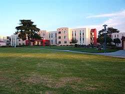
California State University, Monterey Bay is located in Seaside near Fort Ord and is the second newest campus after CSU Channel Islands. Seaside is also home to Monterey College of Law, a private law school.
Economy
The Defense Manpower Data Center has an office in Seaside, on the former Fort Ord.
Message Mountain
Message Mountain is part of Seaside's popular culture. It is a large sand dune near the junction of Fremont Blvd and State Route 1. People write messages on the dune with ice plant. It is a popular place for birthday messages, wedding proposals, and congratulation messages. Many people climb atop it to view fireworks on 4 July. It is also known as "The Big Dune" or "The Dune" or "The Big Sand Hill" or "The Sand Board"
Bayonet and Black Horse golf courses
Bayonet Golf Course, designed in 1954, was built on the Fort Ord military base. It was named after the Army's 7th Infantry division. The course was allegedly designed to play to then-commanding officer Major General Robert B. McClure's terrible slice, and thus has a series of holes nicknamed "Combat Corner" with substantial doglegs. Black Horse, named after the 11th Cavalry, followed in 1964. Until 1997, the golf courses were only open to members of the military; in 1997 it was purchased by the City of Seaside and opened to the public.[17] After several years of renovation, the courses now meet USGA specifications, and have one new and eight redesigned holes.[18] In 2012, these two courses hosted the PGA Professional National Championship[9] Both Bayonet and Black Horse overlook Monterey Bay, and are par 72 courses.[19]
Notable natives and residents
- Herman Edwards was the head coach of the Kansas City Chiefs of the National Football League. He had also coached the New York Jets. Edwards was born in Fort Monmouth, New Jersey and raised in Seaside, California although he played high school football in neighboring Monterey. Edwards is the son of Herman, Sr., the late Master Sergeant, and Martha. Herman Sr. met Martha while he was stationed in Germany with the U.S. Army. Edwards played college football at Monterey Peninsula Junior College in 1973. Edwards hosts an annual football camp at CSUMB sponsored by The Youth Foundation.
- Tony Curtis was the backup tight end for the Dallas Cowboys, and is now with the San Francisco 49ers. He graduated from Seaside High School in 2001 and went on to attend college at Portland State. He attended open try-outs for the Cowboys and was put on the practice squad in 2005. Head coach Wade Phillips promoted Curtis after a strong pre-season to back-up TE. He had 3 catches for 3 touchdowns in the 2007 season. The Niners signed him on February 4, 2010.
- Mason Foster is a linebacker for the Washington Redskins of the National Football League.[20]
- Charlie Harraway, raised in Seaside, attending Monterey High and Monterey Peninsula College, and transferred from the latter to San Jose State. He was drafted by the Browns and signed with the Redskins, going to the Super Bowl in 1972.
References
- ↑ "California Cities by Incorporation Date" (Word). California Association of Local Agency Formation Commissions. Retrieved August 25, 2014.
- ↑ "Mayor & City Council". City of Seaside, CA. Retrieved September 18, 2014.
- ↑ "California's 20th Congressional District - Representatives & District Map". Civic Impulse, LLC. Retrieved September 24, 2014.
- ↑ "2010 Census U.S. Gazetteer Files – Places – California". United States Census Bureau.
- 1 2 3 U.S. Geological Survey Geographic Names Information System: Seaside, California
- 1 2 "Seaside (city) QuickFacts". United States Census Bureau. Retrieved March 19, 2015.
- 1 2 3 4 Durham, David L. (1998). California's Geographic Names: A Gazetteer of Historic and Modern Names of the State. Clovis, Calif.: Word Dancer Press. p. 958. ISBN 1-884995-14-4.
- ↑ "Bayonet Golf Course". montereyinfo.org. Retrieved May 16, 2015.
- 1 2 "2015 PGA Professional National Championship at the Philadelphia Cricket Club, Philadelphia, Pennsylvania - PGA.com". PGA.com. Retrieved May 16, 2015.
- ↑ For the Period of Record, 1906-2012, per the Western Regional Climate Center, www.wrcc.dri.edu
- ↑ "Seaside, California Köppen Climate Classification (Weatherbase)". Weatherbase. Retrieved May 16, 2015.
- ↑ City of Seaside Web Page.http://www.ci.seaside.ca.us/index.aspx?page=55
- ↑ "Annual Estimates of the Resident Population for Incorporated Places: April 1, 2010 to July 1, 2015". Retrieved July 2, 2016.
- ↑ "Census of Population and Housing". Census.gov. Retrieved June 4, 2015.
- ↑ "2010 Census Interactive Population Search: CA - Seaside city". U.S. Census Bureau. Retrieved July 12, 2014.
- ↑ "American FactFinder". United States Census Bureau. Retrieved 2008-01-31.
- ↑ Bayonet and Black Horse: History
- ↑ Bayonet and Black Horse: Renovation
- ↑ Monterey County Convention & Visitors Bureau: Bayonet and Black Horse
- ↑ "Mason Foster player profile". Tampa Bay Buccaneers. Retrieved 2014-09-18.
External links
| Wikivoyage has a travel guide for Seaside. |