Gorda, California
| Gorda | |
|---|---|
| Unincorporated community | |
|
Gorda, California. | |
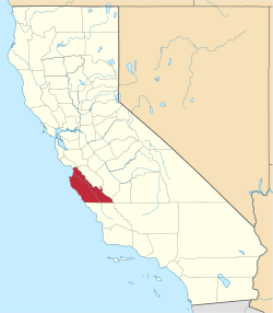
 Gorda Location in California | |
| Coordinates: 35°52′35″N 121°26′46″W / 35.87639°N 121.44611°WCoordinates: 35°52′35″N 121°26′46″W / 35.87639°N 121.44611°W | |
| Country | United States |
| State | California |
| County | Monterey County |
| Elevation[1] | 148 ft (45 m) |
| ZIP code | 93920 |
| Area code | 805 |
| GNIS feature ID | 271364 |
.jpg)
Gorda is an unincorporated community in Monterey County, California.[1] It is located 3 miles (4.8 km) north of Cape San Martin,[2] at an elevation of 148 feet (45 m).[1] It is one of the three small settlements of filling stations, restaurants, and motels located along State Route 1 on the Big Sur coast. The ZIP Code is 93920, but mail must be addressed to Big Sur,[3] and the community is inside area code 805.
History
The fresh springs in Gorda were used by Native American tribes. The first settlement by Westerners was in 1878, when a stagecoach stop was built in Gorda. The settlement expanded with the Gold Rush of the 1880s.[4] The town is now the location of the Gorda Springs Ocean Side Resort.
Gorda is derived from the Spanish word for "fat" or "well-fed".[5]
A post office operated at Gorda from 1893 to 1923, moving in 1910.[2]
Government
At the county level, Gorda is represented on the Monterey County Board of Supervisors by Supervisor Dave Potter.[6]
In the California State Legislature, Gorda is in the 17th Senate District, represented by Democrat Bill Monning, and in the 30th Assembly District, represented by Democrat Anna Caballero.[7]
In the United States House of Representatives, Gorda is in California's 20th congressional district, represented by Democrat Sam Farr[8]
Fuel prices
As of April 26, 2008, Gorda had the highest gasoline prices in the United States at $6.70 per gallon. Part of this cost goes to subsidize the 100 gallon per day Diesel generator fuel bill for the town.[9][10][11]
Geography
Under the Köppen climate classification, "dry-summer subtropical" climates are often referred to as "Mediterranean". This climate zone has an average temperature above 10 °C (50 °F) in their warmest months, and an average in the coldest between 18 to −3 °C (64 to 27 °F). Summers tend to be dry with less than one-third that of the wettest winter month, and with less than 30 mm (1 in) of precipitation in a summer month.[12]
Climate
| Climate data for Gorda, CA | |||||||||||||
|---|---|---|---|---|---|---|---|---|---|---|---|---|---|
| Month | Jan | Feb | Mar | Apr | May | Jun | Jul | Aug | Sep | Oct | Nov | Dec | Year |
| Record high °F (°C) | 81 (27) |
85 (29) |
87 (31) |
98 (37) |
96 (36) |
102 (39) |
99 (37) |
101 (38) |
100 (38) |
100 (38) |
90 (32) |
75 (24) |
102 (39) |
| Average high °F (°C) | 59.7 (15.4) |
61.5 (16.4) |
63.4 (17.4) |
68.3 (20.2) |
72.6 (22.6) |
75.9 (24.4) |
75.6 (24.2) |
77.3 (25.2) |
77.1 (25.1) |
73.2 (22.9) |
64.5 (18.1) |
59.9 (15.5) |
69.1 (20.6) |
| Average low °F (°C) | 42.9 (6.1) |
43.1 (6.2) |
43.4 (6.3) |
43.5 (6.4) |
45.8 (7.7) |
48.3 (9.1) |
50.4 (10.2) |
50.0 (10) |
50.3 (10.2) |
47.9 (8.8) |
44.9 (7.2) |
41.9 (5.5) |
46.0 (7.8) |
| Record low °F (°C) | 27 (−3) |
29 (−2) |
27 (−3) |
30 (−1) |
35 (2) |
37 (3) |
41 (5) |
40 (4) |
39 (4) |
36 (2) |
28 (−2) |
27 (−3) |
27 (−3) |
| Average precipitation inches (mm) | 9.10 (231.1) |
8.65 (219.7) |
6.49 (164.8) |
3.11 (79) |
1.09 (27.7) |
0.24 (6.1) |
0.03 (0.8) |
0.05 (1.3) |
0.42 (10.7) |
2.03 (51.6) |
4.85 (123.2) |
7.62 (193.5) |
43.7 (1,110) |
| Average precipitation days (≥ 0.01 in) | 10.3 | 11.2 | 10.3 | 6.5 | 3.7 | 1.1 | 0.3 | 0.4 | 1.3 | 3.5 | 7.5 | 10.3 | 66.4 |
| Source: NOAA [13] | |||||||||||||

References
- 1 2 3 "Gorda". Geographic Names Information System. United States Geological Survey. Retrieved February 2, 2015.
- 1 2 Durham, David L. (1998). California's Geographic Names: A Gazetteer of Historic and Modern Names of the State. Clovis, Calif.: Word Dancer Press. p. 901. ISBN 1-884995-14-4.
- ↑ "USPS.com® - ZIP Code™ Lookup".
- ↑ "Gorda Springs Resort, Big Sur, CA - California Beaches".
- ↑ Gannett, Henry (1905). The Origin of Certain Place Names in the United States. Govt. Print. Off. p. 139.
- ↑ "Monterey County Supervisorial District 5 Map (North District 5)" (PDF). County of Monterey. Retrieved 21 September 2012.
- ↑ "Statewide Database". UC Regents. Retrieved February 2, 2015.
- ↑ "California's 20th Congressional District - Representatives & District Map". Civic Impulse, LLC. Retrieved September 24, 2014.
- ↑ "ABC News Nightline - High-Priced Gas in the Middle of Nowhere"http://abcnews.go.com/Business/story?id=4532134&page=1
- ↑ "Most Stunning View in Town Is the One at the Pump", Jesse McKinley, The New York Times, March 12, 2008
- ↑ "NBCNews.com Video Player".
- ↑ "Big Sur, California Köppen Climate Classification (Weatherbase)".
- ↑ "NOWData - NOAA Online Weather Data". National Oceanic and Atmospheric Administration. Retrieved 2013-05-02.