Pacific Grove Acres, California
| Pacific Grove Acres | |
|---|---|
| Unincorporated community | |
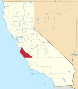
 Pacific Grove Acres  Pacific Grove Acres Location in California | |
| Coordinates: 36°37′44″N 121°55′48″W / 36.62889°N 121.93000°WCoordinates: 36°37′44″N 121°55′48″W / 36.62889°N 121.93000°W | |
| Country | United States |
| State | California |
| County | Monterey County |
| Elevation[1] | 125 ft (38 m) |
Pacific Grove Acres is an unincorporated community in Monterey County, California.[1] It is located northwest of Pacific Grove,[2] at an elevation of 125 feet (38 m).[1]
Government
At the county level, Pacific Grove Acres is represented on the Monterey County Board of Supervisors by Supervisor Dave Potter.[3]
In the California State Legislature, Pacific Grove Acres is in the 17th Senate District, represented by Democrat Bill Monning, and in the 29th Assembly District, represented by Democrat Mark Stone.[4]
In the United States House of Representatives, Pacific Grove Acres is in California's 20th congressional district, represented by Democrat Sam Farr[5]
References
- 1 2 3 U.S. Geological Survey Geographic Names Information System: Pacific Grove Acres, California
- ↑ Durham, David L. (1998). California's Geographic Names: A Gazetteer of Historic and Modern Names of the State. Clovis, Calif.: Word Dancer Press. p. 932. ISBN 1-884995-14-4.
- ↑ "Monterey County Supervisorial District 5 Map (North District 5)" (PDF). County of Monterey. Retrieved 21 September 2012.
- ↑ "Statewide Database". UC Regents. Retrieved February 11, 2015.
- ↑ "California's 20th Congressional District - Representatives & District Map". Civic Impulse, LLC. Retrieved September 24, 2014.
This article is issued from Wikipedia - version of the 7/5/2016. The text is available under the Creative Commons Attribution/Share Alike but additional terms may apply for the media files.