Lockwood, California
| Lockwood | |
|---|---|
| census-designated place | |
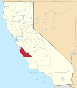
 Lockwood Location in California | |
| Coordinates: 35°56′39″N 121°05′00″W / 35.94417°N 121.08333°WCoordinates: 35°56′39″N 121°05′00″W / 35.94417°N 121.08333°W | |
| Country |
|
| State |
|
| County | Monterey |
| Area[1] | |
| • Total | 10.907 sq mi (28.250 km2) |
| • Land | 10.873 sq mi (28.162 km2) |
| • Water | 0.034 sq mi (0.088 km2) 0.31% |
| Elevation[2] | 971 ft (296 m) |
| Population (2010) | |
| • Total | 379 |
| • Density | 35/sq mi (13/km2) |
| Time zone | Pacific (PST) (UTC-8) |
| • Summer (DST) | PDT (UTC-7) |
| ZIP Code | 93932 |
| Area code(s) | 831 |
| GNIS feature IDs | 1660933; 2583058 |
| U.S. Geological Survey Geographic Names Information System: Lockwood, California; U.S. Geological Survey Geographic Names Information System: Lockwood, California | |
Lockwood[3] is a census-designated place[4] in Monterey County, California.[2] It is located 6 miles (9.7 km) east-southeast of Jolon,[3] 1.8 miles (2.9 km) north of the mouth of Tule Canyon, 3 miles (4.8 km) north of San Antonio River, and 9.3 miles (15 km) north of Bryson, at an elevation of 971 feet (296 m).[2]
Lockwood is in southern Monterey County and is a small town consisting of farms, ranches, and vineyards.
Lockwood encompasses the San Antonio Lake, a very popular destination for many boaters and wakeboarders all around San Luis Obispo and Monterey Counties. There is a post office in Lockwood, a community center, Fayter's Equine/Repair Service, and 2 stores, the Pleyto Store and the Lockwood Store. Just outside Lockwood is Hesperia Hall, located in Bryson-Hesperia. Lockwood also encompasses the San Antonio Valley Vineyards, including several more vineyards and few olive grows. There is extensive grazing land and cattle ranching in the area, and some families have been here ever since the town was founded, ranching and farming for generations. Lockwood is also home to Fort Hunter Liggett Military Base and the San Antonio Mission.
The first post office opened in 1888.[3] The name honors Belva Lockwood, candidate for President of the United States in 1884 and 1888 on the Equal Rights Party ticket.[3]
The ZIP Code is 93932, and the community is inside area code 831.
Geography
According to the United States Census Bureau, the CDP covers an area of 10.9 square miles (28.25 km²), 99.69% of it land, and 0.31% of it water.
Climate
This region experiences warm (but not hot) and dry summers, with no average monthly temperatures above 71.6 °F. According to the Köppen Climate Classification system, Lockwood has a warm-summer Mediterranean climate, abbreviated "Csb" on climate maps.[5]
Demographics
The 2010 United States Census[6] reported that Lockwood had a population of 379. The population density was 34.7 people per square mile (13.4/km²). The racial makeup of Lockwood was 297 (78.4%) White, 4 (1.1%) African American, 6 (1.6%) Native American, 2 (0.5%) Asian, 0 (0.0%) Pacific Islander, 56 (14.8%) from other races, and 14 (3.7%) from two or more races. Hispanic or Latino of any race were 100 persons (26.4%).
The Census reported that 379 people (100% of the population) lived in households, 0 (0%) lived in non-institutionalized group quarters, and 0 (0%) were institutionalized.
There were 163 households, out of which 44 (27.0%) had children under the age of 18 living in them, 76 (46.6%) were opposite-sex married couples living together, 10 (6.1%) had a female householder with no husband present, 5 (3.1%) had a male householder with no wife present. There were 11 (6.7%) unmarried opposite-sex partnerships, and 1 (0.6%) same-sex married couples or partnerships. 57 households (35.0%) were made up of individuals and 18 (11.0%) had someone living alone who was 65 years of age or older. The average household size was 2.33. There were 91 families (55.8% of all households); the average family size was 3.16.
The population was spread out with 98 people (25.9%) under the age of 18, 16 people (4.2%) aged 18 to 24, 78 people (20.6%) aged 25 to 44, 140 people (36.9%) aged 45 to 64, and 47 people (12.4%) who were 65 years of age or older. The median age was 44.5 years. For every 100 females there were 101.6 males. For every 100 females age 18 and over, there were 108.1 males.
There were 197 housing units at an average density of 18.1 per square mile (7.0/km²), of which 97 (59.5%) were owner-occupied, and 66 (40.5%) were occupied by renters. The homeowner vacancy rate was 1.0%; the rental vacancy rate was 13.0%. 220 people (58.0% of the population) lived in owner-occupied housing units and 159 people (42.0%) lived in rental housing units.
References
- ↑ U.S. Census
- 1 2 3 U.S. Geological Survey Geographic Names Information System: Lockwood, California
- 1 2 3 4 Durham, David L. (1998). California's Geographic Names: A Gazetteer of Historic and Modern Names of the State. Clovis, Calif.: Word Dancer Press. p. 917. ISBN 1-884995-14-4.
- ↑ U.S. Geological Survey Geographic Names Information System: Lockwood, California
- ↑ Climate Summary for Lockwood, California
- ↑ "2010 Census Interactive Population Search: CA - Lockwood CDP". U.S. Census Bureau. Retrieved July 12, 2014.