Lonoak, California
| Lonoak | |
|---|---|
| Unincorporated community | |
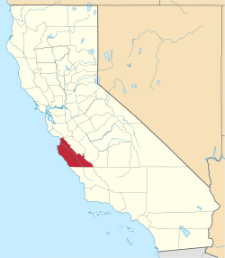
 Lonoak  Lonoak Location in California | |
| Coordinates: 36°16′39″N 120°56′35″W / 36.27750°N 120.94306°WCoordinates: 36°16′39″N 120°56′35″W / 36.27750°N 120.94306°W | |
| Country | United States |
| State | California |
| County | Monterey County |
| Elevation[1] | 883 ft (269 m) |
Lonoak (formerly, Lone Oak and Loanoke)[2] is an unincorporated community in Monterey County, California.[1] It is located 11 miles (18 km) east-northeast of King City on California State Route 25,[2] at an elevation of 883 feet (269 m).[1]
A post office operated at Lonoak from 1885 to 1954.[2]
References
This article is issued from Wikipedia - version of the 7/5/2016. The text is available under the Creative Commons Attribution/Share Alike but additional terms may apply for the media files.