Dunbarton, California
| Dunbarton | |
|---|---|
| Former settlement | |
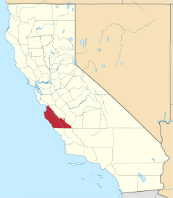
 Dunbarton Location in California | |
| Coordinates: 36°51′30″N 121°38′49″W / 36.85833°N 121.64694°WCoordinates: 36°51′30″N 121°38′49″W / 36.85833°N 121.64694°W | |
| Country | United States |
| State | California |
| County | Monterey County |
| Elevation[1] | 141 ft (43 m) |
Dunbarton (also, Dunbar)[2] is a former settlement in Monterey County, California.[1] It was located 2.25 miles (3.6 km) south of Aromas,[2] at an elevation of 141 feet (43 m).[1] Dunbarton still appeared on USGS maps as of 1917.[1]
The Dunbarton post office operated from 1900 to 1909.[2]
References
This article is issued from Wikipedia - version of the 12/18/2012. The text is available under the Creative Commons Attribution/Share Alike but additional terms may apply for the media files.