Spreckels, California
- You may also be looking for Spreckels Junction, California.
| Spreckels | |
|---|---|
| census-designated place | |
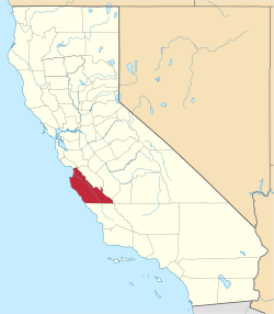
 Location in Monterey County and the state of California | |
 Spreckels Location in the United States | |
| Coordinates: 36°37′19″N 121°38′49″W / 36.62194°N 121.64694°WCoordinates: 36°37′19″N 121°38′49″W / 36.62194°N 121.64694°W | |
| Country |
|
| State |
|
| County | Monterey |
| Government | |
| • State Senator | Anthony Cannella (R)[1] |
| • Assemblymember | Anna Caballero (D)[1] |
| • U. S. Rep. | Sam Farr (D)[2] |
| Area[3] | |
| • Total | 0.122 sq mi (0.316 km2) |
| • Land | 0.122 sq mi (0.316 km2) |
| • Water | 0 sq mi (0 km2) 0% |
| Elevation[4] | 62 ft (19 m) |
| Population (2010) | |
| • Total | 673 |
| • Density | 5,500/sq mi (2,100/km2) |
| Time zone | PST (UTC-8) |
| • Summer (DST) | PDT (UTC-7) |
| ZIP code | 93962 |
| Area code(s) | 831 |
| FIPS code | 06-73612 |
| GNIS feature ID | 1659842 |
Spreckels is a census-designated place (CDP) located in the Salinas Valley of Monterey County, California, United States.[4] Spreckels is located 3 miles (4.8 km) south of Salinas,[5] at an elevation of 62 feet (19 m).[4] The population was 673 at the 2010 census, up from 485 at the 2000 census.
Spreckels is one of the best-preserved company towns in the United States. It was built to house workers for the Spreckels Sugar Company plant which operated there from 1899 until 1982, named after its founder "Sugar King" Claus Spreckels. When it opened, the Spreckels plant was the world's largest sugar beet factory, each day consuming 13 million gallons of water (much of it pumped from wells) to process 3000 tons of beets.
Spreckels is associated with the writer John Steinbeck, who lived and worked there for a time, and used it as a setting in Tortilla Flat. (Spreckels was used as a location for the 1955 Steinbeck movie East of Eden.)
In 2004, controversy erupted in Spreckels when the Tanimura family, which owns the fields around the town, declared that a 1907 plat in its possession gave it the right to build 73 housing units on its land—-an act which would increase the town's size by 40%. A legal battle over the status and definition of "antiquated maps" ensued.
In an out-of-court settlement, the Tanimura company agreed to a requirement that the houses maintain the style and spirit of the town. Although the lots have white picket fences and landscaping, developers failed to avoid a "cookie-cutter" design. The new homes are large and set close together and generally uniform in appearance.
Geography
Spreckels is located at 36°37′19″N 121°38′49″W / 36.62194°N 121.64694°W.[4] It is about 4 miles south of Salinas, California.
According to the United States Census Bureau, the CDP has a total area of 0.1 square miles (0.26 km2), all of it land.
Climate
This region experiences warm (but not hot) and dry summers, with no average monthly temperatures above 71.6 °F. According to the Köppen Climate Classification system, Spreckels has a warm-summer Mediterranean climate, abbreviated "Csb" on climate maps.[6]
History
The Spreckels post office opened in 1898.[5] The name honors Claus Spreckels, who built a sugar mill at the site.[5]
Demographics
2010
The 2010 United States Census[7] reported that Spreckels had a population of 673. The population density was 5,509.4 people per square mile (2,127.2/km²). The racial makeup of Spreckels was 483 (71.8%) White, 0 (0.0%) African American, 13 (1.9%) Native American, 26 (3.9%) Asian, 0 (0.0%) Pacific Islander, 130 (19.3%) from other races, and 21 (3.1%) from two or more races. Hispanic or Latino of any race were 193 persons (28.7%).
The Census reported that 673 people (100% of the population) lived in households, 0 (0%) lived in non-institutionalized group quarters, and 0 (0%) were institutionalized.
There were 229 households, out of which 89 (38.9%) had children under the age of 18 living in them, 134 (58.5%) were opposite-sex married couples living together, 27 (11.8%) had a female householder with no husband present, 12 (5.2%) had a male householder with no wife present. There were 7 (3.1%) unmarried opposite-sex partnerships, and 2 (0.9%) same-sex married couples or partnerships. 45 households (19.7%) were made up of individuals and 17 (7.4%) had someone living alone who was 65 years of age or older. The average household size was 2.94. There were 173 families (75.5% of all households); the average family size was 3.38.
The population was spread out with 172 people (25.6%) under the age of 18, 44 people (6.5%) aged 18 to 24, 173 people (25.7%) aged 25 to 44, 208 people (30.9%) aged 45 to 64, and 76 people (11.3%) who were 65 years of age or older. The median age was 39.4 years. For every 100 females there were 93.9 males. For every 100 females age 18 and over, there were 92.7 males.
There were 246 housing units at an average density of 2,013.8 per square mile (777.6/km²), of which 160 (69.9%) were owner-occupied, and 69 (30.1%) were occupied by renters. The homeowner vacancy rate was 3.6%; the rental vacancy rate was 2.8%. 467 people (69.4% of the population) lived in owner-occupied housing units and 206 people (30.6%) lived in rental housing units.
2000
As of the census[8] of 2000, there were 485 people, 171 households, and 127 families residing in the CDP. The population density was 3,629.3 people per square mile (1,440.5/km²). There were 176 housing units at an average density of 1,317.0 per square mile (522.7/km²). The racial makeup of the CDP was 86.39% White, 0.62% African American, 1.65% Native American, 2.68% Asian, 6.80% from other races, and 1.86% from two or more races. Hispanic or Latino of any race were 27.63% of the population.
There were 171 households out of which 40.9% had children under the age of 18 living with them, 56.7% were married couples living together, 13.5% had a female householder with no husband present, and 25.7% were non-families. 17.0% of all households were made up of individuals and 6.4% had someone living alone who was 65 years of age or older. The average household size was 2.84 and the average family size was 3.20.
In the CDP the population was spread out with 29.1% under the age of 18, 5.4% from 18 to 24, 29.3% from 25 to 44, 25.4% from 45 to 64, and 10.9% who were 65 years of age or older. The median age was 38 years. For every 100 females there were 94.0 males. For every 100 females age 18 and over, there were 93.3 males.
The median income for a household in the CDP was $58,009, and the median income for a family was $51,250. Males had a median income of $22,250 versus $24,750 for females. The per capita income for the CDP was $19,752. None of the families and 1.1% of the population were living below the poverty line, including no under eighteen and none of those over 64.
The elementary school is the only school in town.
Annual events
Spreckels has an annual Fourth of July party that includes a parade, a 10K race and a 1K fun run.[9]
External links
| Wikimedia Commons has media related to Spreckels, California. |
References
- 1 2 "Statewide Database". UC Regents. Retrieved December 30, 2014.
- ↑ "California's 20th Congressional District - Representatives & District Map". Civic Impulse, LLC. Retrieved September 24, 2014.
- ↑ "2010 Census U.S. Gazetteer Files – Places – California". United States Census Bureau.
- 1 2 3 4 U.S. Geological Survey Geographic Names Information System: Spreckels, California
- 1 2 3 Durham, David L. (1998). California's Geographic Names: A Gazetteer of Historic and Modern Names of the State. Clovis, Calif.: Word Dancer Press. p. 962. ISBN 1-884995-14-4.
- ↑ Climate Summary for Spreckels, California
- ↑ "2010 Census Interactive Population Search: CA - Spreckels CDP". U.S. Census Bureau. Retrieved July 12, 2014.
- ↑ "American FactFinder". United States Census Bureau. Retrieved 2008-01-31.
- ↑ "See Monterey: Spreckels, California". Monterey County Convention and Visitors Bureau. Retrieved May 3, 2009.