Santa Fe, Texas
| Santa Fe, Texas | |
|---|---|
| City | |
|
Santa Fe Texas Post Office | |
 Location of Santa Fe, Texas | |
| Coordinates: 29°22′50″N 95°6′15″W / 29.38056°N 95.10417°WCoordinates: 29°22′50″N 95°6′15″W / 29.38056°N 95.10417°W | |
| Country |
|
| State |
|
| County | Galveston |
| Area | |
| • Total | 17.3 sq mi (44.9 km2) |
| • Land | 17.1 sq mi (44.4 km2) |
| • Water | 0.2 sq mi (0.5 km2) |
| Elevation | 30 ft (9 m) |
| Population (2010) | |
| • Total | 12,222 |
| • Density | 710/sq mi (270/km2) |
| Time zone | Central (CST) (UTC-6) |
| • Summer (DST) | CDT (UTC-5) |
| ZIP codes | 77510, 77517 |
| Area code(s) | 409 |
| FIPS code | 48-65726[1] |
| GNIS feature ID | 1351043[2] |

Santa Fe (Spanish: santa—holy, fe—faith) is a city in Galveston County, Texas, United States. It is named for the Santa Fe Railroad (now part of BNSF Railway) which runs through the town alongside State Highway 6. The population of Santa Fe at the 2010 census was 12,222.[3] Locals refer to their town as "The Fe."
History
In 1877, the Gulf, Colorado and Santa Fe Railway was built through the western part of Galveston county.[4] By the turn of the century, three small, unincorporated towns had formed along the railway: Alta Loma, Arcadia and Algoa. The Santa Fe Independent School District, named after the railway, was established shortly afterward to serve the area.

In the mid-1970s, the neighboring city of Hitchcock tried to annex an area in eastern Alta Loma known as the Morningview neighborhood. The residents of this area were passionately opposed to becoming a part of Hitchcock. Hitchcock was culturally very different, and Santa Fe and Hitchcock sports teams had harbored an intense rivalry for decades. To fend off annexation, a petitioning effort was begun to incorporate the area into a new city. On January 21, 1978, a ballot proposal to incorporate Alta Loma and parts of Arcadia (a total of nine square miles) passed by a wide margin, and the city of Santa Fe was born. In the years since, Santa Fe has grown to include all of Arcadia and parts of Algoa, and has become one of the more affluent areas of Galveston County. Today, ironically, Santa Fe is twice the size of Hitchcock.
On February 14, 1981, the Ku Klux Klan hosted a fish fry on a private farm in Santa Fe to protest the growing presence of Vietnamese shrimpers in the Gulf. During the event, a Vietnamese fishing boat was ceremonially burned.[5][6] That controversy, as well as similar conflicts in nearby port towns like Rockport, led to a decision of the United States District Court, S.D.Texas, Houston Division[7] Vietnamese Fishermen's Association v. Knights of the Ku Klux Klan,[8] and also served as the basis for the 1985 Ed Harris film Alamo Bay.
On June 19, 2000, the Supreme Court ruled that the Santa Fe Independent School District's policy of permitting "student-led, student-initiated" prayer at football games and other school events violated the Constitution's prohibitions against the establishment of state religion.[9]
Geography

Santa Fe is located at 29°22′50″N 95°6′15″W / 29.38056°N 95.10417°W (29.380651, −95.104163).[10]
According to the United States Census Bureau, the city has a total area of 17.3 square miles (44.9 km2), of which 17.1 square miles (44.4 km2) is land and 0.19 square miles (0.5 km2), or 1.10%, is water.[11]
Demographics
| Historical population | |||
|---|---|---|---|
| Census | Pop. | %± | |
| 1980 | 6,172 | — | |
| 1990 | 8,429 | 36.6% | |
| 2000 | 9,548 | 13.3% | |
| 2010 | 12,222 | 28.0% | |
| Est. 2015 | 13,037 | [12] | 6.7% |
As of the census of 2010,[1][14] there were 12,222 people and 4,564 households residing in the city. The population density was 682.5 people per square mile (275.31/km²). There were 4,957 housing units at an average density of 289.2 per square mile (111.66/km²). The racial makeup of the city was 93.8% White, 0.4% African American, 0.5% Native American, 0.5% Asian, 0.1% Pacific Islander, 3.3% from other races, and 1.5% from two or more races. Hispanic or Latino of any race were 11.6% of the population.
There were 4,583 households out of which 36.8% had children under the age of 18 living with them, 57.7% were married couples, 12.2% had a female householder with no husband present, and 23.7% were non-families. 27.0% of all households were made up of individuals and 19.3% had someone living alone who was 65 years of age or older. The average household size was 2.67 and the average family size was 3.03.
In the city the population was spread out with 27.2% under the age of 20, 5.2% from 20 to 24, 23.9% from 25 to 44, 29.6% from 45 to 64, and 14.3% who were 65 years of age or older. The median age was 40.5 years. For every 100 females there were 99.6 males. For every 100 females age 18 and over, there were 97.2 males.
The median income for a household in the city was $60,797, and the median income for a family was $69,841. Males had a median income of $57,619 versus $36,445 for females. The per capita income for the city was $27,863. About 7.3% of families and 9.5% of the population were below the poverty line, including 12.3% of those under age 18 and 5.7% of those age 65 or over.
Government and infrastructure
The Santa Fe Post Office is located at 13002 Highway 6.[15]
The Santa Fe Justice Center is located at 3650 FM 646 N.
Education
Primary and secondary schools
Public schools
The city is served by the Santa Fe Independent School District.
The schools in the city include:
- R.J. Wollam Elementary School (Pre-K through 2)
- Dan J. Kubacak Elementary (2 through 3; formerly Santa Fe Elementary North)
- Santa Fe Junior High School (6 through 8)
- Santa Fe High School (9 through 12)
All of Santa Fe is served by the College of the Mainland.
Public libraries
Santa Fe owns the Mae S. Bruce Library at 13302 6th Street.[16] The Santa Fe Community Library opened inside a former World War II army barracks in 1975. By 2011 the barracks became overwhelmed by the library's increasing size. A group of residents established a building committee and, with Moody Foundation and Kempner Fund grants and donations from the community, purchased a 1,920-square-foot (178 m2) metal portable building on land leased from the Santa Fe Independent School District. The portable was across Highway 6 from the barracks. After continuing growth of the library, in 1987 Mae S. Bruce presented a 6,400-square-foot (590 m2) brick structure to the city. The library moved to the structure and was renamed after Bruce.[17]
Transportation
Airports in unincorporated areas near Santa Fe include:
Airports with scheduled commercial airline service for the area, located in Houston, are William P. Hobby Airport and George Bush Intercontinental Airport. Scholes International Airport in nearby Galveston is available for general aviation and non-scheduled commercial service.
Notable residents
Country music star Johnny Lee, best known for his 1980 hit Lookin' for Love, was raised on a dairy farm in Santa Fe (then known as Alta Loma) and graduated from Santa Fe High School in 1964.
Novelist and artist Doug Hiser is a lifelong resident of Santa Fe. His novels, The Honey Bee Girl (2006), set in Santa Fe in 1973, and Montana Mist (2011), were Amazon bestsellers. He is also a professional wildlife artist who has researched animals in the wilds of Africa and South America. Hiser graduated from Santa Fe High School in 1975 and attended the University of Houston–Clear Lake, where he was named a 2012 Distinguished Alumni.
References
- 1 2 "American FactFinder". United States Census Bureau. Retrieved 2008-01-31.
- ↑ "US Board on Geographic Names". United States Geological Survey. 2007-10-25. Retrieved 2008-01-31.
- ↑ "Profile of General Population and Housing Characteristics: 2010 Demographic Profile Data (DP-1): Santa Fe city, Texas". U.S. Census Bureau, American Factfinder. Retrieved January 9, 2012.
- ↑ SANTA FE, TX | The Handbook of Texas Online| Texas State Historical Association (TSHA)
- ↑ Claudia Kolker, San Francisco Chronicle, 11 September 2000, URL: http://www.sfgate.com:80/cgi-bin/article.cgi?file=/chronicle/archive/2000/09/11/MN95611.DTL
- ↑ Still Shrimping: Vietnamese American shrimpers 25 years after the second wave | AsianWeek
- ↑ 543 F.Supp. 198
- ↑ The KKK and Vietnamese Fishermen
- ↑ FindLaw | Cases and Codes
- ↑ "US Gazetteer files: 2010, 2000, and 1990". United States Census Bureau. 2011-02-12. Retrieved 2011-04-23.
- ↑ "Geographic Identifiers: 2010 Demographic Profile Data (G001): Santa Fe city, Texas". U.S. Census Bureau, American Factfinder. Retrieved January 9, 2012.
- ↑ "Annual Estimates of the Resident Population for Incorporated Places: April 1, 2010 to July 1, 2015". Retrieved July 2, 2016.
- ↑ "Census of Population and Housing". Census.gov. Retrieved June 4, 2015.
- ↑ http://quickfacts.census.gov/qfd/states/48/4865726.html
- ↑ "Post Office Location – SANTA FE." United States Postal Service. Retrieved on December 6, 2008.
- ↑ "Welcome to the Mae S. Bruce Library!." Mae S. Bruce Library. Retrieved on December 6, 2011.
- ↑ "About the Mae S. Bruce Library!." Mae S. Bruce Library. Retrieved on December 6, 2008.
External links
- City of Santa Fe official website
- Santa Fe, Texas from the Handbook of Texas Online
- U.S. Geological Survey Geographic Names Information System: Santa Fe, Texas
| Counties | 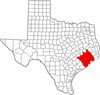 | |
|---|---|---|
| "Principal" cities | ||
| Other cities |
For a complete listing, see list of cities and towns in Houston–The Woodlands–Sugar Land MSA | |
| Unincorporated areas | ||
| Bodies of water | ||
Municipalities and communities of Galveston County, Texas, United States | ||
|---|---|---|
| Cities |  | |
| Village | ||
| CDPs | ||
| Unincorporated communities | ||
| Footnotes | ‡This populated place also has portions in an adjacent county or counties | |
