Hitchcock, Texas
| City of Hitchcock, Texas | |
|---|---|
| City | |
 Location in the state of Texas | |
| Coordinates: 29°20′19″N 95°0′39″W / 29.33861°N 95.01083°WCoordinates: 29°20′19″N 95°0′39″W / 29.33861°N 95.01083°W | |
| Country | United States |
| State | Texas |
| County | Galveston |
| Incorporated | January 30, 1960 |
| Government | |
| • Mayor | Anthony Matranga |
| Area | |
| • Total | 92.1 sq mi (238.5 km2) |
| • Land | 60.5 sq mi (156.6 km2) |
| • Water | 31.6 sq mi (81.9 km2) |
| Elevation | 16 ft (4.9 m) |
| Population (2010) | |
| • Total | 6,961 |
| • Density | 76/sq mi (29/km2) |
| Time zone | CST (UTC-6) |
| • Summer (DST) | CDT (UTC-5) |
| ZIP code | 77563 |
| Area code(s) | 409 |
| FIPS code | 48-34220[1] |
| GNIS feature ID | 1359310[2] |
| Website | http://www.cityofhitchcock.org/ |
Hitchcock is a city in Galveston County, Texas, United States. The population was 6,961 at the 2010 census.[3]
History
Hitchcock was created as a station of the railroad between Galveston and Houston in 1873 and around the turn of the 20th century became a vegetable shipping center. The settlement's economy crashed in the 1930s after insect plagues in the surrounding areas, and the area stayed impoverished until the establishment of the Camp Wallace[4] anti-aircraft training base and the Hitchcock Naval Air Station at the beginning of World War II. After the end of the war, the bases were used as discharge centers, and some former soldiers settled in the area. Hitchcock was established in 1960 as the area's population boomed, topping out at nearly 7,000 by the end of the 1960s. Today, the town serves as a suburb of Galveston and houses workers from the Johnson Space Center.
Since 1984, Hitchcock has been home to the Galveston County Fair & Rodeo.[5] The Galveston County Fair & Rodeo began in 1938 and was held at facilities in Runge Park in Arcadia. In the early 1980s, the County Fair had reached its limits of growth at Runge Park, and plans began for a move to Jack Brooks Park in Hitchcock. The move to Jack Brooks Park was completed in time for the 1984 fair.
Geography

Hitchcock is located at 29°20′19″N 95°0′39″W / 29.33861°N 95.01083°W (29.338715, -95.010861).[6]
According to the United States Census Bureau, the city has a total area of 92.1 square miles (238.5 km2), of which 60.5 square miles (156.6 km2) is land and 31.6 square miles (81.9 km2), or 34.35%, is water.[7]
Demographics
| Historical population | |||
|---|---|---|---|
| Census | Pop. | %± | |
| 1960 | 5,216 | — | |
| 1970 | 5,565 | 6.7% | |
| 1980 | 6,103 | 9.7% | |
| 1990 | 5,868 | −3.9% | |
| 2000 | 6,386 | 8.8% | |
| 2010 | 6,961 | 9.0% | |
| Est. 2015 | 7,621 | [8] | 9.5% |
As of the census[1] of 2000, there were 6,386 people, 2,434 households, and 1,737 families residing in the city. The population density was 96.1 people per square mile (37.1/km²). There were 2,754 housing units at an average density of 41.4 per square mile (16.0/km²). The racial makeup of the city was 59.96% White, 32.81% African American, 0.28% Native American, 0.16% Asian, 0.03% Pacific Islander, 4.76% from other races, and 2.00% from two or more races. Hispanic or Latino of any race were 13.73% of the population.
There were 2,434 households out of which 32.1% had children under the age of 18 living with them, 48.7% were married couples living together, 17.3% had a female householder with no husband present, and 28.6% were non-families. 25.6% of all households were made up of individuals and 10.8% had someone living alone who was 65 years of age or older. The average household size was 2.62 and the average family size was 3.14.
In the city the population was spread out with 27.7% under the age of 18, 8.4% from 18 to 24, 27.2% from 25 to 44, 22.2% from 45 to 64, and 14.4% who were 65 years of age or older. The median age was 36 years. For every 100 females there were 92.2 males. For every 100 females age 18 and over, there were 87.3 males.
The median income for a household in the city was $29,848, and the median income for a family was $35,013. Males had a median income of $31,098 versus $22,340 for females. The per capita income for the city was $14,964. About 16.3% of families and 19.0% of the population were below the poverty line, including 27.3% of those under age 18 and 15.8% of those age 65 or over.
Government and infrastructure
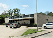
The Hitchcock Post Office is located at 8120 Texas State Highway 6.[10]
Education
Primary and secondary schools
Public schools
Most of the city of Hitchcock is served by the Hitchcock Independent School District.
Some of Hitchcock is served by the Santa Fe Independent School District.
Hitchcock ISD 2015- 2016 accountability Rating according to the Texas Education Agency is IMPROVEMENT REQUIRED.
Hitchcock ISD received a warning for LOW ACCOUNTABILITY marks in 2011 and 2013. [11]
Private schools
Our Lady of Lourdes School, a Roman Catholic elementary school operated by the Roman Catholic Archdiocese of Galveston-Houston, is in Hitchcock.
Colleges and universities
All of Hitchcock is served by the College of the Mainland.
Notable people
- Taurian Fontenette (born 1983), famous streetball player whose nicknames include "The Air Up There" and "Mr. 720"
- Michael Sam, Free Agent defensive end, first openly gay NFL player
- Randy Hymes, former NFL player who played for Baltimore Ravens, Jacksonville Jaguars, and Minnesota Vikings
- David M. Medina, former Texas Supreme Court Justice and General Counsel to Governor Rick Perry
References
- 1 2 "American FactFinder". United States Census Bureau. Retrieved 2008-01-31.
- ↑ "US Board on Geographic Names". United States Geological Survey. 2007-10-25. Retrieved 2008-01-31.
- ↑ "Profile of General Population and Housing Characteristics: 2010 Demographic Profile Data (DP-1): Hitchcock city, Texas". U.S. Census Bureau, American Factfinder. Retrieved January 6, 2012.
- ↑ http://www.lib.utexas.edu/taro/utcah/01953/cah-01953.html
- ↑ http://www.galvestoncountyfair.com/
- ↑ "US Gazetteer files: 2010, 2000, and 1990". United States Census Bureau. 2011-02-12. Retrieved 2011-04-23.
- ↑ "Geographic Identifiers: 2010 Demographic Profile Data (G001): Hitchcock city, Texas". U.S. Census Bureau, American Factfinder. Retrieved January 6, 2012.
- ↑ "Annual Estimates of the Resident Population for Incorporated Places: April 1, 2010 to July 1, 2015". Retrieved July 2, 2016.
- ↑ "Census of Population and Housing". Census.gov. Retrieved June 4, 2015.
- ↑ "Post Office Location - LA MARQUE." United States Postal Service. Retrieved on December 6, 2008.
- ↑ http://tea.texas.gov/Student_Testing_and_Accountability/Accountability/Accreditation/2013-2014_Accreditation_Statuses/
External links
- City of Hitchcock official website
- Historic Images from the Genevieve Miller Public Library, hosted by the Portal to Texas History
- Hitchcock, Texas from the Handbook of Texas Online
| Counties | 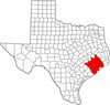 | |
|---|---|---|
| "Principal" cities | ||
| Other cities |
For a complete listing, see list of cities and towns in Houston–The Woodlands–Sugar Land MSA | |
| Unincorporated areas | ||
| Bodies of water | ||
Municipalities and communities of Galveston County, Texas, United States | ||
|---|---|---|
| Cities |  | |
| Village | ||
| CDPs | ||
| Unincorporated communities | ||
| Footnotes | ‡This populated place also has portions in an adjacent county or counties | |
