Perungudi
| Perungudi | |
|---|---|
| suburb | |
 Perungudi | |
| Coordinates: 12°58′N 80°15′E / 12.97°N 80.25°ECoordinates: 12°58′N 80°15′E / 12.97°N 80.25°E | |
| Country | India |
| State | Tamil Nadu |
| District | Chennai |
| Metro | Chennai |
| Government | |
| • Body | Corporation of Chennai |
| Elevation | 9 m (30 ft) |
| Population (2011) | |
| • Total | 43,111 |
| Languages | |
| • Official | Tamil |
| Time zone | IST (UTC+5:30) |
| Vehicle registration | TN-14 |
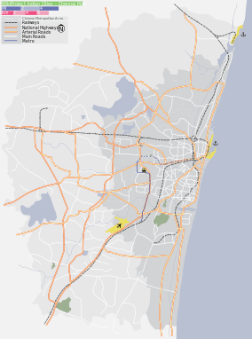
Perungudi (Tamil: பெருங்குடி) is a city in Chennai district in the Indian state of Tamil Nadu. It is a suburb of Chennai, situated about 10kilometres from the popular town centre of Adyar. It is bordered on two sides by the old Mahabalipuram Road and the Perungudi lake. The neighbouring areas include Kandhan Chavadi to the north, Thoraipakkam (also called Thuraipakkam) to the south, Palavakkam on the east side and a combination of natural landscapes, including the Perungudi lake, marshes(Pallikaranai), barren excavated lands, and paddy fields, on the western part. Perungudi
The suburb is inhabited by an equal mix of new migrants and descendants of some early clans who migrated to the place some 300 years ago. Perungudi is seeing heightened activities in recent years due to its strategic location. The population of Perungudi was round 8,000 in 2000, but has grown significantly in the years since then. Being in the IT Corridor of Chennai, Perungudi is increasingly being preferred as a residential locality by Software Engineers. Despite significant growth, Perungudi lacks basic civic amenities such as underground storm and waste drainage system, piped potable water and good roads. Garbage is strewn openly in many places while sewage flows in open drains at other places. The resident community has not received any benefits from the Government despite the huge amount of professional tax collected from the companies located in the region. This region has gained more importance owing to location on IT highway and proximity to city neighbourhoods like Thiruvanmyur, Adyar and Velachery.
Geography
Perungudi is located at 12°58′N 80°15′E / 12.97°N 80.25°E.[1] It has an average elevation of 9 metres (29 feet).
Demographics
As of 2001 India census,[2] Perungudi had a population of 23,481. Males constitute 53% of the population and females 47%. Perungudi has an average literacy rate of 72%, higher than the national average of 59.5%: male literacy is 77%, and female literacy is 65%. In Perungudi, 12% of the population is under 6 years of age.
Economy
Perungudi has developed from a small village to a vibrant and thriving commercial/residential hub after the boom in the Indian IT industry. Perungudi had developed an industrial estate in the 90's. It is still struggling with poor infrastructure for decades despite boasting offices of some the biggest IT companies in India.
Dump Yard
Perungudi houses one of the two major landfills in Chennai. The dump yard is constantly in the news for the burning of garbage despite it being banned. The dump yard also spills into the pallikarnai marshland which is home to a lot of local and migratory birds. The plans to close the dumpyard by the corporation have not yet fructified.
Administrative
Panchayat
In 2011 Perungudi Town Panchayat was merged with Chennai Corporation.
Elections
Although the panchayat presidential elections are nominally held once every five years, no elections were held for a period of 15 years between 1979 and 1994.
Metropolitan Transport Corporation

The "Metropolitan Transport Corporation" ("MTC" from P(pallavan)TC) connects Perungudi to transit points like Saidapet, Adayar, and Tiruvanmiyur. The bus numbers include 19B, 21H and 19K. New Bus services (routes T51, 19C, M5, S21, M19D, 519, 568) to Tambaram, Kannagi Nagar,Kelambakkam, Royapettah, Marina have been added. There are plans to start new bus routes to the interior areas of Perungudi; Kamaraj Nagar, Rajiv Nagar, Telephone Nagar, Elim Nagar etc. Bus services are quite frequent but are still incapable of catering for the rising population. Overcrowded buses are common during peak hours. Also, recently a mini bus service was launched to cater to the needs of the interior parts of perungudi, it acts as feeder service from Mettukuppam to SRP tools.
Location in context
 |
Velachery | Taramani | Kottivakkam(ECR) | |
| Velachery MRTS/Perungudi lake | |
Palavakkam(ECR) | ||
| ||||
| | ||||
| Pallikaranai | Thoraipakkam | Neelankarai(ECR) |
References
| Wikimedia Commons has media related to Perungudi. |
- ↑ Falling Rain Genomics, Inc - Perungudi
- ↑ "Census of India 2001: Data from the 2001 Census, including cities, villages and towns (Provisional)". Census Commission of India. Archived from the original on 2004-06-16. Retrieved 2008-11-01.