Moulivakkam
| Moulivakkam மௌலிவாக்கம் | |
|---|---|
| suburb | |
| Nickname(s): Bai Kadai | |
 Moulivakkam  Moulivakkam  Moulivakkam | |
| Coordinates: 13°01′13″N 80°08′37″E / 13.020269°N 80.143578°ECoordinates: 13°01′13″N 80°08′37″E / 13.020269°N 80.143578°E | |
| Country | India |
| State | Tamil Nadu |
| District | Chennai District |
| Metro | Chennai |
| Talukas | Sriperumbudur |
| Government | |
| • Body | CMDA |
| Languages | |
| • Official | Tamil |
| Time zone | IST (UTC+5:30) |
| PIN | 600116 |
| Lok Sabha constituency | Sriperumbudur |
| Vidhan Sabha constituency | Alandur |
| Planning agency | CMDA |
| Website |
www |
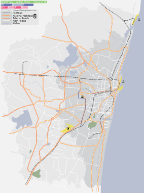
Moulivakkam is a suburb of Chennai. It is situated 18 km south-west of Chennai on the Arcot road. It is bounded by Porur on the north, Kolappakkam on the south, Mugalivakkam on the east and Manapakkam on the south east directions. The nearest railway station is at Guindy which is about 6 kilometres away. Porur junction is around 3 km away and Kathipara Junction is around 5 km away.
Recent developments
Real estate boom in India and Chennai had its course in Moulivakkam too. DLF IT City was built and opened next to Moulivakkam in 2010. Multinational companies such as IBM, HP, CTS, L&T Infotech have been located in this IT City. L&T ECC, L&T Ship Building and L&T Audco are also vested in this area.
Kolapakkam is the backside of Moulivakkam. It is a pleasent area.
Streets: MRK Nagar, Madha Nagar are main streets.
Location in context
 |
Iyyapanthangal | Porur | Porur | |
| Mangadu | |
Mugalivakkam | ||
| ||||
| | ||||
| Gerugambakkam | Kolappakkam | Manapakkam |