Nerkundram
| Nerkundram | |
|---|---|
| suburb | |
 Nerkundram  Nerkundram  Nerkundram | |
| Coordinates: 13°04′15″N 80°11′05″E / 13.0707°N 80.1846°ECoordinates: 13°04′15″N 80°11′05″E / 13.0707°N 80.1846°E | |
| Country | India |
| State | Tamil Nadu |
| District | Thiruvallur |
| Metro | Chennai |
| Elevation | 18 m (59 ft) |
| Population (2001) | |
| • Total | 39,544 |
| Languages | |
| • Official | Tamil |
| Time zone | IST (UTC+5:30) |
| PIN | 600107 |
| Vehicle registration | TN-12 |
Nerkundram(Tamil: நெற்குன்றம்) is a census town located in Chennai City, Thiruvallur district in the Indian state of Tamil Nadu. It is part of the Chennai Corporation.
Geography
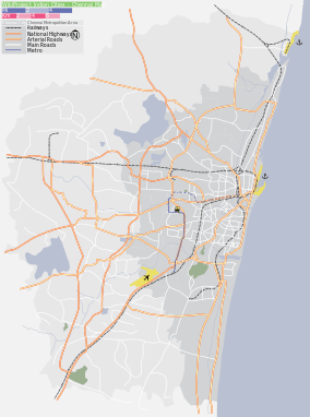
Nerkundram is located at 13°04′15″N 80°11′05″E / 13.0707°N 80.1846°E.[1] It has an average elevation of 18 metres (59 feet).
 |
Maduravoyal | Mogappair East | Anna Nagar | |
| Valasaravakkam | |
Koyambedu | ||
| ||||
| | ||||
| Alwarthirunagar | Nesapakkam | Virugambakkam |
Demographics
As of 2001 India census,[2] Nerkundram had a population of 39,544. Males constitute 52% of the population and females 48%. Nerkundram has an average literacy rate of 72%, higher than the national average of 59.5%: male literacy is 78%, and female literacy is 65%. In Nerkundram, 14% of the population is under 6 years of age.
Localities
Now Nerkundram is a Part of Chennai Corporation. It Belongs to 145 th circle in Chennai corporation. Previously Nerkundram was in the Suburban Panchayat near Chennai.
Ward 1
P.H. Road, People Flats, Pallavan Nagar, Nerkundram, Church St, Mandaveli St
Ward 2
valliammai nagar,Celliyamman Nagar, Senthamizh Nagar, Santha Avenue, Agathiyar Nagar, Sakthi Nagar, RJR Nagar, Muthumariyamman Koil St, Sivasakthi Nagar, Kanniyamman Nagar, Nethaji Avenue, Azhagammal Nagar, Thmarai Avenue, Rajiv Gandhi Nagar, Krishna Nagar, Kothandaramar Nagar, Jayalakshmi Nagar, Moogambigai Nagar, Balakrishna Nagar, Dhanalakshmi Nagar, Thiramalai Nagar, Muniyappa Nagar, Annammal Nagar, Thiruvalluvar Colony, Saraswathi Colony, Janakiraman Colony
Ward 3
Mettukuppam, Goverthana Nagar, Rajiv Nagar, Nesammal Nagar, Jayaram Nagar, Dhanalakshmi Nagar, Sri Kadambadi Amman Nagar, CDN Nagar, Ramalinga Nagar, Nesammal Nagar, Buvaneswari Nagar, Senthil Nagar, Balavinayagar Nagar, Sakthivel Nagar, Abirami Nagar, Vadavenniyamman Nagar
Ward 4
Periyar Nagar, Sri Lakshmi Nagar, Bakaji Nagar
Ward 5
Saraswathi Nagar, Meenatchiyamman Nagar,JAYA NURSERY AND PRIMARY SCHOOL, Dhidilnagar, Nekundram New Colony, Perumal Koil St.
Schools, colleges ,shops and welfare clubs
- missile hero kalam's welfare club (munniyappa nagar 3rd street)
- Dayasadan Agarwal Vidyalaya School (CBSE)
- Sri Devi Matriculation School
- Lbeaar Matriculation School
- Jain Joseph Nursery and Primary School
- Sri Sastha Matriculation School
- Thai Moogambigai Polytechnic College
- maa school of hotel management
- Nathan Girls Higher Secondary SchooL
- Krishna Matriculation School
- Marys Nursery & Primary School
- Dr MGR University
- Canan School of Catering and Hotel Management
- Walkinweb NetCafe
- Sri Ragavendra Travels
- Amman Travels
- Sai Tempo Auto Parts (Spacialist in Tempo Traveller Oil and Spares)
- Jaya Nursery and Primary school, No.20, Thiruvalluvar Street, Meenakshi Amman Nagar, Alwarthirunagar, Chennai 600 087
- St.Antony Nursery&Primary School Annammal Nagar Nerkundram
Importance
Following the November 2008 Mumbai terrorist attacks, the Indian government decided to establish four regional hubs of National Security Guard in Chennai, Kolkata, Mumbai and Hyderabad. All the hubs were established in six months in June 2009. A permanent hub for the National Security Guard Regional was established at Nerkundram off the Grand Southern Trunk Road on 17 December 2011 at a cost of ₹ 540 million in an area spread across 69.28 acres.[3] The facility, sandwiched between 15 acres of forests and hillocks, is ideal for training commandos in rappelling (a controlled descent down a rock face using a rope).[4]
Areas Near Nerkundram
References
- ↑ Falling Rain Genomics, Inc - Nerkundram
- ↑ "Census of India 2001: Data from the 2001 Census, including cities, villages and towns (Provisional)". Census Commission of India. Archived from the original on 2004-06-16. Retrieved 2008-11-01.
- ↑ "Commandos get a hub at Nerkundram". NDTV. NDTV. 18 December 2011. Retrieved 19 Dec 2011.
- ↑ "NSG city hub gets a new 69-acre facility". Times of India epaper. Chennai: The Times Group. 18 December 2011. Retrieved 20 Dec 2011.