Mugalivakkam
| Mugalivakkam முகலிவாக்கம் | |
|---|---|
| suburb | |
 Mugalivakkam  Mugalivakkam  Mugalivakkam | |
| Coordinates: 13°01′18″N 80°09′38″E / 13.0215653°N 80.160520°ECoordinates: 13°01′18″N 80°09′38″E / 13.0215653°N 80.160520°E | |
| Country | India |
| State | Tamil Nadu |
| District | Kanchipuram District |
| Metro | Chennai |
| Talukas | Sriperumbudur |
| Government | |
| • Body | CMDA |
| Languages | |
| • Official | Tamil |
| Time zone | IST (UTC+5:30) |
| PIN | 600125 |
| Lok Sabha constituency | Sriperumbudur |
| Vidhan Sabha constituency | Alandur |
| Planning agency | CMDA |
| Website |
www |
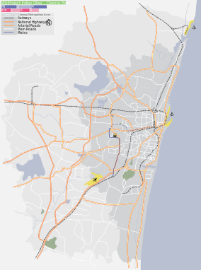
Mugalivakkam is a suburb of Chennai. It is situated 16 km south-west of Chennai on the Guindy-Mount-Poonamallee road. It is bounded by Porur on the north, Meenambakkam on the south and south east, and Ramapuram on the north east directions. The nearest railway station is at Guindy which is about 6 kilometres away. Porur junction is around 2 km away and Kathipara Junction is around 5 km away.
The word, Mugalivakkam, might have evolved during the brief Mughal rule of Poonamallee during the later half of the 17th century CE and the 18th century CE.[1]
Recent developments
Real estate boom in India and Chennai had its course in Mugalilvakkam too. DLF IT City was built and opened next to Mugalivakkam in 2010. Multinational companies such as IBM, HP, CTS, L&T Infotech have been located in this IT City. L&T ECC, L&T Ship Building and L&T Audco are also vested in this area. Mugalivakkam is included in chennai city limits from 2012. The availability of small parks, educational institutions, hospitals, banks and superstores identify itself as a decent residential area in this part of the city.
Flood Prone
Residents of the M and M Thiruvalluvar Nagar (Mugalivakkam and Manapakkam) Residents Welfare Association said surplus water from the Pour Lake should drain into the Manapakkam Channel through Moulivakkam, Mugalivakkam, Madha Nagar, Rajeswari Avenue and Mahalakshmi Nagar. The channel once 40 feet wide drains surplus water from the Porur Lake as well as storm water into the Adyar River at Manapakkam. The problem, residents complained, was primarily due to the shrinking of the Manapakkam Channel.
Residents of the Thiruvalluvar Nagar unable to reach homes as the area is completely under water in the years 2005, 06, 08, 11 and 2015. Adding to the inundation is the problem of breaches in Manapakkam canal that runs 500 metres from the locality. Two breaches each five feet wide allow water from the canal to flow into Thiruvalluvar Nagar
Educational Institutions
MKM
Pon vidyashram
PSBB
Omega International school
St Ann's MHSS
Swamy's School
Health care and Hospitals
Kedar Hospital
Meru Ortho Specialty Centre
Government health care centre
Financial Institutions
Indian Oversees Bank
Indian Bank
Allahabad Bank
All major private/public sector Banks with in 2 KM radius
All major ATMs with in few 100 metres
Temples
Murugan kovil Temple
Sri Ayyappan Temple
maariamman kovil
ellaiamman kovil
panichathaman kovil
kesava perumaal temple
jalakandishwarar kovil
Mugaliswarar Kovil
Perumal Kovil
Location in context
 |
Porur | Porur | Ramapuram | |
| Moulivakkam | |
Manapakkam | ||
| ||||
| | ||||
| Kolappakkam | Kolappakkam | Manapakkam |