Peerkankaranai
| Peerkankaranai | |
|---|---|
| neighbourhood | |
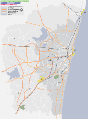 Peerkankaranai Location in Chennai, India | |
| Coordinates: 12°54′40″N 80°06′13″E / 12.911126°N 80.103636°ECoordinates: 12°54′40″N 80°06′13″E / 12.911126°N 80.103636°E | |
| Country |
|
| State | Tamil Nadu |
| Metro | Chennai |
| Taluk | Chennai city - Tambaram |
| Government | |
| • Body | CMDA |
| Elevation | 25 m (82 ft) |
| Population (2001) | |
| • Total | 17,521 |
| Languages | |
| • Official | Tamil |
| Time zone | IST (UTC+5:30) |
| PIN | 600063 |
| Telephone code | 044-2274 |
| Vehicle registration | TN-11 |
| Lok Sabha constituency | Chennai South (Lok Sabha constituency) |
| Civic agency | Chennai Corporation |
| Website |
www |
Peerkankaranai is a residential locality in Southern part of the metropolitan city of Chennai in the Indian state of Tamil Nadu.It comes under Tambaram taulk and St Thomas mount Panchayat Union.
Demographics
As of 2001 India census,[1] Peerkankaranai had a population of 17,521. Males constitute 50% of the population and females 50%. Peerkankaranai has an average literacy rate of 82%, higher than the national average of 59.5%: male literacy is 86%, and female literacy is 79%. In Peerkankaranai, 10% of the population is under 6 years of age.
Peerkankaranai is located on NH-45 highway between Tambaram and perungalathur.It has a small lake and provides water to most of the residents nearby.It has well transportation facilities.It has nearby railway station. Peerkankaranai and Perungalathur shares Common bus stop named "Perungalathur"and it has another bustop named "Erikarai". The area is under development and government sanctioned with drainage system.
Primary Schools:
- Government Higher Secondary School, Peerkankaranai
- ST.Anne's Matriculation School, Maraimalai Adigal Street, Srinivasa Nagar
- ALFA Matriculation School, Sriram Nagar
- MGR Matriculation school, Sriram Nagar
- Peter Nursery and Primary school, Devanesan Nagar
- Kalaimagal Kalasalai, Kamaraj Nagar
- Vivekananda Vidyalaya(Nursery school), Peerkankaranai
Peerkankaranai consists of:
- Velunagar,
- Sri ram nagar,
- Devanesan nagar,
- Kamaraj Nagar,
- Srinivasa Nagar
- KK Nagar
- TTK Nagar
Places of workship:
- Kamatshi Amman Temple, Srinivasa Nagar
- Arulmigu Vadivudai Amman sametha Vedapureesvarar Temple,Devanesan Nagar,
- Anjaneyar temple,
- Muthu Mariamman Temple,
- Varasithi Vinayagar Temple,
- Selva Vinayagar Temple, Devanesan nagar,
- Mosque at Velunagar,
- Nagathamman Temple,
- Infant Jesus Shrine,
- Karaneeshwarar temple,
- Ayyanar Appan Kovil,
- Soorathamman Kovil.
Nowadays wastes and decomposing materials are buried in the lake makes unsuitalble for the lake to survive. Burial ground situated at the end of the area which is common for New perungalathur and Irumbuliur Residents.
References
- ↑ "Census of India 2001: Data from the 2001 Census, including cities, villages and towns (Provisional)". Census Commission of India. Archived from the original on 2004-06-16. Retrieved 2008-11-01.