Injambakkam
| Injambakkam ஈஞ்சம்பாக்கம் | |
|---|---|
| neighbourhood | |
|
Coastline at Injambakkam | |
 Injambakkam  Injambakkam  Injambakkam | |
| Coordinates: 12°54′58″N 80°14′56″E / 12.9162°N 80.2488°ECoordinates: 12°54′58″N 80°14′56″E / 12.9162°N 80.2488°E | |
| Country | India |
| State | Tamil Nadu |
| Taluka | Sholinganallur |
| Metro | Chennai |
| Population (2011) | |
| • Total | 23,346 |
| Languages | |
| • Official | Tamil |
| Time zone | IST (UTC+5:30) |
| Vehicle registration | TN 07 |

Injambakkam is a locality in the south of Chennaiin the Indian state of Tamil Nadu. Being a part of the Walajabad block of the district, its panchayat is part of Walajabad panchayat union.[1] Injambakkam is located along the ECR.
Demographics
In the 2001 India census,[2] Injambakkam had a population of 10,084. Males constituted 52% of the population and females 48%. Injambakkam had an average literacy rate of 73%, higher than the national average of 59.5%: male literacy was 78%, and female literacy was 68%. In 2001 in Injambakkam, 15% of the population was under 6 years of age.
In the 2011 census, Injambakkam had a population of 23,346.[3]
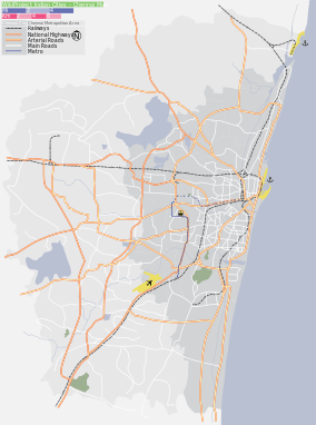
Location in context
 |
Thuraipakkam | Neelankarai | Bay of Bengal | |
| Karappakkam | |
Bay of Bengal | ||
| ||||
| | ||||
| Sholinganallur | Panayur | Bay of Bengal |
References
| Wikimedia Commons has media related to Injambakkam. |
- ↑ "Local Body Elections 2006". Official website of Kancheepuram district. Retrieved 22 February 2013.
- ↑ "Census of India 2001: Data from the 2001 Census, including cities, villages and towns (Provisional)". Census Commission of India. Archived from the original on 2004-06-16. Retrieved 2008-11-01.
- ↑ "NPR Report: Tamil Nadu: Kancheepuram: Sholinganallur". National Population Register, Ministry of Home Affairs, Government of India. 2011.
This article is issued from Wikipedia - version of the 9/8/2016. The text is available under the Creative Commons Attribution/Share Alike but additional terms may apply for the media files.