Mudichur
| Mudichur முடிச்சூர் | |
|---|---|
| neighbourhood | |
 Mudichur  Mudichur  Mudichur | |
| Coordinates: 12°54′46″N 80°04′10″E / 12.912736°N 80.069467°ECoordinates: 12°54′46″N 80°04′10″E / 12.912736°N 80.069467°E | |
| Country | India |
| State | Tamil Nadu |
| Metro | Chennai |
| Locality | Tambaram |
| Taluk | Chennai city - Tambaram |
| Government | |
| • Body | CMDA |
| Languages | |
| • Official | Tamil |
| Time zone | IST (UTC+5:30) |
| Telephone code | 044 |
| Vehicle registration | TN-11 |
| Lok Sabha constituency | Chennai South (Lok Sabha constituency) |
| Civic agency | Chennai Corporation |
| Website |
www |
Mudichur is a Census Town and residential locality in Southern part of the Metropolitan city Chennai in the Indian state of Tamil Nadu. Mudichur Comes under TambaramTaulk and St Thomas MountPanchayat union.Mudichur lies between Perungalathur and Tambaram Mudichur road just 4 kilometres (2.5 mi) from Tambaram.
Demographics
Mudichur has population totaling 15,438 with about 7748 men and 7690 women.As per Population Census 2011.population of children with age 0-6 is 1723 which makes up 11.16% of total population of Town. Average Sex Ratio of Mudichur Town is 993 which is lower than Tamil Nadu state average of 996. Child Sex Ratio for the Mudichur as per census is 969, higher than Tamil Nadu average of 943.
Climate
| Climate data for Chennai, India (1971–2000) | |||||||||||||
|---|---|---|---|---|---|---|---|---|---|---|---|---|---|
| Month | Jan | Feb | Mar | Apr | May | Jun | Jul | Aug | Sep | Oct | Nov | Dec | Year |
| Record high °C (°F) | 34.4 (93.9) |
36.7 (98.1) |
40.6 (105.1) |
42.8 (109) |
45.0 (113) |
43.3 (109.9) |
41.1 (106) |
40.0 (104) |
38.9 (102) |
39.4 (102.9) |
35.4 (95.7) |
33.0 (91.4) |
45.0 (113) |
| Average high °C (°F) | 28.8 (83.8) |
30.5 (86.9) |
32.5 (90.5) |
34.3 (93.7) |
36.8 (98.2) |
36.9 (98.4) |
35.0 (95) |
34.3 (93.7) |
33.9 (93) |
31.8 (89.2) |
29.6 (85.3) |
28.5 (83.3) |
32.8 (91) |
| Average low °C (°F) | 20.9 (69.6) |
22.0 (71.6) |
23.8 (74.8) |
26.4 (79.5) |
27.9 (82.2) |
27.5 (81.5) |
26.3 (79.3) |
25.7 (78.3) |
25.5 (77.9) |
24.5 (76.1) |
23.0 (73.4) |
21.9 (71.4) |
24.6 (76.3) |
| Record low °C (°F) | 13.9 (57) |
15.0 (59) |
16.7 (62.1) |
20.0 (68) |
21.1 (70) |
20.6 (69.1) |
21.0 (69.8) |
20.6 (69.1) |
20.6 (69.1) |
16.7 (62.1) |
15.0 (59) |
13.9 (57) |
13.9 (57) |
| Average rainfall mm (inches) | 22.5 (0.886) |
2.2 (0.087) |
4.0 (0.157) |
7.7 (0.303) |
43.9 (1.728) |
55.9 (2.201) |
100.3 (3.949) |
140.4 (5.528) |
137.3 (5.406) |
278.8 (10.976) |
407.4 (16.039) |
191.1 (7.524) |
1,391.5 (54.783) |
| Average rainy days | 1.3 | 0.4 | 0.3 | 0.6 | 1.4 | 4.0 | 6.9 | 8.5 | 7.1 | 10.6 | 11.7 | 6.3 | 59.1 |
| Average relative humidity (%) | 73 | 72 | 70 | 69 | 62 | 57 | 64 | 66 | 72 | 77 | 78 | 77 | 70 |
| Mean monthly sunshine hours | 268.3 | 268.1 | 293.6 | 290.2 | 279.9 | 202.6 | 185.2 | 193.6 | 198.6 | 194.6 | 182.7 | 204.3 | 2,761.7 |
| Source #1: India Meteorological Department (temperatures and precipitation)[1][2] | |||||||||||||
| Source #2: NOAA (sunshine duration and humidity 1971–1990)[3] | |||||||||||||
Literacy
Mudichur has higher literacy rate compared to Tamil Nadu. In 2011, literacy rate of Mudichur panchayat was 90.78% compared to 80.09% of Tamil Nadu. In Mudichur Male literacy stands at 94.09% while female literacy rate was 87.46%.
As per constitution of India and Panchyati Raaj Act, Mudichur Panchayat is administrated by Sarpanch (Head of Village) who is elected representative of village.
Solid waste management
Mudichur Town in Chennai city,Tamil Nadu is one of five cities have been Implemented Solid waste Management system's in Tamil Nadu.
The system Received Huge amount of appreciation from locals and Neighbourhood.
Flood disaster
Mudichur Town is one of the Places Severely affected in ChennaiFloods resulted from heavy rainfall generated by the annual northeast monsoon in November–December 2015.
Lakes,ponds have been broken out and People were stranded in Flood. NDRF has helped people to get into safe places. 2015 South Indian floods is major Disaster in India.
List Of MTC Bus route numbers for Mudichur
- M55 Tambaram-Mannivakkam
- 55 Tambaram-VandalurGate
- 55V Tambaram-Vandalur Zoo
- L18 Koyambedu-Mudichur
- M79 Tambaram-Padappai
- 80 Tambaram-Padappai
- 79K keelkattalai
- 579 Broadway
- 579A Tambaram
- 579V Velachery
- 583 Tambaram
- 583C Tambaram
- 583B Tambaram
- 583P Tambaram
- 583E Pallavaram
Nearest places to Mudichur
Mudichur's nearest places /city/important place is Perungalathur located at the distance of 2 kilometres (1.2 mi). Surrounding town/city/TP/CT from Mudichur are as follows.
- Perungalathur 2 kilometres (1.2 mi)
- Peerkankaranai 2.8 kilometres (1.7 mi)
- Vandalur 4 kilometres (2.5 mi)
- Tambaram 4 kilometres (2.5 mi)
Schools in and around Mudichur nearest schools has been listed as follows.
- Sugandhi Bala Bhavan School 0.8 kilometres (0.50 mi).
- Natesan School Bus Stop Mannivakkam 1.3 kilometres (0.81 mi)
- Joshua School 1.4 kilometres (0.87 mi)
- Natesan Vidyalaya School Mannivakkam 1.5 kilometres (0.93 mi)
- Bharath Matric School 1.6 kilometres (0.99 mi)
Outer ring road
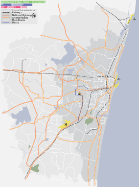
Mudichur Outer Ring Road, Chennai is a major transport corridor being developed along the periphery of Chennai Metropolitan Area(CMA) by the Chennai Metropolitan Development Authority(CMDA).. It is 62.3 km long connecting NH 45(GST Road) at Vandalur, NH 4(GWT Road) at Nazarathpet near poonamallee.The Segment I extends from GST Road (Vandalur) to NH4 (Nazarathpet) covering a distance of 19.7 km. The development covers an area of about 265.38 Hectares.
Road connectivity
Mudichur has excellent Road connectivity to Travel neighbourhood places in Chennai.Tambaram Mudichur road is the one of the important roads in Chennai 8 km long Connecting Areas Around Mudichur, Tambaram, perungalathur,and Upto Mannivakkam koot Road. Outer Ring Road, Chennai is another Fast lane for Heavy Transport Vehicles .Currently Mudicur Road is Planning to Expand as 4 way Lane to overcome heavy Traffic During Peak Hours.
Place of worship
- Shiva Vishnu Temple
- Sree Vidya Amibigai Samedha BheemeshwaraTemple
- Nagathamman Temple,Madanapuram
- Sithi Vinayagar Temple
- Jain Temple
- CSI Church ,Mudichur
Recent development
Mudichur is Rapidly developing town in TambaramArea and has excellent Transport facility and Road ways like Outer Ring Road, Chennai,SH-48 That connects to Vandalur High road.
Famous holiday places
- VandalurZoo 4 km
- KishkintaAmusement park 8 km
- Kovalam Beach 25 km
- QueenslandAmusement park 19 km
- Childrens park 24 km
- NanganallurAnjaneya temple 15 km
- Marina Beach 32 km
High-Growth Zone
The region close to NH-45 is seen as a high-growth area covering the suburbs of vandalur,Mudichur, Mangadu, Poonamallee & Avadi
Beaches in and around Mudichur
Mudichur's nearest beach is Golden Beach located at the distance of 19.6 kilometres (12.2 mi). Surrounding beaches from Mudichur are as follows.
- Golden Beach 19.6 kilometres (12.2 mi)
- Thiruvanmiyur Beach 22.3 kilometres (13.9 mi)
- Adyar Beach 22.7 kilometres (14.1 mi)
- Elliots Beach 23.8 kilometres (14.8 mi)
- Santhome Beach 24.7 kilometres (15.3 mi)
List of Banks and ATM in Mudichur
- ICICI Bank
- City Union Bank
- Indian Bank
- Indian Overseas Bank
- IDBI Bank Ltd
- Bank of Baroda
- State Bank of Hyderabad (Lakshmipuram Branch)
Politics
Mudichur is one of the important Areas in Tambaram Assembly constituency.Tambaram was Chennai south Region largest constituency before creating new taulk area Sholinganallur formed in 2011 Election.
Airport
Mudichur's nearest airport is Tambaram Air Force Station situated at 4.7 kilometres (2.9 mi) distance. Few more airports around Mudichur are as follows.
- Tambaram Air Force Station 4.7 kilometres (2.9 mi)
- Chennai International Airport 13.2 kilometres (8.2 mi)
References
- ↑ "Chennai- Climatological Information". India Meteorological Department. Retrieved 29 May 2014.
- ↑ India Meteorological Department. "Ever Recorded Maximum Temperature, Minimum Temperature and 24 Hours Heaviest Rainfall up to 2010" (PDF). India Meteorological Department, Pune. p. 67. Retrieved 29 May 2014.
- ↑ "Madras (Chennai) Climate Normals 1971–1990". National Oceanic and Atmospheric Administration. Retrieved 25 March 2015.
- "Tambaram and Mudichur among worst hit - How Indian army is helping Chennai flood victims". Economictimes.com. 2015-12-04. Retrieved 2016-08-28.
- "As 35 lakes breach their banks, Chennai goes under again". The Hindu. 2015-12-02. Retrieved 2016-08-28.