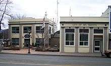
Mount Shasta, California
| Mount Shasta, California | |
|---|---|
| City | |
| City of Mount Shasta | |
 Location in Siskiyou County and the state of California | |
 Mount Shasta, California Location in the United States | |
| Coordinates: 41°18′52″N 122°18′41″W / 41.31444°N 122.31139°WCoordinates: 41°18′52″N 122°18′41″W / 41.31444°N 122.31139°W | |
| Country |
|
| State |
|
| County |
|
| Incorporated | May 31, 1905[1] |
| Area[2] | |
| • Total | 3.770 sq mi (9.764 km2) |
| • Land | 3.766 sq mi (9.754 km2) |
| • Water | 0.004 sq mi (0.010 km2) 0.10% |
| Elevation[3] | 3,586 ft (1,093 m) |
| Population (2010) | |
| • Total | 3,394 |
| • Density | 900/sq mi (350/km2) |
| Time zone | Pacific (PST) (UTC-8) |
| • Summer (DST) | PDT (UTC-7) |
| ZIP code | 96067 |
| Area code(s) | 530 |
| FIPS code | 06-49852 |
| GNIS feature IDs | 277559, 2411181 |
| Website |
www |
Mount Shasta is a city in Siskiyou County, California, at about 3,600 feet (1,100 m) above sea level on the flanks of Mount Shasta, a prominent northern California landmark. The city is less than 9 miles (14 km) southwest of the summit of its namesake volcano. As of the 2010 Census the city had a population of 3,394, down from 3,624 at the 2000 census.
Commerce and tourism
The city of Mount Shasta is located in the Shasta Cascade area of Northern California.[4] Visitors use the city as a base for trout fishing in the nearby Sacramento, McCloud and Klamath rivers,[5][6] for climbing at Mount Shasta, Castle Crags or the Trinity Alps, or to view scenery.[4][7] Both alpine and cross-country skiing[8] runs are available nearby as well as biking or hiking to waterfalls, streams and lakes in the area, including nearby Mossbrae Falls, Lake Siskiyou, Castle Lake and Shasta Lake.[4][7]
History
The site of the present-day city of Mount Shasta was within the range of the Okwanuchu tribe of Native Americans. During the 1820s, early Euro-American trappers and hunters first passed through the area, following the path of the Siskiyou Trail. The Siskiyou Trail was based on a network of ancient Native American footpaths connecting California and the Pacific Northwest. The discovery of gold at nearby Yreka, California in 1851 dramatically increased traffic along the Siskiyou Trail and through the site of present-day Mount Shasta. Pioneer Ross McCloud built one of the first lumber mills in the area, near the site of the present Sisson Museum. The completion of a stagecoach road between Yreka and Upper Soda Springs in the late 1850s led to the building of Sisson's Hotel, as a stop for weary travelers, and as a staging ground for adventuresome tourists intending to climb Mount Shasta.

The area where the town grew was known first as Strawberry Valley, and then as Berryvale.[9] The post office opened in 1870 as Berryvale.[10] After 1886 it was known as Sisson after a local businessman, Justin Hinckley Sisson who ran a stagecoach inn and tavern as well as donated the land for the town site and the Central Pacific Railroad station in 1886.[10] Street names honor members of Sisson's family.[10]
The 1887 completion of the Central Pacific Railroad, built along the line of the Siskiyou Trail, brought a dramatic increase in tourism, lumbering, and population into Mount Shasta. This early development continued to focus on tourism and lumbering. The early 1900s saw the influx of a large number of Italian immigrants to Mount Shasta and neighboring towns, most of whom were employed in the timber industry.
The city incorporated on May 31, 1905.[11] The name of the city was finalized "City of Mount Shasta" on November 10, 1925,[12][13] after a popular vote in 1922.
Theosophist Guy Ballard claimed to have met Saint Germain while hiking on Mount Shasta in 1930.[14]
Geography
Mount Shasta is located at 41°18'52" North, 122°18'41" West (41.314542, -122.311510),[15] along Interstate 5 south of Weed and north of Dunsmuir, California.
According to the United States Census Bureau, the city has a total area of 3.8 square miles (9.8 km2), of which 3.8 square miles (9.8 km2) is land and only 0.10% of it is covered by water.
The area hydrology consists of an unnamed stream in the south part of town which joins Big Springs Creek, which then flows south as Cold Creek to join the headwaters of the South Fork of the Sacramento River.[16] The typical depth to groundwater is quite shallow in the predominant alluvium.[17]
The settlement is on the distal gently sloping southwest flanks of Mount Shasta, with the chief surficial soils being Quaternary alluvium. This alluvium is adjacent to and probably underlain by volcanic clastic rock deposited by Mount Shasta in the course of its development. Groundwater elevation is approximately at the elevation of the underlying native black peat soil. Where it occurs this peat, of approximately two feet thickness, is underlain by stream deposit sands and gravels.
Climate
Mount Shasta to the east forces moisture out of the air as it rises and cools, and the dip in the Klamath Mountains allows more moisture to reach inland, so the city receives more precipitation than the semiarid region to the north. This means that in the winter, the city gets nearly 103 inches (260 cm) of snowfall despite its low 3,600 feet (1,100 m) elevation.[18] In comparison, other towns in the region get much less snow.[19] The Köppen climate classification is Csb, humid subtropical with dry summers, or warm-summer Mediterranean climate.
The record high temperature was 105 °F (41 °C) on August 7, 1981, and the record low temperature was −13 °F (−25 °C) on December 22, 1990.[20] The wettest year was 1998 with 75.15 inches (190.9 cm) and the driest year was 1976 with 14.27 inches (36.2 cm). The most rainfall in one month was 27.48 inches (69.8 cm) in January 1995, including 5.97 inches (15.2 cm) on January 9. The most snowfall in one year was 349.6 inches (888 cm) in 1952, including 137.7 inches (350 cm) in January 1952.[21]
| Mount Shasta[20] | ||||||||||||||||||||||||||||||||||||||||||||||||||||||||||||
|---|---|---|---|---|---|---|---|---|---|---|---|---|---|---|---|---|---|---|---|---|---|---|---|---|---|---|---|---|---|---|---|---|---|---|---|---|---|---|---|---|---|---|---|---|---|---|---|---|---|---|---|---|---|---|---|---|---|---|---|---|
| Climate chart (explanation) | ||||||||||||||||||||||||||||||||||||||||||||||||||||||||||||
| ||||||||||||||||||||||||||||||||||||||||||||||||||||||||||||
| ||||||||||||||||||||||||||||||||||||||||||||||||||||||||||||
| Climate data for Mount Shasta, California | |||||||||||||
|---|---|---|---|---|---|---|---|---|---|---|---|---|---|
| Month | Jan | Feb | Mar | Apr | May | Jun | Jul | Aug | Sep | Oct | Nov | Dec | Year |
| Record high °F (°C) | 67 (19) |
72 (22) |
80 (27) |
86 (30) |
97 (36) |
99 (37) |
102 (39) |
105 (41) |
103 (39) |
93 (34) |
80 (27) |
72 (22) |
105 (41) |
| Average high °F (°C) | 43.0 (6.1) |
47.5 (8.6) |
52.0 (11.1) |
59.0 (15) |
67.7 (19.8) |
75.9 (24.4) |
87.9 (31.1) |
83.7 (28.7) |
77.3 (25.2) |
65.1 (18.4) |
50.9 (10.5) |
43.6 (6.4) |
62.8 (17.11) |
| Average low °F (°C) | 25.8 (−3.4) |
28.2 (−2.1) |
30.0 (−1.1) |
33.5 (0.8) |
39.8 (4.3) |
46.1 (7.8) |
50.4 (10.2) |
48.6 (9.2) |
43.8 (6.6) |
37.1 (2.8) |
30.5 (−0.8) |
26.3 (−3.2) |
36.68 (2.59) |
| Record low °F (°C) | 2 (−17) |
−3 (−19) |
11 (−12) |
15 (−9) |
23 (−5) |
28 (−2) |
35 (2) |
34 (1) |
27 (−3) |
15 (−9) |
6 (−14) |
−13 (−25) |
−13 (−25) |
| Average precipitation inches (mm) | 7.11 (180.6) |
6.30 (160) |
5.20 (132.1) |
2.83 (71.9) |
1.87 (47.5) |
1.01 (25.7) |
0.34 (8.6) |
0.38 (9.7) |
0.79 (20.1) |
2.26 (57.4) |
5.12 (130) |
6.74 (171.2) |
39.94 (1,014.5) |
| Average snowfall inches (cm) | 27.2 (69.1) |
18.6 (47.2) |
15.4 (39.1) |
7.4 (18.8) |
0.7 (1.8) |
0.0 (0) |
0.0 (0) |
0.0 (0) |
0.0 (0) |
0.4 (1) |
9.4 (23.9) |
23.8 (60.5) |
102.9 (261.4) |
| Average rainy days | 13 | 12 | 13 | 10 | 8 | 5 | 2 | 2 | 3 | 6 | 11 | 13 | 98 |
| Source: Weatherbase [20] | |||||||||||||
Demographics
| Historical population | |||
|---|---|---|---|
| Census | Pop. | %± | |
| 1890 | 556 | — | |
| 1910 | 636 | — | |
| 1920 | 542 | −14.8% | |
| 1930 | 1,009 | 86.2% | |
| 1940 | 1,618 | 60.4% | |
| 1950 | 1,909 | 18.0% | |
| 1960 | 1,936 | 1.4% | |
| 1970 | 2,256 | 16.5% | |
| 1980 | 2,837 | 25.8% | |
| 1990 | 3,460 | 22.0% | |
| 2000 | 3,621 | 4.7% | |
| 2010 | 3,394 | −6.3% | |
| Est. 2015 | 3,296 | [22] | −2.9% |
2010
The 2010 United States Census[24] reported that Mount Shasta had a population of 3,394. The population density was 900.3 people per square mile (347.6/km²). The racial makeup of Mount Shasta was 3,041 (89.6%) White, 61 (1.8%) African American, 19 (0.6%) Native American, 56 (1.6%) Asian, 2 (0.1%) Pacific Islander, 51 (1.5%) from other races, and 164 (4.8%) from two or more races. Hispanic or Latino of any race were 277 persons (8.2%).
The Census reported that 3,358 people (98.9% of the population) lived in households, 6 (0.2%) lived in non-institutionalized group quarters, and 30 (0.9%) were institutionalized.
There were 1,664 households, out of which 401 (24.1%) had children under the age of 18 living in them, 537 (32.3%) were married couples, 190 (11.4%) had a female householder with no husband present, 84 (5.0%) had a male householder with no wife present. There were 113 (6.8%) unmarried couples, and only 9 (0.5%) same-sex couples. 719 households (43.2%) were made up of individuals and 285 (17.1%) had someone living alone who was 65 years of age or older. The average household size was 2.02. There were 811 families (48.7% of all households); the average family size was 2.79.
The population was spread out with 692 people (20.4%) under the age of 18, 242 people (7.1%) aged 18 to 24, 732 people (21.6%) aged 25 to 44, 1,109 people (32.7%) aged 45 to 64, and 619 people (18.2%) who were 65 years of age or older. The median age was 45.7 years. For every 100 females there were 84.7 males. For every 100 females age 18 and over, there were 80.6 males.
There were 1,895 housing units at an average density of 502.7 per square mile (194.1/km²), of which 781 (46.9%) were owner-occupied, and 883 (53.1%) were occupied by renters. The homeowner vacancy rate was 2.5%; the rental vacancy rate was 5.8%. 1,699 people (50.1% of the population) lived in owner-occupied housing units and 1,659 people (48.9%) lived in rental housing units.
2000
As of the census of 2000, there were 3,621 people, 1,669 households, and 926 families residing in the city. The population density was 967.5 people per square mile (373.8/km²). There were 1,798 housing units at an average density of 480.4 per square mile (185.6/km²). The racial makeup of the city was 91.77% White, 1.52% Black or African American, 0.44% Native American, 1.63% Asian, 0.14% Pacific Islander, 2.13% from other races, and 2.38% from two or more races. 5.83% of the population were Hispanic or Latino of any race.
There are 1,669 households out of which 27.9% have children under the age of 18 living with them, 38.1% are married couples living together, 12.3% have a female householder with no husband present, and 44.5% are non-families. 38.0% of all households are made up of individuals and 16.0% have someone living alone who is 65 years of age or older. The average household size is 2.14 and the average family size is 2.83.
In the city the population is spread out with 24.0% under the age of 18, 7.7% from 18 to 24, 24.5% from 25 to 44, 26.4% from 45 to 64, and 17.5% who are 65 years of age or older. The median age is 42 years. For every 100 females there are 87.9 males. For every 100 females age 18 and over, there are 84.5 males.
The median income for a household in the city is $26,500, and the median income for a family is $37,313. Males have a median income of $37,697 versus $18,708 for females. The per capita income for the city is $20,629. 19.4% of the population and 14.9% of families are below the poverty line. Out of the total population, 31.5% of those under the age of 18 and 11.2% of those 65 and older are living below the poverty line.
Politics
The city council of Mount Shasta is composed of seven officials: five city council members, a City Treasurer and a City Clerk who are elected at large and serve a four-year term.[25] The Mayor and Mayor Pro Tem are elected each year from the five council members and serve a one-year term.[25]
In the state legislature Mount Shasta is in the 1st Senate District, represented by Republican Ted Gaines,[26] and the 1st Assembly District, represented by Republican Brian Dahle.[27]
Federally, Mount Shasta is in California's 1st congressional district, represented by Republican Doug LaMalfa.[28]
Notable people
- Terry Huntingdon - Miss California USA 1959, Miss USA 1959.
- Ann Little - silent-film actress
- Anita Loos - writer and author of the screenplay Gentlemen Prefer Blondes was born in Sisson (now Mount Shasta) in 1888.
- Jason Sehorn - former NFL defensive star graduated Mount Shasta High School in 1989.
Local media
- KSIZ-FM 99.3/102.3 FM Mount Shasta
- KZRO-FM 100.1 Mount Shasta
- KKLC 107.9 K-LOVE, Fall River Mills
- KNSQ-FM 88.1 Jefferson Public Radio, Mount Shasta
- KLDD-FM 91.9 Jefferson Public Radio, Mount Shasta
- KMJC-AM 620 Jefferson Public Radio, Mount Shasta
- Mount Shasta Herald
- Northland Communications
- MCTV 15 Mountain Community Television
See also
References
- ↑ "California Cities by Incorporation Date" (Word). California Association of Local Agency Formation Commissions. Retrieved August 25, 2014.
- ↑ "2010 Census Gazetteer Files - Places - California". United States Census Bureau. Retrieved March 26, 2015.
- ↑ "Mount Shasta". Geographic Names Information System. United States Geological Survey. Retrieved March 20, 2015.
- 1 2 3 Welcome to Mount Shasta, Mount Shasta Chamber of Commerce, accessed 23 April 2013
- ↑ Ross, John (2005). Trout Unlimited's Guide to America's 100 Best Trout Streams, Updated and Revised. Guilford, CT: The Lyons Press. ISBN 1-59228-585-6.
- ↑ Brooks, Wade (2006). Fly fishing and the meaning of life. St. Paul, MN: Voyageur Press. p. 92. ISBN 0-7603-2575-8.
- 1 2 Outdoor recreational activities in area accessed 2008-02-24
- ↑ Mount Shasta 14162 ft (4317 m), Skiing the Cascade Volcanoes, accessed 23 April 2013
- ↑ Lee Apperson (1987). Sisson - Mount Shasta: The Early Years. Mount Shasta Print. Company.
- 1 2 3 Benjamin S. Orlove; Ellen Wiegandt; Brian H. Luckman (2008). Darkening Peaks: Glacier Retreat, Science, and Society. University of California Press. pp. 56–. ISBN 978-0-520-25305-6.
- ↑ California Roster. Secretary of State. 1971. p. 106.
- ↑ William C. Miesse; Mount Shasta Collection (College of the Siskiyous); College of the Siskiyous. Library (1993). Mount Shasta: an annotated bibliography. College of the Siskiyous. p. 111.
- ↑ Paul T. Hellmann (February 14, 2006). Historical Gazetteer of the United States. Routledge. pp. 100–. ISBN 1-135-94859-3.
- ↑ King, Godfre Ray. Unveiled Mysteries. Chicago, Illinois: Saint Germain Press 1934
- ↑ "US Gazetteer files: 2010, 2000, and 1990". United States Census Bureau. 2011-02-12. Retrieved 2011-04-23.
- ↑ U.S. Geological Survey, Weed 15 Minute Quadrangle, U.S. Government Printing Office, Washington DC (1954)
- ↑ Phase I Environmental Site Assessment,301 West Lake Street, Mount Shasta, California, Earth Metrics Incorporated, San Mateo, California, Report Number 10363, December 18, 1989
- ↑ Information about Cascade Snowdepth Measurement Sites, Skiing the Cascade Volcanoes, April 2005, accessed 23 April 2013
- ↑ Cascade Snow Depth Comparison, Skiing the Cascade Volcanoes, April 2005, accessed 23 April 2013
- 1 2 3 Mount Shasta, California Monthly - Weather Averages Summary, Weatherbase, accessed 23 April 2013
- ↑ Mount Shasta, California (045983) Period of Record Monthly Climate Summary, Western Regional Climate Center, 2010, accessed 23 April 2013
- ↑ "Annual Estimates of the Resident Population for Incorporated Places: April 1, 2010 to July 1, 2015". Retrieved July 2, 2016.
- ↑ "Census of Population and Housing". Census.gov. Retrieved June 4, 2015.
- ↑ "2010 Census Interactive Population Search: CA - Mount Shasta city". U.S. Census Bureau. Retrieved July 12, 2014.
- 1 2 Elected Officials, City of Mount Shasta, 2014
- ↑ "Senators". State of California. Retrieved March 10, 2013.
- ↑ "Members Assembly". State of California. Retrieved March 2, 2013.
- ↑ "California's 1st Congressional District - Representatives & District Map". Civic Impulse, LLC. Retrieved March 1, 2013.
External links
-
 Geographic data related to Mount Shasta, California at OpenStreetMap
 - Official website
- Museum of the Siskiyou Trail
- Images of Mount Shasta from the Eastman’s Originals Collection,Special Collections Dept., University of California, Davis.
| Mountains |  | |
|---|---|---|
| Bodies of Water | ||
| Rivers | ||
| Incorporated Cities | ||
| Counties | ||
| Parks |
| |
Municipalities and communities of Siskiyou County, California, United States | ||
|---|---|---|
| Cities | 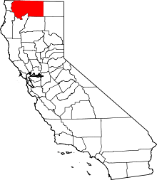 | |
| CDPs | ||
| Unincorporated communities | ||
| Indian reservation | ||
| Ghost towns | ||
| Footnotes | ‡This populated place also has portions in an adjacent county or counties | |