Callahan, California
| Callahan, California | |
|---|---|
| Unincorporated community | |
 Callahan, California | |
| Coordinates: 41°18′35″N 122°48′05″W / 41.30972°N 122.80139°WCoordinates: 41°18′35″N 122°48′05″W / 41.30972°N 122.80139°W | |
| Country | United States |
| State | California |
| County | Siskiyou |
| Elevation | 3,140 ft (960 m) |
| Time zone | Pacific (PST) (UTC-8) |
| • Summer (DST) | PDT (UTC-7) |
| ZIP code | 96014 |
| Area code(s) | 530 |
| GNIS feature ID | 257834[1] |
Callahan is an unincorporated community in Siskiyou County, California, United States. Callahan is located on California State Route 3 11.5 miles (18.5 km) south-southeast of Etna. Callahan has a post office with ZIP code 96014.[2] The post office opened as Callahan's Ranch in 1858 and changed its name to Callahan in 1892. The community was named after M.B. Callahan, who opened a travelers' stop in the community in 1851.[3]
The Last Lynching in California
On January 6, 1947, school children at Callahan's one room schoolhouse were greeted by the body of a dead African American man, strung up from a nearby telephone pole. A calfskin was wrapped around his shoulders and he was riddled with bullet holes. The January 10, 1947 edition of the Western Sentinel newspaper carried a front page story about the lynching, identifying the man as a butcher from Weed, California. The January 12, 1947 edition of the Etna Gazette also carried the story. All copies of the newspapers were subsequently destroyed, including copies from the Siskiyou County library. The identity of those responsible for the destruction remains a mystery. It was the last known lynching in California. The crime has never been solved.[4]
Climate
This region experiences warm (but not hot) and dry summers, with no average monthly temperatures above 71.6 °F. According to the Köppen Climate Classification system, Callahan has a warm-summer Mediterranean climate, abbreviated "Csb" on climate maps.[5]
| Climate data for Callahan (1943-2012) | |||||||||||||
|---|---|---|---|---|---|---|---|---|---|---|---|---|---|
| Month | Jan | Feb | Mar | Apr | May | Jun | Jul | Aug | Sep | Oct | Nov | Dec | Year |
| Record high °F (°C) | 65 (18) |
72 (22) |
82 (28) |
86 (30) |
98 (37) |
103 (39) |
106 (41) |
105 (41) |
105 (41) |
91 (33) |
75 (24) |
65 (18) |
106 (41) |
| Average high °F (°C) | 44.9 (7.2) |
50.9 (10.5) |
56.4 (13.6) |
62.7 (17.1) |
71.5 (21.9) |
80.1 (26.7) |
88.5 (31.4) |
87.2 (30.7) |
80.6 (27) |
68 (20) |
51.9 (11.1) |
44.2 (6.8) |
65.6 (18.7) |
| Average low °F (°C) | 25.4 (−3.7) |
27.9 (−2.3) |
29.9 (−1.2) |
32.7 (0.4) |
38 (3) |
43.7 (6.5) |
48.9 (9.4) |
47.5 (8.6) |
41.7 (5.4) |
35.2 (1.8) |
29.8 (−1.2) |
25.7 (−3.5) |
35.5 (1.9) |
| Record low °F (°C) | −6 (−21) |
−1 (−18) |
4 (−16) |
18 (−8) |
21 (−6) |
23 (−5) |
30 (−1) |
32 (0) |
23 (−5) |
15 (−9) |
9 (−13) |
−9 (−23) |
−9 (−23) |
| Average precipitation inches (mm) | 3.46 (87.9) |
2.7 (69) |
2.1 (53) |
1.26 (32) |
1.09 (27.7) |
0.76 (19.3) |
0.43 (10.9) |
0.37 (9.4) |
0.5 (13) |
1.57 (39.9) |
2.88 (73.2) |
3.79 (96.3) |
20.92 (531.4) |
| Average snowfall inches (cm) | 4.5 (11.4) |
1.7 (4.3) |
2.2 (5.6) |
0.3 (0.8) |
0.2 (0.5) |
0 (0) |
0 (0) |
0 (0) |
0 (0) |
0.1 (0.3) |
1.3 (3.3) |
2.6 (6.6) |
12.8 (32.5) |
| Average precipitation days | 12 | 10 | 11 | 8 | 7 | 5 | 2 | 2 | 3 | 6 | 11 | 12 | 89 |
| Source: WRCC[6] | |||||||||||||
References
- ↑ U.S. Geological Survey Geographic Names Information System: Callahan, California
- ↑ ZIP Code Lookup
- ↑ Durham, David L. (1998). California's Geographic Names: A Gazetteer of Historic and Modern Names of the State. Quill Driver Books. p. 206. ISBN 1-884995-14-4.
- ↑ Kulczyk,David. (2008). California Justice: Shootouts, Lynching and Assassinations in the Golden State. Word Dancer Press. P115 ISBN 1-884995-54-3
- ↑ Climate Summary for Callahan, California
- ↑ "CALLAHAN, CA (041316)". Western Regional Climate Center. Retrieved November 29, 2015.
Municipalities and communities of Siskiyou County, California, United States | ||
|---|---|---|
| Cities | 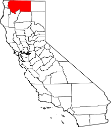 | |
| CDPs | ||
| Unincorporated communities | ||
| Indian reservation | ||
| Ghost towns | ||
| Footnotes | ‡This populated place also has portions in an adjacent county or counties | |