Hatfield, California–Oregon
| Hatfield | |
|---|---|
| Unincorporated community | |
 Hatfield | |
| Coordinates: 41°59′53″N 121°31′10″W / 41.99806°N 121.51944°WCoordinates: 41°59′53″N 121°31′10″W / 41.99806°N 121.51944°W | |
| Country | United States |
| States | California, Oregon |
| Counties | Siskiyou (California), Klamath (Oregon) |
| Elevation | 4,065 ft (1,239 m) |
| Time zone | Pacific (PST) (UTC-8) |
| • Summer (DST) | PDT (UTC-7) |
| Area code(s) | 530, 541, 458 |
| GNIS feature ID | 261153[1] |
Hatfield is an unincorporated community in both Siskiyou County, California, and Klamath County, Oregon, in the United States. Hatfield is located at the junction of Oregon Route 39, California State Route 161, and California State Route 139; all three routes terminate at a four-way junction in the community. The Lost River also runs through Hatfield.[2] Hatfield is 3.6 miles (5.8 km) northwest of Tulelake, California, and 4.6 miles (7.4 km) east-southeast of Merrill, Oregon.
See also
References
- ↑ "Hatfield". Geographic Names Information System. United States Geological Survey.
- ↑ Hatfield, Calif.–Oreg. (Map). 1:24,000. 7.5 Minute Series (Topographic). United States Geological Survey. 1985.
Municipalities and communities of Siskiyou County, California, United States | ||
|---|---|---|
| Cities | 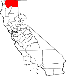 | |
| CDPs | ||
| Unincorporated communities | ||
| Indian reservation | ||
| Ghost towns | ||
| Footnotes | ‡This populated place also has portions in an adjacent county or counties | |
Municipalities and communities of Klamath County, Oregon, United States | ||
|---|---|---|
| Cities | 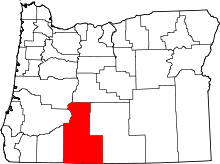 | |
| CDP | ||
| Unincorporated communities | ||
This article is issued from Wikipedia - version of the 8/22/2014. The text is available under the Creative Commons Attribution/Share Alike but additional terms may apply for the media files.