Etna, California
| Etna, California Etna Mills (former) | |
|---|---|
| City | |
| City of Etna | |
 Location in Siskiyou County and the state of California | |
 Etna, California Location in the United States | |
| Coordinates: 41°27′26″N 122°53′49″W / 41.45722°N 122.89694°WCoordinates: 41°27′26″N 122°53′49″W / 41.45722°N 122.89694°W | |
| Country |
|
| State |
|
| County |
|
| Incorporated | March 13, 1878[1] |
| Government | |
| • Type | Elected |
| • Mayor | Marilyn Seward[2] |
| • City clerk | Pamela Russell |
| • Chief of police | Joshua E. Short |
| Area[3] | |
| • Total | 0.759 sq mi (1.965 km2) |
| • Land | 0.758 sq mi (1.962 km2) |
| • Water | 0.001 sq mi (0.002 km2) 0.12% |
| Elevation[4] | 2,936 ft (895 m) |
| Population (2010) | |
| • Total | 737 |
| • Density | 970/sq mi (380/km2) |
| Time zone | Pacific (UTC-8) |
| • Summer (DST) | PDT (UTC-7) |
| ZIP code | 96027 |
| Area code | 530 |
| FIPS code | 06-22972 |
| GNIS feature IDs | 277509, 2410458 |
| Website |
www |
Etna is a city in the Scott Valley area of Siskiyou County, California, United States. The population was 737 at the 2010 census, down from 781 at the 2000 census.
Name
Originally named Rough and Ready, it was changed by statute in 1874 to Etna after the local flour mill (spelled Ætna/Aetna after Mount Ætna in Sicily).[5]
Geography
Etna is located at 41°27′26″N 122°53′49″W / 41.45722°N 122.89694°W (41.457350, -122.896875).[6] Etna is in Northern California near the Oregon border, located in Scott Valley next to the CPD of Greenview, the city of Fort Jones and the city of Callahan. Etna is located at the foot of the Marble Mountain Wilderness in the Siskiyou Mountain (Cascades) Range and is an attraction for hikers, rafters, climbers and people who do all sorts of other outdoor activities. According to the United States Census Bureau, the city has a total area of 0.8 square miles (2.1 km2), 99.88% of it land and 0.12% of it water.
Demographics
| Historical population | |||
|---|---|---|---|
| Census | Pop. | %± | |
| 1880 | 361 | — | |
| 1890 | 271 | −24.9% | |
| 1900 | 500 | 84.5% | |
| 1910 | 518 | 3.6% | |
| 1920 | 425 | −18.0% | |
| 1930 | 379 | −10.8% | |
| 1940 | 456 | 20.3% | |
| 1950 | 649 | 42.3% | |
| 1960 | 596 | −8.2% | |
| 1970 | 667 | 11.9% | |
| 1980 | 754 | 13.0% | |
| 1990 | 835 | 10.7% | |
| 2000 | 781 | −6.5% | |
| 2010 | 737 | −5.6% | |
| Est. 2015 | 716 | [7] | −2.8% |
2010
The 2010 United States Census[9] reported that Etna had a population of 737. The population density was 971.6 people per square mile (375.1/km²). The racial makeup of Etna was 627 (85.1%) White, 0 (0.0%) African American, 28 (3.8%) Native American, 1 (0.1%) Asian, 1 (0.1%) Pacific Islander, 6 (0.8%) from other races, and 74 (10.0%) from two or more races. Hispanic or Latino of any race were 26 persons (3.5%).
The Census reported that 731 people (99.2% of the population) lived in households, 6 (0.8%) lived in non-institutionalized group quarters, and 0 (0%) were institutionalized.
There were 323 households, out of which 93 (28.8%) had children under the age of 18 living in them, 141 (43.7%) were opposite-sex married couples living together, 36 (11.1%) had a female householder with no husband present, 24 (7.4%) had a male householder with no wife present. There were 19 (5.9%) unmarried opposite-sex partnerships, and 3 (0.9%) same-sex married couples or partnerships. 105 households (32.5%) were made up of individuals and 47 (14.6%) had someone living alone who was 65 years of age or older. The average household size was 2.26. There were 201 families (62.2% of all households); the average family size was 2.86.
The population was spread out with 173 people (23.5%) under the age of 18, 35 people (4.7%) aged 18 to 24, 125 people (17.0%) aged 25 to 44, 251 people (34.1%) aged 45 to 64, and 153 people (20.8%) who were 65 years of age or older. The median age was 48.5 years. For every 100 females there were 101.9 males. For every 100 females age 18 and over, there were 97.2 males.
There were 359 housing units at an average density of 473.3 per square mile (182.7/km²), of which 206 (63.8%) were owner-occupied, and 117 (36.2%) were occupied by renters. The homeowner vacancy rate was 4.5%; the rental vacancy rate was 4.8%. 441 people (59.8% of the population) lived in owner-occupied housing units and 290 people (39.3%) lived in rental housing units.
2000
As of the census[10] of 2000, there were 781 people, 329 households, and 210 families residing in the city. The population density was 989.9 people per square mile (381.7/km²). There were 362 housing units at an average density of 458.8 per square mile (176.9/km²). The racial makeup of the city was 88.48% White, 0.13% African American, 6.02% Native American, 0.64% Asian, 1.02% from other races, and 3.71% from two or more races. Hispanic or Latino of any race were 3.46% of the population.
There were 329 households out of which 28.0% had children under the age of 18 living with them, 48.9% were married couples living together, 11.6% had a female householder with no husband present, and 35.9% were non-families. 31.0% of all households were made up of individuals and 17.6% had someone living alone who was 65 years of age or older. The average household size was 2.37 and the average family size was 2.98.
In the city the population was spread out with 26.1% under the age of 18, 4.7% from 18 to 24, 21.4% from 25 to 44, 25.1% from 45 to 64, and 22.7% who were 65 years of age or older. The median age was 44 years. For every 100 females there were 95.3 males. For every 100 females age 18 and over, there were 93.6 males.
The median income for a household in the city was $25,179, and the median income for a family was $30,461. Males had a median income of $25,972 versus $20,750 for females. The per capita income for the city was $13,737. About 13.7% of families and 19.7% of the population were below the poverty line, including 23.5% of those under age 18 and 9.1% of those age 65 or over.
Government
In the California State Legislature, Etna is in the 1st Senate District, represented by Republican Ted Gaines,[11] and the 1st Assembly District, represented by Republican Brian Dahle.[12]
In the United States House of Representatives, Etna is in California's 1st congressional district, represented by Republican Doug LaMalfa.[13]
References
- ↑ "California Cities by Incorporation Date" (Word). California Association of Local Agency Formation Commissions. Retrieved August 25, 2014.
- ↑ "City Council Members". City of Etna. Retrieved January 24, 2015.
- ↑ "2010 Census U.S. Gazetteer Files – Places – California". United States Census Bureau.
- ↑ "Etna". Geographic Names Information System. United States Geological Survey. Retrieved January 24, 2015.
- ↑ Gudde, Erwin G. (1998). California place names : the origin and etymology of current geographical names (4th ed., rev. and enl. ed.). Berkeley: University of California Press. p. 126. ISBN 0520213165.
- ↑ "US Gazetteer files: 2010, 2000, and 1990". United States Census Bureau. 2011-02-12. Retrieved 2011-04-23.
- ↑ "Annual Estimates of the Resident Population for Incorporated Places: April 1, 2010 to July 1, 2015". Retrieved July 2, 2016.
- ↑ "Census of Population and Housing". Census.gov. Archived from the original on May 11, 2015. Retrieved June 4, 2015.
- ↑ "2010 Census Interactive Population Search: CA - Etna city". U.S. Census Bureau. Retrieved July 12, 2014.
- ↑ "American FactFinder". United States Census Bureau. Archived from the original on September 11, 2013. Retrieved 2008-01-31.
- ↑ "Senators". State of California. Retrieved March 10, 2013.
- ↑ "Members Assembly". State of California. Retrieved March 2, 2013.
- ↑ "California's 1st Congressional District - Representatives & District Map". Civic Impulse, LLC. Retrieved March 1, 2013.
External links
| Wikivoyage has a travel guide for Etna, California. |
Municipalities and communities of Siskiyou County, California, United States | ||
|---|---|---|
| Cities | 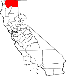 | |
| CDPs | ||
| Unincorporated communities | ||
| Indian reservation | ||
| Ghost towns | ||
| Footnotes | ‡This populated place also has portions in an adjacent county or counties | |