Montgomery, Ohio
| Montgomery, Ohio | |
|---|---|
| City | |
|
Downtown | |
 Location in Hamilton County and the state of Ohio. | |
| Coordinates: 39°14′50″N 84°20′51″W / 39.24722°N 84.34750°WCoordinates: 39°14′50″N 84°20′51″W / 39.24722°N 84.34750°W | |
| Country | United States |
| State | Ohio |
| County | Hamilton |
| Government | |
| • Mayor | Chris Dobrozsi (R)[1] |
| Area[2] | |
| • Total | 5.30 sq mi (13.73 km2) |
| • Land | 5.29 sq mi (13.70 km2) |
| • Water | 0.01 sq mi (0.03 km2) |
| Elevation[3] | 801 ft (244 m) |
| Population (2010)[4] | |
| • Total | 10,251 |
| • Estimate (2012[5]) | 10,292 |
| • Density | 1,937.8/sq mi (748.2/km2) |
| Time zone | Eastern (EST) (UTC-5) |
| • Summer (DST) | EDT (UTC-4) |
| ZIP code | 45242 |
| Area code(s) | 513 |
| FIPS code | 39-51716[6] |
| GNIS feature ID | 1065047[3] |
| Website |
www |

Montgomery is a city in Hamilton County, Ohio, United States, settled in 1796. The town was a coach stop on the Cincinnati-Zanesville Road, later known as the Montgomery Pike, with an inn, two taverns, a grist mill and a carding mill to process its agricultural products. It would remain a rather sleepy hamlet until the 1960s when it became an affluent bedroom community for people working in Cincinnati.[7] It retains its historic downtown with many other 19th-century houses scattered throughout the community. It is currently accessed from exit 15 off Interstate 71 and exit 50 off Interstate 275, and it is the eastern terminus of the Ronald Reagan Cross County Highway about five miles northeast of the Cincinnati city line. The population was 10,251 at the 2010 census.[8]
Geography
Montgomery is located at 39°14′50″N 84°20′51″W / 39.24722°N 84.34750°W (39.247359, -84.347556).[9]
According to the United States Census Bureau, the city has a total area of 5.30 square miles (13.73 km2), of which 5.29 square miles (13.70 km2) is land and 0.01 square miles (0.03 km2) is water.[2]
History
Montgomery is one of the oldest settlements in Hamilton County, almost as old as Columbia-Tusculum. A log cabin was the first tavern of the community; this was a resting place for teamsters and travelers on the main road. In 1806-7 a number of people from Montgomery, New York settled around this point for trade and farming, and named the village for their former home.[10]
Demographics
| Historical population | |||
|---|---|---|---|
| Census | Pop. | %± | |
| 1920 | 378 | — | |
| 1930 | 394 | 4.2% | |
| 1940 | 461 | 17.0% | |
| 1950 | 579 | 25.6% | |
| 1960 | 3,075 | 431.1% | |
| 1970 | 5,683 | 84.8% | |
| 1980 | 10,084 | 77.4% | |
| 1990 | 9,753 | −3.3% | |
| 2000 | 10,163 | 4.2% | |
| 2010 | 10,251 | 0.9% | |
| Est. 2015 | 10,506 | [11] | 2.5% |
| Sources:[6][12][13][14][15] | |||
2010 census
As of the census[4] of 2010, there were 10,251 people, 3,849 households, and 2,940 families residing in the city. The population density was 1,937.8 inhabitants per square mile (748.2/km2). There were 4,055 housing units at an average density of 766.5 per square mile (295.9/km2). The racial makeup of the city was 89.9% White, 2.7% African American, 0.1% Native American, 5.6% Asian, 0.4% from other races, and 1.4% from two or more races. Hispanic or Latino of any race were 1.8% of the population.
There were 3,849 households of which 34.8% had children under the age of 18 living with them, 68.5% were married couples living together, 5.9% had a female householder with no husband present, 1.9% had a male householder with no wife present, and 23.6% were non-families. 21.2% of all households were made up of individuals and 12.6% had someone living alone who was 65 years of age or older. The average household size was 2.60 and the average family size was 3.04.
The median age in the city was 46.9 years. 25.3% of residents were under the age of 18; 4.8% were between the ages of 18 and 24; 16.7% were from 25 to 44; 33.3% were from 45 to 64; and 19.9% were 65 years of age or older. The gender makeup of the city was 48.1% male and 51.9% female.
2000 census
As of the census[6] of 2000, there were 10,163 people, 3,616 households, and 2,943 families residing in the city. The population density was 1,908.7 people per square mile (737.6/km²). There were 3,716 housing units at an average density of 697.9 per square mile (269.7/km²). The racial makeup of the city was 94.00% White, 1.57% African American, 0.05% Native American, 3.26% Asian, 0.10% from other races, and 1.02% from two or more races. Hispanic or Latino of any race were 0.77% of the population.
There were 3,616 households out of which 39.0% had children under the age of 18 living with them, 74.8% were married couples living together, 4.8% had a female householder with no husband present, and 18.6% were non-families. 16.7% of all households were made up of individuals and 8.6% had someone living alone who was 65 years of age or older. The average household size was 2.75 and the average family size was 3.11.
In the city the population was spread out with 28.1% under the age of 18, 4.1% from 18 to 24, 22.1% from 25 to 44, 30.1% from 45 to 64, and 15.5% who were 65 years of age or older. The median age was 43 years. For every 100 females there were 93.4 males. For every 100 females age 18 and over, there were 88.1 males.
The median income for a household in the city was $89,224, and the median income for a family was $100,158. Males had a median income of $78,881 versus $45,000 for females. The per capita income for the city was $45,460. About 2.0% of families and 2.8% of the population were below the poverty line, including 3.2% of those under age 18 and 1.2% of those age 65 or over.
Education
Montgomery is served by the Sycamore Community School District which has received the highest rating from the state of Ohio ten consecutive years. The city is also served by the private schools of Moeller High School for boys and Ursuline Academy for girls. Montgomery lies within the Great Oaks joint vocational school district.
Notable people
- Jane French, singer and songwriter
- Paul O'Neill, Major League Baseball player
- Connie Pillich, Ohio state representative
- Daniel von Bargen, actor, best known for his roles in Seinfeld, Malcolm in the Middle, and numerous films
- John B. Weller, governor of California
Sister cities
Montgomery has one sister city, as designated by the Sister Cities International:
References
- ↑ "Hamilton County Officials 2016" (PDF). Hamilton County Board of Elections. 27 January 2016. p. 16. Retrieved 1 February 2016.
- 1 2 "US Gazetteer files 2010". United States Census Bureau. Retrieved 2013-01-06.
- 1 2 "US Board on Geographic Names". United States Geological Survey. 2007-10-25. Retrieved 2008-01-31.
- 1 2 "American FactFinder". United States Census Bureau. Retrieved 2013-01-06.
- ↑ "Population Estimates". United States Census Bureau. Retrieved 2013-06-17.
- 1 2 3 "American FactFinder". United States Census Bureau. Retrieved 2008-01-31.
- ↑ "Montgomery, Ohio", Ohio History Central
- ↑ "Profile of General Population and Housing Characteristics: 2010 Demographic Profile Data (DP-1): Montgomery city, Ohio". U.S. Census Bureau, American Factfinder. Retrieved October 30, 2012.
- ↑ "US Gazetteer files: 2010, 2000, and 1990". United States Census Bureau. 2011-02-12. Retrieved 2011-04-23.
- ↑ Clarke, S. J. (1912). Cincinnati, the Queen City, 1788-1912, Volume 2. The S. J. Clarke Publishing Company. p. 532. Retrieved 2013-05-20.
- ↑ "Annual Estimates of the Resident Population for Incorporated Places: April 1, 2010 to July 1, 2015". Retrieved July 2, 2016.
- ↑ "Population: Ohio" (PDF). 1930 US Census. U.S. Census Bureau. Retrieved 28 November 2013.
- ↑ "Number of Inhabitants: Ohio" (PDF). 18th Census of the United States. U.S. Census Bureau. Retrieved 22 November 2013.
- ↑ "Ohio: Population and Housing Unit Counts" (PDF). U.S. Census Bureau. Retrieved 22 November 2013.
- ↑ "Incorporated Places and Minor Civil Divisions Datasets: Subcounty Population Estimates: April 1, 2010 to July 1, 2012". U.S. Census Bureau. Retrieved 25 November 2013.
External links
| Wikivoyage has a travel guide for Montgomery (Ohio). |
Municipalities and communities of Hamilton County, Ohio, United States | ||
|---|---|---|
| Cities | 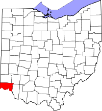 | |
| Villages | ||
| Townships | ||
| CDPs |
| |
| Other unincorporated communities | ||
| Footnotes | ‡This populated place also has portions in an adjacent county or counties | |