Cleves, Ohio
| Cleves, Ohio | |
|---|---|
| city | |
|
Cleves from the air, looking northeast, along the Great Miami River | |
| Motto: "Heart of the Three Rivers Valley" | |
 Location in Hamilton County and the state of Ohio. | |
| Coordinates: 39°9′40″N 84°45′1″W / 39.16111°N 84.75028°WCoordinates: 39°9′40″N 84°45′1″W / 39.16111°N 84.75028°W | |
| Country | United States |
| State | Ohio |
| County | Hamilton |
| Township | Miami |
| Area[1] | |
| • Total | 1.58 sq mi (4.09 km2) |
| • Land | 1.58 sq mi (4.09 km2) |
| • Water | 0 sq mi (0 km2) |
| Elevation[2] | 495 ft (151 m) |
| Population (2010)[3] | |
| • Total | 3,234 |
| • Estimate (2012[4]) | 3,329 |
| • Density | 2,046.8/sq mi (790.3/km2) |
| Time zone | Eastern (EST) (UTC-5) |
| • Summer (DST) | EDT (UTC-4) |
| ZIP code | 45002 |
| Area code(s) | 513 |
| FIPS code | 39-16028[5] |
| GNIS feature ID | 1056814[2] |
| Website |
www |

Cleves is a village in Miami Township, Hamilton County, Ohio, United States, located along the Ohio River. The population was 3,234 at the 2010 census.[6] Founded in 1818, it is named for John Cleves Symmes[7] who lived here, laid out the original town site, and sold lots.
Geography
Cleves is located at 39°9′40″N 84°45′1″W / 39.16111°N 84.75028°W (39.161241, -84.750288)[8] between the Great Miami River and the Ohio River. It is separated from the Ohio River by the village of North Bend, along the southern border of Cleves. U.S. Route 50 passes through the village, leading east 16 miles (26 km) to downtown Cincinnati and west to Lawrenceburg, Indiana.
According to the United States Census Bureau, the village has a total area of 1.58 square miles (4.09 km2), all land.[1]
Demographics
| Historical population | |||
|---|---|---|---|
| Census | Pop. | %± | |
| 1880 | 836 | — | |
| 1890 | 1,227 | 46.8% | |
| 1900 | 1,328 | 8.2% | |
| 1910 | 1,423 | 7.2% | |
| 1920 | 1,454 | 2.2% | |
| 1930 | 1,711 | 17.7% | |
| 1940 | 1,871 | 9.4% | |
| 1950 | 1,981 | 5.9% | |
| 1960 | 2,076 | 4.8% | |
| 1970 | 2,044 | −1.5% | |
| 1980 | 2,094 | 2.4% | |
| 1990 | 2,208 | 5.4% | |
| 2000 | 2,790 | 26.4% | |
| 2010 | 3,234 | 15.9% | |
| Est. 2015 | 3,386 | [9] | 4.7% |
2010 census
As of the census[3] of 2010, there were 3,234 people, 1,079 households, and 823 families residing in the village. The population density was 2,046.8 inhabitants per square mile (790.3/km2). There were 1,190 housing units at an average density of 753.2 per square mile (290.8/km2). The racial makeup of the village was 96.9% White, 0.6% African American, 0.4% Native American, 0.4% Asian, 0.1% from other races, and 1.6% from two or more races. Hispanic or Latino of any race were 1.2% of the population.
There were 1,079 households of which 46.2% had children under the age of 18 living with them, 57.2% were married couples living together, 13.2% had a female householder with no husband present, 5.9% had a male householder with no wife present, and 23.7% were non-families. 19.4% of all households were made up of individuals and 7.1% had someone living alone who was 65 years of age or older. The average household size was 3.00 and the average family size was 3.45.
The median age in the village was 33.2 years. 32.5% of residents were under the age of 18; 7.7% were between the ages of 18 and 24; 28.3% were from 25 to 44; 23.8% were from 45 to 64; and 7.7% were 65 years of age or older. The gender makeup of the village was 50.3% male and 49.7% female.
2000 census
As of the census[5] of 2000, there were 2,790 people, 960 households, and 750 families residing in the village. The population density was 1,754.7 people per square mile (677.5/km²). There were 1,020 housing units at an average density of 641.5 per square mile (247.7/km²). The racial makeup of the village was 98.21% White, 0.57% African American, 0.14% Native American, 0.14% Asian, 0.14% Pacific Islander, 0.07% from other races, and 0.72% from two or more races. Hispanic or Latino of any race were 0.36% of the population.
There were 960 households out of which 43.5% had children under the age of 18 living with them, 61.8% were married couples living together, 10.6% had a female householder with no husband present, and 21.8% were non-families. 17.6% of all households were made up of individuals and 7.8% had someone living alone who was 65 years of age or older. The average household size was 2.91 and the average family size was 3.30.
In the village the population was spread out with 31.4% under the age of 18, 7.7% from 18 to 24, 33.8% from 25 to 44, 18.1% from 45 to 64, and 9.0% who were 65 years of age or older. The median age was 33 years. For every 100 females there were 100.1 males. For every 100 females age 18 and over, there were 96.1 males.
The median income for a household in the village was $47,553, and the median income for a family was $50,926. Males had a median income of $32,917 versus $25,000 for females. The per capita income for the village was $17,617. About 6.3% of families and 7.6% of the population were below the poverty line, including 10.6% of those under age 18 and none of those age 65 or over.
Elected officials
Danny Stacy, Mayor, Janet Rouse, Vice Mayor and Member of Council, Geri Meister, Member of Council, Stephen Myers, Member of Council, Tiffiney Myers, Member of Council, Michael Flynn, Member of Council, Kevin Burns, Member of Council
References
- 1 2 "US Gazetteer files 2010". United States Census Bureau. Archived from the original on 2012-06-26. Retrieved 2013-01-06.
- 1 2 "US Board on Geographic Names". United States Geological Survey. 2007-10-25. Retrieved 2008-01-31.
- 1 2 "American FactFinder". United States Census Bureau. Retrieved 2013-01-06.
- ↑ "Population Estimates". United States Census Bureau. Archived from the original on 2013-06-17. Retrieved 2013-06-17.
- 1 2 "American FactFinder". United States Census Bureau. Archived from the original on 2013-09-11. Retrieved 2008-01-31.
- ↑ "Profile of General Population and Housing Characteristics: 2010 Demographic Profile Data (DP-1): Cleves village, Ohio". U.S. Census Bureau, American Factfinder. Archived from the original on September 11, 2013. Retrieved October 31, 2012.
- ↑ Overman, William Daniel (1958). Ohio Town Names. Akron, OH: Atlantic Press. p. 30.
- ↑ "US Gazetteer files: 2010, 2000, and 1990". United States Census Bureau. 2011-02-12. Retrieved 2011-04-23.
- ↑ "Annual Estimates of the Resident Population for Incorporated Places: April 1, 2010 to July 1, 2015". Retrieved July 2, 2016.
- ↑ "Census of Population and Housing". Census.gov. Archived from the original on May 11, 2015. Retrieved June 4, 2015.
External links
Municipalities and communities of Hamilton County, Ohio, United States | ||
|---|---|---|
| Cities | 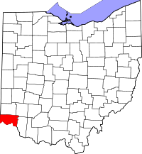 | |
| Villages | ||
| Townships | ||
| CDPs |
| |
| Other unincorporated communities | ||
| Footnotes | ‡This populated place also has portions in an adjacent county or counties | |