Wyoming, Ohio
| Wyoming, Ohio | |
|---|---|
| City | |
|
Streetside in Wyoming | |
 Location in Hamilton County and the state of Ohio. | |
| Coordinates: 39°13′43″N 84°28′28″W / 39.22861°N 84.47444°WCoordinates: 39°13′43″N 84°28′28″W / 39.22861°N 84.47444°W | |
| Country | United States |
| State | Ohio |
| County | Hamilton |
| Area[1] | |
| • Total | 2.87 sq mi (7.43 km2) |
| • Land | 2.87 sq mi (7.43 km2) |
| • Water | 0 sq mi (0 km2) |
| Elevation[2] | 574 ft (175 m) |
| Population (2010)[3] | |
| • Total | 8,428 |
| • Estimate (2012[4]) | 8,398 |
| • Density | 2,936.6/sq mi (1,133.8/km2) |
| Time zone | Eastern (EST) (UTC-5) |
| • Summer (DST) | EDT (UTC-4) |
| ZIP codes | 45215, 45231 |
| Area code(s) | 513 |
| FIPS code | 39-86730[5] |
| GNIS feature ID | 1049349[2] |
| Website |
www |

Wyoming is a city in Hamilton County, Ohio, United States. The population was 8,428 at the 2010 census.[6]
Geography
Wyoming is located at 39°13′43″N 84°28′28″W / 39.22861°N 84.47444°W (39.228609, −84.474391).[7]
According to the United States Census Bureau, the city has a total area of 2.87 square miles (7.43 km2), all land.[1]
History
Among the earliest settlers in what is now Wyoming was the Pendery family who came in 1805.[8]
Wyoming was named after Wyoming County, Pennsylvania.[9]
Education
Wyoming has a renowned education program – the Wyoming City School District was ranked first in the state of Ohio on the 2004–2005 State Report Card, with an index score of 108.2. This includes Wyoming High School, a top-ranked public high school. There are three elementary schools (Vermont, Hilltop, and Elm), one middle school and one high school.
Wyoming is served by a branch of the Public Library of Cincinnati and Hamilton County.[10]
Demographics
| Historical population | |||
|---|---|---|---|
| Census | Pop. | %± | |
| 1880 | 840 | — | |
| 1890 | 1,454 | 73.1% | |
| 1900 | 1,450 | −0.3% | |
| 1910 | 1,893 | 30.6% | |
| 1920 | 2,323 | 22.7% | |
| 1930 | 3,767 | 62.2% | |
| 1940 | 4,466 | 18.6% | |
| 1950 | 5,582 | 25.0% | |
| 1960 | 7,736 | 38.6% | |
| 1970 | 9,089 | 17.5% | |
| 1980 | 8,282 | −8.9% | |
| 1990 | 8,128 | −1.9% | |
| 2000 | 8,261 | 1.6% | |
| 2010 | 8,428 | 2.0% | |
| Est. 2015 | 8,411 | [11] | −0.2% |
| Sources:[5][12][13][14][15][16] | |||
2010 census
As of the census[3] of 2010, there were 8,428 people, 3,105 households, and 2,385 families residing in the city. The population density was 2,936.6 inhabitants per square mile (1,133.8/km2). There were 3,272 housing units at an average density of 1,140.1 per square mile (440.2/km2). The racial makeup of the city was 83.6% White, 11.3% African American, 0.1% Native American, 2.1% Asian, 0.5% from other races, and 2.2% from two or more races. Hispanic or Latino of any race were 1.8% of the population.
There were 3,105 households of which 42.1% had children under the age of 18 living with them, 63.2% were married couples living together, 10.7% had a female householder with no husband present, 2.9% had a male householder with no wife present, and 23.2% were non-families. 21.2% of all households were made up of individuals and 9.5% had someone living alone who was 65 years of age or older. The average household size was 2.68 and the average family size was 3.13.
The median age in the city was 42.4 years. 29.7% of residents were under the age of 18; 4.7% were between the ages of 18 and 24; 19.8% were from 25 to 44; 31.6% were from 45 to 64; and 14.2% were 65 years of age or older. The gender makeup of the city was 47.5% male and 52.5% female.
2000 census
As of the census[5] of 2000, there were 8,261 people, 3,047 households, and 2,404 families residing in the city. The population density was 2,865.9 people per square mile (1,107.5/km2). There were 3,172 housing units at an average density of 1,100.4 per square mile (425.2/km2). The racial makeup of the city was 87.53% White, 9.54% African American, 0.13% Native American, 1.36% Asian, 0.39% from other races, and 1.05% from two or more races. Hispanic or Latino of any race were 1.28% of the population.
There were 3,047 households out of which 42.3% had children under the age of 18 living with them, 67.3% were married couples living together, 9.7% had a female householder with no husband present, and 21.1% were non-families. 19.3% of all households were made up of individuals and 8.4% had someone living alone who was 65 years of age or older. The average household size was 2.70 and the average family size was 3.11.
In the city the population is age-diverse with 30.6% under the age of 18, 4.0% from 18 to 24, 25.0% from 25 to 44, 26.2% from 45 to 64, and 14.2% who were 65 years of age or older. The median age was 40 years. For every 100 females there were 90.1 males. For every 100 females age 18 and over, there were 85.2 males.
The median income for a household in the city was $88,241, and the median income for a family was $103,089. Males had a median income of $71,851 versus $40,601 for females. The per capita income for the city was $38,180. About 0.7% of families and 1.4% of the population were below the poverty line, including 0.6% of those under age 18 and 2.0% of those age 65 or over.
Notable people
- Tom Agna, award-winning comedy writer and actor
- Jacob Ammen, United States Army general
- Alyssa Beckerman, gymnast
- Jacob H. Bromwell, congressman from Ohio and mayor of Wyoming
- Paul Hackett, politician
- Angelo Herndon, Communist organizer
- Livingston W. Houston, president of Rensselaer Polytechnic Institute
- Peter G. Levine, stroke researcher and educator
- Robert McGinnis, artist
- C.F. Payne, illustrator
- David Payne, Olympic silver medalist hurdler
- John Weld Peck, federal judge
- Ahmed Plummer, cornerback for the San Francisco 49ers
- Robert Reily, founder of Wyoming and United States Army officer
- Jeff Russell, Major League Baseball pitcher
- Tracy Smith, CBS News journalist
- David Shenk, author
- Frank D. Walker, Commander of the USS Crevalle (SS-291)
See also
References
- 1 2 "US Gazetteer files 2010". United States Census Bureau. Archived from the original on January 24, 2012. Retrieved 2013-01-06.
- 1 2 "US Board on Geographic Names". United States Geological Survey. 2007-10-25. Retrieved 2008-01-31.
- 1 2 "American FactFinder". United States Census Bureau. Retrieved 2013-01-06.
- ↑ "Population Estimates". United States Census Bureau. Archived from the original on June 17, 2013. Retrieved 2013-06-17.
- 1 2 3 "American FactFinder". United States Census Bureau. Archived from the original on September 11, 2013. Retrieved 2008-01-31.
- ↑ "Profile of General Population and Housing Characteristics: 2010 Demographic Profile Data (DP-1): Wyoming city, Ohio". U.S. Census Bureau, American Factfinder. Archived from the original on September 11, 2013. Retrieved October 31, 2012.
- ↑ "US Gazetteer files: 2010, 2000, and 1990". United States Census Bureau. 2011-02-12. Retrieved 2011-04-23.
- ↑ Clarke, S. J. (1912). "Cincinnati, the Queen City, 1788–1912, Volume 2". The S. J. Clarke Publishing Company. p. 530. Retrieved 2013-05-20.
- ↑ Mangus, Michael; Herman, Jennifer L. (2008). Ohio Encyclopedia. North American Book Dist LLC. p. 584. ISBN 978-1-878592-68-2.
- ↑ "Wyoming Branch". Public Library of Cincinnati and Hamilton County. Retrieved 12 June 2014.
- ↑ "Annual Estimates of the Resident Population for Incorporated Places: April 1, 2010 to July 1, 2015". Retrieved July 2, 2016.
- ↑ "Population: Ohio" (PDF). 1910 U.S. Census. U.S. Census Bureau. Retrieved 28 November 2013.
- ↑ "Population: Ohio" (PDF). 1930 US Census. U.S. Census Bureau. Retrieved 28 November 2013.
- ↑ "Number of Inhabitants: Ohio" (PDF). 18th Census of the United States. U.S. Census Bureau. Retrieved 22 November 2013.
- ↑ "Ohio: Population and Housing Unit Counts" (PDF). U.S. Census Bureau. Retrieved 22 November 2013.
- ↑ "Incorporated Places and Minor Civil Divisions Datasets: Subcounty Population Estimates: April 1, 2010 to July 1, 2012". U.S. Census Bureau. Archived from the original on June 17, 2013. Retrieved 25 November 2013.
External links
| Wikimedia Commons has media related to Wyoming, Ohio. |
Municipalities and communities of Hamilton County, Ohio, United States | ||
|---|---|---|
| Cities | 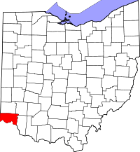 | |
| Villages | ||
| Townships | ||
| CDPs |
| |
| Other unincorporated communities | ||
| Footnotes | ‡This populated place also has portions in an adjacent county or counties | |