Golf Manor, Ohio
| Golf Manor, Ohio | |
|---|---|
| Village | |
|
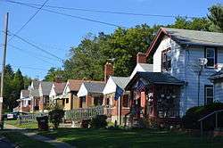
Houses on Hammel Avenue | |
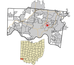 Location in Hamilton County and the state of Ohio. | |
| Coordinates: 39°11′14″N 84°26′47″W / 39.18722°N 84.44639°WCoordinates: 39°11′14″N 84°26′47″W / 39.18722°N 84.44639°W | |
| Country | United States |
| State | Ohio |
| County | Hamilton |
| Area[1] | |
| • Total | 0.57 sq mi (1.48 km2) |
| • Land | 0.57 sq mi (1.48 km2) |
| • Water | 0 sq mi (0 km2) |
| Elevation[2] | 659 ft (201 m) |
| Population (2010)[3] | |
| • Total | 3,611 |
| • Estimate (2012[4]) | 3,591 |
| • Density | 6,335.1/sq mi (2,446.0/km2) |
| Time zone | Eastern (EST) (UTC-5) |
| • Summer (DST) | EDT (UTC-4) |
| ZIP code | 45237 |
| Area code(s) | 513 |
| FIPS code | 39-30786[5] |
| GNIS feature ID | 1048793[2] |
Golf Manor is a village in Hamilton County, Ohio, United States. It is surrounded nearly completely by the Pleasant Ridge and Roselawn neighborhoods of Cincinnati. The population was 3,611 at the 2010 census.
History
Golf Manor was laid out by property developers in the 1920s.[6]
Geography
Golf Manor is located at 39°11′14″N 84°26′47″W / 39.18722°N 84.44639°W (39.187109, -84.446365).[7]
According to the United States Census Bureau, the village has a total area of 0.57 square miles (1.48 km2), all land.[1]
Demographics
| Historical population | |||
|---|---|---|---|
| Census | Pop. | %± | |
| 1950 | 3,603 | — | |
| 1960 | 4,648 | 29.0% | |
| 1970 | 5,170 | 11.2% | |
| 1980 | 4,317 | −16.5% | |
| 1990 | 4,154 | −3.8% | |
| 2000 | 3,999 | −3.7% | |
| 2010 | 3,611 | −9.7% | |
| Est. 2015 | 3,583 | [8] | −0.8% |
2010 census
As of the census[3] of 2010, there were 3,611 people, 1,614 households, and 897 families residing in the village. The population density was 6,335.1 inhabitants per square mile (2,446.0/km2). There were 1,837 housing units at an average density of 3,222.8 per square mile (1,244.3/km2). The racial makeup of the village was 24.3% White, 72.6% African American, 0.1% Native American, 0.2% Asian, 0.4% from other races, and 2.3% from two or more races. Hispanic or Latino of any race were 1.2% of the population.
There were 1,614 households of which 30.4% had children under the age of 18 living with them, 25.6% were married couples living together, 25.9% had a female householder with no husband present, 4.1% had a male householder with no wife present, and 44.4% were non-families. 39.3% of all households were made up of individuals and 12.6% had someone living alone who was 65 years of age or older. The average household size was 2.24 and the average family size was 3.01.
The median age in the village was 38.1 years. 26.1% of residents were under the age of 18; 7.6% were between the ages of 18 and 24; 25.4% were from 25 to 44; 28.1% were from 45 to 64; and 12.7% were 65 years of age or older. The gender makeup of the village was 44.6% male and 55.4% female.
2000 census
As of the census[5] of 2000, there were 3,999 people, 1,751 households, and 1,055 families residing in the village. The population density was 6,896.3 people per square mile (2,662.1/km²). There were 1,840 housing units at an average density of 3,173.1 per square mile (1,224.9/km²). The racial makeup of the village was 34.23% White, 62.89% African American, 0.05% Native American, 0.70% Asian, 0.38% from other races, and 1.75% from two or more races. Hispanic or Latino of any race were 0.60% of the population.
There were 1,751 households out of which 29.4% had children under the age of 18 living with them, 34.6% were married couples living together, 21.2% had a female householder with no husband present, and 39.7% were non-families. 34.7% of all households were made up of individuals and 11.5% had someone living alone who was 65 years of age or older. The average household size was 2.28 and the average family size was 2.95.
In the village the population was spread out with 25.6% under the age of 18, 6.9% from 18 to 24, 29.8% from 25 to 44, 23.3% from 45 to 64, and 14.4% who were 65 years of age or older. The median age was 38 years. For every 100 females there were 81.5 males. For every 100 females age 18 and over, there were 75.4 males.
The median income for a household in the village was $37,111, and the median income for a family was $47,328. Males had a median income of $34,444 versus $29,116 for females. The per capita income for the village was $19,044. About 9.2% of families and 10.7% of the population were below the poverty line, including 13.0% of those under age 18 and 14.5% of those age 65 or over.
Religion
The village has the oldest Orthodox Jewish synagogue in the Cincinnati area, Golf Manor Synagogue.
References
- 1 2 "US Gazetteer files 2010". United States Census Bureau. Retrieved 2013-01-06.
- 1 2 "US Board on Geographic Names". United States Geological Survey. 2007-10-25. Retrieved 2008-01-31.
- 1 2 "American FactFinder". United States Census Bureau. Retrieved 2013-01-06.
- ↑ "Population Estimates". United States Census Bureau. Retrieved 2013-06-17.
- 1 2 "American FactFinder". United States Census Bureau. Retrieved 2008-01-31.
- ↑ "The History of Golf Manor". Village of Golf Manor. Retrieved 1 May 2014.
- ↑ "US Gazetteer files: 2010, 2000, and 1990". United States Census Bureau. 2011-02-12. Retrieved 2011-04-23.
- ↑ "Annual Estimates of the Resident Population for Incorporated Places: April 1, 2010 to July 1, 2015". Retrieved July 2, 2016.
- ↑ "Census of Population and Housing". Census.gov. Retrieved June 4, 2015.
External links
Municipalities and communities of Hamilton County, Ohio, United States | ||
|---|---|---|
| Cities | 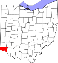 | |
| Villages | ||
| Townships | ||
| CDPs |
| |
| Other unincorporated communities | ||
| Footnotes | ‡This populated place also has portions in an adjacent county or counties | |