Lockland, Ohio
| Lockland, Ohio | |
|---|---|
| Village | |
 Location in Hamilton County and the state of Ohio. | |
| Coordinates: 39°13′35″N 84°27′19″W / 39.22639°N 84.45528°WCoordinates: 39°13′35″N 84°27′19″W / 39.22639°N 84.45528°W | |
| Country | United States |
| State | Ohio |
| County | Hamilton |
| Government | |
| • Mayor | Jim Brown (D)[1] |
| Area[2] | |
| • Total | 1.23 sq mi (3.19 km2) |
| • Land | 1.23 sq mi (3.19 km2) |
| • Water | 0 sq mi (0 km2) |
| Elevation[3] | 581 ft (177 m) |
| Population (2010)[4] | |
| • Total | 3,449 |
| • Estimate (2012[5]) | 3,432 |
| • Density | 2,804.1/sq mi (1,082.7/km2) |
| Time zone | Eastern (EST) (UTC-5) |
| • Summer (DST) | EDT (UTC-4) |
| ZIP code | 45215 |
| Area code(s) | 513 |
| FIPS code | 39-44366[6] |
| GNIS feature ID | 1059632[3] |
| Website |
www |
Lockland is a village in Hamilton County, Ohio, United States. The population was 3,449 at the 2010 census.[7] Lockland is located in southwest Ohio, north of Cincinnati. Its population has somewhat declined since the latter part of the 20th century.
Geography
Lockland is located at 39°13′35″N 84°27′19″W / 39.22639°N 84.45528°W (39.226409, -84.455217).[8]
According to the United States Census Bureau, the village has a total area of 1.23 square miles (3.19 km2), all land.[2]
Demographics
| Historical population | |||
|---|---|---|---|
| Census | Pop. | %± | |
| 1870 | 1,299 | — | |
| 1880 | 1,884 | 45.0% | |
| 1890 | 2,474 | 31.3% | |
| 1900 | 2,695 | 8.9% | |
| 1910 | 3,439 | 27.6% | |
| 1920 | 4,007 | 16.5% | |
| 1930 | 5,703 | 42.3% | |
| 1940 | 5,601 | −1.8% | |
| 1950 | 5,736 | 2.4% | |
| 1960 | 5,292 | −7.7% | |
| 1970 | 5,288 | −0.1% | |
| 1980 | 4,292 | −18.8% | |
| 1990 | 4,357 | 1.5% | |
| 2000 | 3,707 | −14.9% | |
| 2010 | 3,449 | −7.0% | |
| Est. 2015 | 3,426 | [9] | −0.7% |
2010 census
As of the census[4] of 2010, there were 3,449 people, 1,462 households, and 797 families residing in the village. The population density was 2,804.1 inhabitants per square mile (1,082.7/km2). There were 1,738 housing units at an average density of 1,413.0 per square mile (545.6/km2). The racial makeup of the village was 64.5% White, 29.9% African American, 0.2% Native American, 0.2% Asian, 0.1% Pacific Islander, 1.9% from other races, and 3.4% from two or more races. Hispanic or Latino of any race were 4.2% of the population.
There were 1,462 households of which 29.6% had children under the age of 18 living with them, 28.5% were married couples living together, 18.2% had a female householder with no husband present, 7.8% had a male householder with no wife present, and 45.5% were non-families. 34.4% of all households were made up of individuals and 9% had someone living alone who was 65 years of age or older. The average household size was 2.36 and the average family size was 3.04.
The median age in the village was 35.7 years. 23.8% of residents were under the age of 18; 10.5% were between the ages of 18 and 24; 28.3% were from 25 to 44; 27% were from 45 to 64; and 10.4% were 65 years of age or older. The gender makeup of the village was 51.3% male and 48.7% female.
2000 census
As of the census[6] of 2000, there were 3,707 people, 1,617 households, and 902 families residing in the village. The population density was 3,030.8 people per square mile (1,173.2/km²). There were 1,826 housing units at an average density of 1,492.9 per square mile (577.9/km²). The racial makeup of the village was 70.43% White, 26.30% African American, 0.27% Native American, 0.46% Asian, 0.94% from other races, and 1.59% from two or more races. Hispanic or Latino of any race were 1.54% of the population.
There were 1,617 households out of which 27.2% had children under the age of 18 living with them, 34.8% were married couples living together, 16.1% had a female householder with no husband present, and 44.2% were non-families. 36.9% of all households were made up of individuals and 11.8% had someone living alone who was 65 years of age or older. The average household size was 2.29 and the average family size was 2.99.
In the village the population was spread out with 24.0% under the age of 18, 9.4% from 18 to 24, 33.2% from 25 to 44, 21.5% from 45 to 64, and 11.9% who were 65 years of age or older. The median age was 36 years. For every 100 females there were 101.6 males. For every 100 females age 18 and over, there were 101.0 males.
The median income for a household in the village was $28,292, and the median income for a family was $33,984. Males had a median income of $30,638 versus $22,755 for females. The per capita income for the village was $15,661. About 14.2% of families and 17.1% of the population were below the poverty line, including 26.5% of those under age 18 and 9.8% of those age 65 or over.
History
The birth of the town, and its name, are related to the first set of lock gates that one would have encountered heading north on the Miami and Erie Canal. The canal served as a major transportation route linking commerce from as far as New Orleans to New York City. Many people and industry were attracted to the western Ohio area by the idea of connecting Lake Erie to the Ohio River. Lockland provided an abundance of water power, having a 15-foot (4.6 m) difference in water tables. This allowed for a water mill which ground flour for local farmers. A large reservoir pond allowed boats to dock for repairs or layover. Even today a section of Lockland is still referred to as "Bud-Town" which was the bedding and entertainment area of the day. Despite the locomotive boom the canal remained semi-operational until 1929. The canal sat still for a few years during the thirties. The Mill Creek Expressway reused some portions of the dead canal as well as the Wright-Lockland Highway. The National Interstate and Defense Highways Act of 1956 created today's interstate system, including Interstate 75 along the Mill Creek Expressway. Lockland's past and future are directly related to the growth of national transportation and commerce.
Lockland was home to the Stearns and Foster Mattress company, which was founded in Cincinnati in 1846 and moved to Lockland in 1880. The original factory and office building still stand in the downtown area of the village. However, after a fire in 2004 the two factory buildings, which sit on approximately 18 acres (73,000 m2), began to be demolished.[11]
Local government
Lockland's mayor is Jim Brown, a member of the Mayors Against Illegal Guns coalition,[12] a bipartisan group with a stated goal of "making the public safer by getting illegal guns off the streets."
Notable people
- Jacob Ammen (1806-1894), Union Army general and civil engineer retired and died here.
- Ramona (1909-1972), singer and cabaret performer
- William Goines (born 1936), first African-American Navy SEAL[13]
References
- ↑ "Hamilton County Officials 2016" (PDF). Hamilton County Board of Elections. 27 January 2016. p. 36. Retrieved 1 February 2016.
- 1 2 "US Gazetteer files 2010". United States Census Bureau. Retrieved 2013-01-06.
- 1 2 "US Board on Geographic Names". United States Geological Survey. 2007-10-25. Retrieved 2008-01-31.
- 1 2 "American FactFinder". United States Census Bureau. Retrieved 2013-01-06.
- ↑ "Population Estimates". United States Census Bureau. Retrieved 2013-06-17.
- 1 2 "American FactFinder". United States Census Bureau. Retrieved 2008-01-31.
- ↑ "Profile of General Population and Housing Characteristics: 2010 Demographic Profile Data (DP-1): Lockland village, Ohio". U.S. Census Bureau, American Factfinder. Retrieved November 1, 2012.
- ↑ "US Gazetteer files: 2010, 2000, and 1990". United States Census Bureau. 2011-02-12. Retrieved 2011-04-23.
- ↑ "Annual Estimates of the Resident Population for Incorporated Places: April 1, 2010 to July 1, 2015". Retrieved July 2, 2016.
- ↑ "Census of Population and Housing". Census.gov. Retrieved June 4, 2015.
- ↑ http://www.enquirer.com/editions/2004/05/02/loc_fire02side.html
- ↑ "Mayors Against Illegal Guns: Coalition Members".
- ↑ Knight, Cameron (July 8, 2016). "Hometown Hero: First African-American Navy SEAL Hails from Lockland". The Cincinnati Enquirer.
External links
Municipalities and communities of Hamilton County, Ohio, United States | ||
|---|---|---|
| Cities | 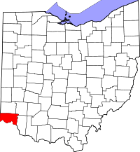 | |
| Villages | ||
| Townships | ||
| CDPs |
| |
| Other unincorporated communities | ||
| Footnotes | ‡This populated place also has portions in an adjacent county or counties | |