Mount Healthy, Ohio
| Mount Healthy, Ohio | |
|---|---|
| City | |
|
| |
| Motto: "A city with a historic past working toward the future" | |
 Location in Hamilton County and the state of Ohio. | |
| Coordinates: 39°13′55″N 84°32′50″W / 39.23194°N 84.54722°WCoordinates: 39°13′55″N 84°32′50″W / 39.23194°N 84.54722°W | |
| Country | United States |
| State | Ohio |
| County | Hamilton |
| Founded | 1817 (as Mount Pleasant) |
| Government | |
| • Mayor | James Wolf (D)[1] |
| Area[2] | |
| • Total | 1.41 sq mi (3.65 km2) |
| • Land | 1.41 sq mi (3.65 km2) |
| • Water | 0 sq mi (0 km2) |
| Elevation[3] | 837 ft (255 m) |
| Population (2010)[4] | |
| • Total | 6,098 |
| • Estimate (2012[5]) | 6,066 |
| • Density | 4,324.8/sq mi (1,669.8/km2) |
| Time zone | Eastern (EST) (UTC-5) |
| • Summer (DST) | EDT (UTC-4) |
| ZIP code | 45231 |
| Area code(s) | 513 |
| FIPS code | 39-52752[6] |
| GNIS feature ID | 1056439[3] |
| Website |
www |
Mount Healthy is a city in Hamilton County, Ohio, United States, in the Cincinnati/Northern Kentucky metropolitan area. The population was 6,098 at the 2010 census.[7]
Geography
Mount Healthy is located at 39°13′55″N 84°32′50″W / 39.23194°N 84.54722°W (39.231808, -84.547244).[8]
According to the United States Census Bureau, the city has a total area of 1.41 square miles (3.65 km2), all land.[2]
History
Mount Healthy was founded in 1817 as the village of Mount Pleasant.[9] In 1850, the village renamed itself "Mount Healthy", following a cholera epidemic, in which many of its citizens survived while those in the surrounding territory did not.[10] The village became a city in 1951.[11]
Demographics
| Historical population | |||
|---|---|---|---|
| Census | Pop. | %± | |
| 1900 | 1,354 | — | |
| 1910 | 1,799 | 32.9% | |
| 1920 | 2,255 | 25.3% | |
| 1930 | 3,530 | 56.5% | |
| 1940 | 3,997 | 13.2% | |
| 1950 | 5,533 | 38.4% | |
| 1960 | 6,553 | 18.4% | |
| 1970 | 7,446 | 13.6% | |
| 1980 | 7,562 | 1.6% | |
| 1990 | 7,580 | 0.2% | |
| 2000 | 7,149 | −5.7% | |
| 2010 | 6,098 | −14.7% | |
| Est. 2015 | 6,039 | [12] | −1.0% |
| Sources:[13][14][15][16][6][17] | |||
2010 census
As of the census[4] of 2010, there were 6,098 people, 2,716 households, and 1,454 families residing in the city. The population density was 4,324.8 inhabitants per square mile (1,669.8/km2). There were 3,034 housing units at an average density of 2,151.8 per square mile (830.8/km2). The racial makeup of the city was 62.4% White, 33.0% African American, 0.2% Native American, 0.7% Asian, 0.1% Pacific Islander, 0.9% from other races, and 2.6% from two or more races. Hispanic or Latino of any race were 1.9% of the population.
There were 2,716 households of which 27.7% had children under the age of 18 living with them, 31.4% were married couples living together, 17.2% had a female householder with no husband present, 4.9% had a male householder with no wife present, and 46.5% were non-families. 41.2% of all households were made up of individuals and 17.5% had someone living alone who was 65 years of age or older. The average household size was 2.17 and the average family size was 2.97.
The median age in the city was 40 years. 22.9% of residents were under the age of 18; 8% were between the ages of 18 and 24; 25.3% were from 25 to 44; 25.8% were from 45 to 64; and 18.2% were 65 years of age or older. The gender makeup of the city was 44.9% male and 55.1% female.
2000 census
As of the census[6] of 2000, there were 7,149 people, 3,222 households, and 1,772 families residing in the city. The population density was 5,022.2 people per square mile (1,943.8/km²). There were 3,421 housing units at an average density of 2,403.2 per square mile (930.2/km²). The racial makeup of the city was 73.70% White, 23.32% African American, 0.20% Native American, 0.49% Asian, 0.06% Pacific Islander, 0.60% from other races, and 1.64% from two or more races. Hispanic or Latino of any race were 1.02% of the population.
There were 3,222 households out of which 28.2% had children under the age of 18 living with them, 36.3% were married couples living together, 15.3% had a female householder with no husband present, and 45.0% were non-families. 40.5% of all households were made up of individuals and 18.1% had someone living alone who was 65 years of age or older. The average household size was 2.16 and the average family size was 2.93.
In the city the population was spread out with 24.0% under the age of 18, 8.4% from 18 to 24, 30.4% from 25 to 44, 17.9% from 45 to 64, and 19.3% who were 65 years of age or older. The median age was 37 years. For every 100 females there were 77.1 males. For every 100 females age 18 and over, there were 71.4 males.
The median income for a household in the city was $32,982, and the median income for a family was $41,753. Males had a median income of $31,783 versus $26,926 for females. The per capita income for the city was $18,662. About 6.8% of families and 8.9% of the population were below the poverty line, including 13.4% of those under age 18 and 11.4% of those age 65 or over.
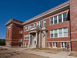
Education
There are currently three schools within the actual city limits (one square mile): Mt. Healthy South Elementary School, Mt. Healthy North Elementary School, and Mount Healthy Jr./Sr. High School, which are all part of the Mt. Healthy City School District.[18] There is also the Mt. Healthy Preparatory and Fitness Academy which is a charter school.
Mount Healthy is served by a branch of the Public Library of Cincinnati and Hamilton County.[19]
References
- ↑ "Hamilton County Officials 2016" (PDF). Hamilton County Board of Elections. 27 January 2016. p. 17. Retrieved 1 February 2016.
- 1 2 "US Gazetteer files 2010". United States Census Bureau. Retrieved 2013-01-06.
- 1 2 "US Board on Geographic Names". United States Geological Survey. 2007-10-25. Retrieved 2008-01-31.
- 1 2 "American FactFinder". United States Census Bureau. Retrieved 2013-01-06.
- ↑ "Population Estimates". United States Census Bureau. Retrieved 2013-06-17.
- 1 2 3 "American FactFinder". United States Census Bureau. Retrieved 2008-01-31.
- ↑ "Profile of General Population and Housing Characteristics: 2010 Demographic Profile Data (DP-1): Mount Healthy city, Ohio". U.S. Census Bureau, American Factfinder. Retrieved October 31, 2012.
- ↑ "US Gazetteer files: 2010, 2000, and 1990". United States Census Bureau. 2011-02-12. Retrieved 2011-04-23.
- ↑ "About Mt. Healthy". City of Mt. Healthy, Ohio. Retrieved 12 June 2014.
- ↑ "Guide to Clifton, College Hill/North College Hill, Mount Healthy and Northside". Cincinnati City Beat. 27 August 2013. Retrieved 12 June 2014.
- ↑ "Mt. Healthy History". Mt. Healthy Historical Society. Retrieved 12 June 2014.
- ↑ "Annual Estimates of the Resident Population for Incorporated Places: April 1, 2010 to July 1, 2015". Retrieved July 2, 2016.
- ↑ "Population: Ohio" (PDF). 1910 U.S. Census. U.S. Census Bureau. Retrieved 28 November 2013.
- ↑ "Population: Ohio" (PDF). 1930 US Census. U.S. Census Bureau. Retrieved 28 November 2013.
- ↑ "Number of Inhabitants: Ohio" (PDF). 18th Census of the United States. U.S. Census Bureau. Retrieved 22 November 2013.
- ↑ "Ohio: Population and Housing Unit Counts" (PDF). U.S. Census Bureau. Retrieved 22 November 2013.
- ↑ "Incorporated Places and Minor Civil Divisions Datasets: Subcounty Population Estimates: April 1, 2010 to July 1, 2012". U.S. Census Bureau. Retrieved 25 November 2013.
- ↑ http://www.mthcs.org/schoolsframe.html
- ↑ "Mt. Healthy Branch". Public Library of Cincinnati and Hamilton County. Retrieved 12 June 2014.
External links
- City website
- [http://www. mthealthyrenaissance.org Mt. Healthy Renaissance Project], a Community Development Corporation
Municipalities and communities of Hamilton County, Ohio, United States | ||
|---|---|---|
| Cities | 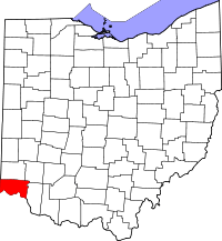 | |
| Villages | ||
| Townships | ||
| CDPs |
| |
| Other unincorporated communities | ||
| Footnotes | ‡This populated place also has portions in an adjacent county or counties | |