New Haven, Hamilton County, Ohio
| New Haven, Ohio | |
|---|---|
| Census-designated place | |
 Location in Hamilton County and the state of Ohio. | |
| Coordinates: 39°16′32″N 84°44′26″W / 39.27556°N 84.74056°WCoordinates: 39°16′32″N 84°44′26″W / 39.27556°N 84.74056°W | |
| Country | United States |
| State | Ohio |
| County | Hamilton |
| Area | |
| • Total | 1.3 sq mi (3.4 km2) |
| • Land | 1.3 sq mi (3.4 km2) |
| • Water | 0 sq mi (0 km2) |
| Elevation[1] | 561 ft (171 m) |
| Population (2010) | |
| • Total | 583 |
| • Density | 440/sq mi (170/km2) |
| Time zone | Eastern (EST) (UTC-5) |
| • Summer (DST) | EDT (UTC-4) |
| FIPS code | 39-54684[2] |
| GNIS feature ID | 1065119[1] |
New Haven is a census-designated place (CDP) in Crosby Township, Hamilton County, Ohio, United States. The population was 583 at the 2010 census.[3]
New Haven was platted as a village by Joab Comstock in 1815. In the 19th century the village had a post office, but was known as "Preston". This was necessary since there was already a New Haven in Huron County, Ohio, and the name was assigned by the first postmaster, Alexander Preston Cavender.
Geography
New Haven is located at 39°16′32″N 84°44′26″W / 39.27556°N 84.74056°W[4] in western Crosby Township, 22 miles (35 km) northwest of downtown Cincinnati and 4 miles (6 km) northeast of Harrison.
According to the United States Census Bureau, the CDP has a total area of 1.3 square miles (3.4 km2), all land.[3]
References
- 1 2 "US Board on Geographic Names". United States Geological Survey. 2007-10-25. Retrieved 2008-01-31.
- ↑ "American FactFinder". United States Census Bureau. Retrieved 2008-01-31.
- 1 2 "Geographic Identifiers: 2010 Demographic Profile Data (G001): New Haven CDP (Hamilton County), Ohio". U.S. Census Bureau, American Factfinder. Retrieved November 14, 2012.
- ↑ "US Gazetteer files: 2010, 2000, and 1990". United States Census Bureau. 2011-02-12. Retrieved 2011-04-23.
Municipalities and communities of Hamilton County, Ohio, United States | ||
|---|---|---|
| Cities | 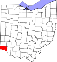 | |
| Villages | ||
| Townships | ||
| CDPs |
| |
| Other unincorporated communities | ||
| Footnotes | ‡This populated place also has portions in an adjacent county or counties | |