Miamitown, Ohio
| Miamitown, Ohio | |
|---|---|
| Census-designated place | |
|
Whitewater Historical Society and Fire Station in Miamitown | |
 Location in Hamilton County and the state of Ohio. | |
| Coordinates: 39°12′57″N 84°42′15″W / 39.21583°N 84.70417°WCoordinates: 39°12′57″N 84°42′15″W / 39.21583°N 84.70417°W | |
| Country | United States |
| State | Ohio |
| County | Hamilton |
| Area | |
| • Total | 1.4 sq mi (3.5 km2) |
| • Land | 1.4 sq mi (3.5 km2) |
| • Water | 0.04 sq mi (0.1 km2) |
| Elevation[1] | 525 ft (160 m) |
| Population (2010) | |
| • Total | 1,259 |
| • Density | 930/sq mi (360/km2) |
| Time zone | Eastern (EST) (UTC-5) |
| • Summer (DST) | EDT (UTC-4) |
| ZIP code | 45041 |
| FIPS code | 39-49462[2] |
| GNIS feature ID | 1056423[1] |

Miamitown is a census-designated place (CDP) in western Whitewater Township, Hamilton County, Ohio, United States. The population was 1,259 at the 2010 census.[3] Although it is unincorporated, it has a post office, with the ZIP code of 45041.[4]
Geography
Miamitown is located 16 miles (26 km) northwest of downtown Cincinnati. It is situated on the west bank of the Great Miami River at the intersection of Harrison Pike and Ohio State Route 128 (Hamilton Cleves Pike Road). Interstate 74 runs along the southern edge of the village, with access to it via Exit 7.
According to the United States Census Bureau, the CDP has a total area of 1.37 square miles (3.54 km2), of which 1.34 square miles (3.48 km2) is land and 0.023 square miles (0.06 km2), or 1.72%, is water.[3]
History
Miamitown was founded in 1816 by Arthur Henry, who operated a flour mill and distillery.[5] The community was named after the nearby Great Miami River.[6]
References
- 1 2 "US Board on Geographic Names". United States Geological Survey. 2007-10-25. Retrieved 2008-01-31.
- ↑ "American FactFinder". United States Census Bureau. Retrieved 2008-01-31.
- 1 2 "Geographic Identifiers: 2010 Demographic Profile Data (G001): Miamitown CDP, Ohio". U.S. Census Bureau, American Factfinder. Retrieved November 14, 2012.
- ↑ Zip Code Lookup
- ↑ Nelson, S. B. (1894). History of Cincinnati and Hamilton County, Ohio: Their Past and Present, Including...biographies and Portraits of Pioneers and Representative Citizens, etc., Volume 1. p. 460. Retrieved 11 December 2013.
- ↑ Overman, William Daniel (1958). Ohio Town Names. Akron, OH: Atlantic Press. p. 87.
External links
Municipalities and communities of Hamilton County, Ohio, United States | ||
|---|---|---|
| Cities | 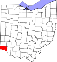 | |
| Villages | ||
| Townships | ||
| CDPs |
| |
| Other unincorporated communities | ||
| Footnotes | ‡This populated place also has portions in an adjacent county or counties | |