Reading, Ohio
| Reading, Ohio | |
|---|---|
| City | |
|
Benson Street downtown | |
| Motto: "The Crossroads of Opportunity" | |
 Location in Hamilton County and the state of Ohio. | |
| Coordinates: 39°13′22″N 84°26′21″W / 39.22278°N 84.43917°WCoordinates: 39°13′22″N 84°26′21″W / 39.22278°N 84.43917°W | |
| Country | United States |
| State | Ohio |
| County | Hamilton |
| Government | |
| • Mayor | Robert Bemmes (R)[1] |
| Area[2] | |
| • Total | 2.89 sq mi (7.49 km2) |
| • Land | 2.89 sq mi (7.49 km2) |
| • Water | 0 sq mi (0 km2) |
| Elevation[3] | 561 ft (171 m) |
| Population (2010)[4] | |
| • Total | 10,385 |
| • Estimate (2012[5]) | 10,348 |
| • Density | 3,593.4/sq mi (1,387.4/km2) |
| Time zone | Eastern (EST) (UTC-5) |
| • Summer (DST) | EDT (UTC-4) |
| ZIP codes | 45215, 45236, 45237 |
| Area code(s) | 513 |
| FIPS code | 39-65732[6] |
| GNIS feature ID | 1056486[3] |
| Website |
www |

Reading /ˈrɛdɪŋ/ is a city in Hamilton County, Ohio, United States. The population was 10,385 at the 2010 census.[7] It is a suburb of Cincinnati.
History
In 1794, a German immigrant by the name of Abraham Voorhees moved his family from their home near Philadelphia, building a large double log cabin along the west bank of the Millcreek in Sycamore Township. Shortly after, a visitor from Reading, PA (Harvey Redinbo) was pleased with the land that Voorhees had acquired and purchased his own land, in the area of Hunt Road and Columbia Avenue. This early settlement (1797) was known as Voorhees-Town, but was changed to Reading in the honor of Redinbo’s hometown, and the birthplace of his father-in-law (William Penn, founder of Pennsylvania – born in Reading, England).
Reading was incorporated as a village in 1851.[8]
Geography
Reading is located at 39°13′22″N 84°26′21″W / 39.22278°N 84.43917°W (39.222709, -84.439036).[9]
According to the United States Census Bureau, the city has a total area of 2.89 square miles (7.49 km2), all land.[2]
Demographics
| Historical population | |||
|---|---|---|---|
| Census | Pop. | %± | |
| 1860 | 1,230 | — | |
| 1870 | 1,575 | 28.0% | |
| 1880 | 2,680 | 70.2% | |
| 1900 | 3,076 | — | |
| 1910 | 3,985 | 29.6% | |
| 1920 | 4,540 | 13.9% | |
| 1930 | 5,723 | 26.1% | |
| 1940 | 6,079 | 6.2% | |
| 1950 | 7,836 | 28.9% | |
| 1960 | 12,832 | 63.8% | |
| 1970 | 14,617 | 13.9% | |
| 1980 | 12,843 | −12.1% | |
| 1990 | 12,038 | −6.3% | |
| 2000 | 11,292 | −6.2% | |
| 2010 | 10,385 | −8.0% | |
| Est. 2015 | 10,324 | [10] | −0.6% |
| Sources:[6][11][12][13] | |||
2010 census
As of the census[4] of 2010, there were 10,385 people, 4,554 households, and 2,624 families residing in the city. The population density was 3,593.4 inhabitants per square mile (1,387.4/km2). There were 4,962 housing units at an average density of 1,717.0 per square mile (662.9/km2). The racial makeup of the city was 89.1% White, 7.3% African American, 0.1% Native American, 1.0% Asian, 0.6% from other races, and 1.9% from two or more races. Hispanic or Latino of any race were 1.7% of the population.
There were 4,554 households of which 26.8% had children under the age of 18 living with them, 39.0% were married couples living together, 13.3% had a female householder with no husband present, 5.3% had a male householder with no wife present, and 42.4% were non-families. 36.6% of all households were made up of individuals and 11.1% had someone living alone who was 65 years of age or older. The average household size was 2.26 and the average family size was 2.97.
The median age in the city was 39.5 years. 21.6% of residents were under the age of 18; 8.6% were between the ages of 18 and 24; 27.2% were from 25 to 44; 27.5% were from 45 to 64; and 14.9% were 65 years of age or older. The gender makeup of the city was 49.1% male and 50.9% female.
2000 census
As of the census[6] of 2000, there were 11,292 people, 4,885 households, and 2,921 families residing in the city. The population density was 3,867.6 people per square mile (1,493.1/km²). There were 5,128 housing units at an average density of 1,756.4 per square mile (678.1/km²). The racial makeup of the city was 93.69% White, 3.20% African American, 0.16% Native American, 1.18% Asian, 0.02% Pacific Islander, 0.51% from other races, and 1.25% from two or more races. Hispanic or Latino of any race were 0.79% of the population.
There were 4,885 households out of which 27.1% had children under the age of 18 living with them, 44.7% were married couples living together, 11.0% had a female householder with no husband present, and 40.2% were non-families. 34.3% of all households were made up of individuals and 11.8% had someone living alone who was 65 years of age or older. The average household size was 2.27 and the average family size was 2.96.
In the city the population was spread out with 22.5% under the age of 18, 9.3% from 18 to 24, 31.1% from 25 to 44, 21.1% from 45 to 64, and 16.0% who were 65 years of age or older. The median age was 38 years. For every 100 females there were 94.8 males. For every 100 females age 18 and over, there were 91.2 males.
The median income for a household in the city was $39,140, and the median income for a family was $51,858. Males had a median income of $35,466 versus $26,250 for females. The per capita income for the city was $23,527. About 4.7% of families and 7.3% of the population were below the poverty line, including 7.8% of those under age 18 and 10.2% of those age 65 or over.
Education
Reading's public school system includes two neighborhood schools, Central Elementary and Hilltop Elementary, which both serve Pre-K through fifth grade. Reading Middle School is co-located with Central Elementary and houses grades 6-8. Reading High School serves grades 9-12 and is the home of the 2003 division III state boys basketball champions.
Reading includes a Roman Catholic all-girl's high school, Mount Notre Dame High School, where the daughter of Civil War general William Tecumseh Sherman was one of the first students. Two Catholic elementary schools, Sts. Peter and Paul Academy and St. Nicholas Academy, serve students in grades 1-8.
Reading is served by a branch of the Public Library of Cincinnati and Hamilton County.[14]
References
- ↑ "Hamilton County Officials 2016" (PDF). Hamilton County Board of Elections. 27 January 2016. p. 20. Retrieved 1 February 2016.
- 1 2 "US Gazetteer files 2010". United States Census Bureau. Retrieved 2013-01-06.
- 1 2 "US Board on Geographic Names". United States Geological Survey. 2007-10-25. Retrieved 2008-01-31.
- 1 2 "American FactFinder". United States Census Bureau. Retrieved 2013-01-06.
- ↑ "Population Estimates". United States Census Bureau. Retrieved 2013-06-17.
- 1 2 3 "American FactFinder". United States Census Bureau. Retrieved 2008-01-31.
- ↑ "Profile of General Population and Housing Characteristics: 2010 Demographic Profile Data (DP-1): Reading city, Ohio". U.S. Census Bureau, American Factfinder. Retrieved October 31, 2012.
- ↑ Nelson, S. B. (1894). "History of Cincinnati and Hamilton County, Ohio: Their Past and Present, Including...biographies and Portraits of Pioneers and Representative Citizens, etc., Volume 1". p. 449. Retrieved 11 December 2013.
- ↑ "US Gazetteer files: 2010, 2000, and 1990". United States Census Bureau. 2011-02-12. Retrieved 2011-04-23.
- ↑ "Annual Estimates of the Resident Population for Incorporated Places: April 1, 2010 to July 1, 2015". Retrieved July 2, 2016.
- ↑ "Number of Inhabitants: Ohio" (PDF). 18th Census of the United States. U.S. Census Bureau. Retrieved 22 November 2013.
- ↑ "Ohio: Population and Housing Unit Counts" (PDF). U.S. Census Bureau. Retrieved 22 November 2013.
- ↑ "Incorporated Places and Minor Civil Divisions Datasets: Subcounty Population Estimates: April 1, 2010 to July 1, 2012". U.S. Census Bureau. Retrieved 25 November 2013.
- ↑ "Reading Branch". Public Library of Cincinnati and Hamilton County. Retrieved 12 June 2014.
External links
Municipalities and communities of Hamilton County, Ohio, United States | ||
|---|---|---|
| Cities | 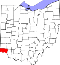 | |
| Villages | ||
| Townships | ||
| CDPs |
| |
| Other unincorporated communities | ||
| Footnotes | ‡This populated place also has portions in an adjacent county or counties | |