Hooven, Ohio
| Hooven, Ohio | |
|---|---|
| Census-designated place | |
 Location in Hamilton County and the state of Ohio. | |
| Coordinates: 39°10′41″N 84°45′33″W / 39.17806°N 84.75917°WCoordinates: 39°10′41″N 84°45′33″W / 39.17806°N 84.75917°W | |
| Country | United States |
| State | Ohio |
| County | Hamilton |
| Area | |
| • Total | 2.6 sq mi (6.8 km2) |
| • Land | 2.5 sq mi (6.6 km2) |
| • Water | 0.08 sq mi (0.2 km2) |
| Elevation[1] | 510 ft (160 m) |
| Population (2010) | |
| • Total | 534 |
| • Density | 200/sq mi (79/km2) |
| Time zone | Eastern (EST) (UTC-5) |
| • Summer (DST) | EDT (UTC-4) |
| ZIP code | 45033 |
| FIPS code | 39-36232[2] |
| GNIS feature ID | 1048851[1] |
Hooven is a census-designated place (CDP) in southeastern Whitewater Township, Hamilton County, Ohio, United States. The population was 534 at the 2010 census.,[3] with the ZIP code of 45033.
Geography
Hooven is located at 39°10′41″N 84°45′33″W / 39.17806°N 84.75917°W,[4] in the valley of the Great Miami River, 18 miles (29 km) northwest of downtown Cincinnati. State Route 128 is the main road through the community, running northeast to Miamitown. U.S. Route 50 forms the southern edge of the CDP, and Interstate 275 forms the northwestern edge, with access to Hooven via Exit 21. The Great Miami River is the eastern edge of the community.
According to the United States Census Bureau, the CDP has a total area of 2.6 square miles (6.8 km2), of which 2.5 square miles (6.6 km2) is land and 0.077 square miles (0.2 km2), or 2.96%, is water.[3]
References
- 1 2 "US Board on Geographic Names". United States Geological Survey. 2007-10-25. Retrieved 2008-01-31.
- ↑ "American FactFinder". United States Census Bureau. Retrieved 2008-01-31.
- 1 2 "Geographic Identifiers: 2010 Demographic Profile Data (G001): Hooven CDP, Ohio". U.S. Census Bureau, American Factfinder. Retrieved November 13, 2012.
- ↑ "US Gazetteer files: 2010, 2000, and 1990". United States Census Bureau. 2011-02-12. Retrieved 2011-04-23.
Municipalities and communities of Hamilton County, Ohio, United States | ||
|---|---|---|
| Cities | 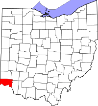 | |
| Villages | ||
| Townships | ||
| CDPs |
| |
| Other unincorporated communities | ||
| Footnotes | ‡This populated place also has portions in an adjacent county or counties | |