Brecon, Ohio
| Brecon, Ohio | |
|---|---|
| Census-designated place | |
 Location in Hamilton County and the state of Ohio. | |
| Coordinates: 39°16′50″N 84°21′23″W / 39.28056°N 84.35639°WCoordinates: 39°16′50″N 84°21′23″W / 39.28056°N 84.35639°W | |
| Country | United States |
| State | Ohio |
| County | Hamilton |
| Area | |
| • Total | 0.5 sq mi (1.4 km2) |
| • Land | 0.5 sq mi (1.4 km2) |
| • Water | 0 sq mi (0 km2) |
| Elevation[1] | 870 ft (270 m) |
| Population (2010) | |
| • Total | 244 |
| • Density | 450/sq mi (170/km2) |
| Time zone | Eastern (EST) (UTC-5) |
| • Summer (DST) | EDT (UTC-4) |
| FIPS code | 39-08378[2] |
| GNIS feature ID | 1064484[1] |
Brecon is a census-designated place (CDP) in Sycamore Township, Hamilton County, Ohio, United States. The population was 244 at the 2010 census.[3]
History
Brecon was a depot on the Cincinnati, Lebanon and Northern Railway. In 1894, it was described as a village of 50 inhabitants with a store, school and church.[4]
Geography
Brecon is located at 39°16′50″N 84°21′23″W / 39.28056°N 84.35639°W,[5] along East Kemper Road, 18 miles (29 km) northeast of downtown Cincinnati and just north of the interchange between Interstate 71 and Interstate 275. The community is bordered by the CDP of Highpoint to the north, unincorporated Sycamore Township to the east, the city of Montgomery to the south, the city of Blue Ash to the southwest, and the city of Sharonville to the northwest.
According to the United States Census Bureau, the CDP has a total area of 0.54 square miles (1.4 km2), all land.[3]
References
- 1 2 "US Board on Geographic Names". United States Geological Survey. 2007-10-25. Retrieved 2008-01-31.
- ↑ "American FactFinder". United States Census Bureau. Archived from the original on 2013-09-11. Retrieved 2008-01-31.
- 1 2 "Geographic Identifiers: 2010 Demographic Profile Data (G001): Brecon CDP, Ohio". U.S. Census Bureau, American Factfinder. Retrieved November 13, 2012.
- ↑ Nelson, S. B. (1894). History of Cincinnati and Hamilton County, Ohio: Their Past and Present, Including...biographies and Portraits of Pioneers and Representative Citizens, etc., Volume 1. p. 452. Retrieved 11 December 2013.
- ↑ "US Gazetteer files: 2010, 2000, and 1990". United States Census Bureau. 2011-02-12. Retrieved 2011-04-23.
Municipalities and communities of Hamilton County, Ohio, United States | ||
|---|---|---|
| Cities | 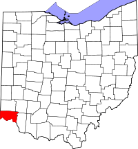 | |
| Villages | ||
| Townships | ||
| CDPs |
| |
| Other unincorporated communities | ||
| Footnotes | ‡This populated place also has portions in an adjacent county or counties | |