Dunlap, Ohio
| Dunlap, Ohio | |
|---|---|
| Census-designated place | |
 Location in Hamilton County and the state of Ohio. | |
| Coordinates: 39°17′31″N 84°37′5″W / 39.29194°N 84.61806°WCoordinates: 39°17′31″N 84°37′5″W / 39.29194°N 84.61806°W | |
| Country | United States |
| State | Ohio |
| County | Hamilton |
| Area | |
| • Total | 6.7 sq mi (17.3 km2) |
| • Land | 6.5 sq mi (16.9 km2) |
| • Water | 0.2 sq mi (0.4 km2) |
| Elevation[1] | 857 ft (261 m) |
| Population (2010) | |
| • Total | 1,719 |
| • Density | 260/sq mi (99/km2) |
| Time zone | Eastern (EST) (UTC-5) |
| • Summer (DST) | EDT (UTC-4) |
| FIPS code | 39-22960[2] |
| GNIS feature ID | 1064568[1] |
Dunlap is a census-designated place (CDP) in Colerain Township, Hamilton County, Ohio, United States. The population was 1,719 at the 2010 census.[3] The Siege of Dunlap's Station was a battle that took place near here on the Great Miami in 1791 during the Northwest Indian War.
Geography
Dunlap is located at 39°17′31″N 84°37′5″W / 39.29194°N 84.61806°W,[4] 15 miles (24 km) north of downtown Cincinnati. U.S. Route 27 runs through the eastern part of the CDP, and Colerain Avenue is the main road through the center of the community.
According to the United States Census Bureau, the CDP has a total area of 6.7 square miles (17.3 km2), of which 6.5 square miles (16.9 km2) is land and 0.15 square miles (0.4 km2), or 2.39%, is water.[3]
History
William and Asher Williamson owned a large part of the village site. They sold their land in 1849 to Mr. Parker who platted a number of lots along the Colerain Pike and Hamilton Road. In 1850, Oliver S. Glisson, an officer in the United States Navy, retained attorney Thomas S. Yeatman to lay out a subdivision south of the village on the farm of Glisson's recently deceased father, Thomas Glisson. George Struble built several of the first houses in the village on his farmland east of the pike. The village was originally named Georgetown in his honor.
The first business established was a blacksmith shop opened by Thomas Gray. Asher Williamson kept the first store and George Struble the first hotel. Dunlap post office, which had operated out of a cotton factory in Colerain was moved to the village and Dunlap became the de facto and then eventually the actual name for the village. By 1894, there were two churches, a schoolhouse, several stores and industries.[5]:384
References
- 1 2 "US Board on Geographic Names". United States Geological Survey. 2007-10-25. Retrieved 2008-01-31.
- ↑ "American FactFinder". United States Census Bureau. Retrieved 2008-01-31.
- 1 2 "Geographic Identifiers: 2010 Demographic Profile Data (G001): Dunlap CDP, Ohio". U.S. Census Bureau, American Factfinder. Retrieved November 13, 2012.
- ↑ "US Gazetteer files: 2010, 2000, and 1990". United States Census Bureau. 2011-02-12. Retrieved 2011-04-23.
- ↑ History of Cincinnati and Hamilton County, Ohio. Cincinnati, Ohio: S. B. Nelson & Company, Publishers. 1894.
Municipalities and communities of Hamilton County, Ohio, United States | ||
|---|---|---|
| Cities | 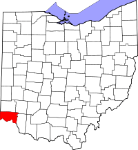 | |
| Villages | ||
| Townships | ||
| CDPs |
| |
| Other unincorporated communities | ||
| Footnotes | ‡This populated place also has portions in an adjacent county or counties | |