Calabarzon
| Calabarzon (Region IV-A) Southern Tagalog Mainland, Timog Katagalugan | |||||
|---|---|---|---|---|---|
| Region | |||||
| |||||
| |||||
 Location in the Philippines | |||||
| Coordinates: 14°00′N 121°30′E / 14°N 121.5°ECoordinates: 14°00′N 121°30′E / 14°N 121.5°E | |||||
| Country | Philippines | ||||
| Island group | Luzon | ||||
| Regional center | Calamba (Laguna) | ||||
| Area | |||||
| • Total | 16,873.31 km2 (6,514.82 sq mi) | ||||
| Population (2015 census)[1] | |||||
| • Total | 14,414,774 | ||||
| • Density | 850/km2 (2,200/sq mi) | ||||
| Time zone | PST (UTC+8) | ||||
| ISO 3166 code | PH-40 | ||||
| Provinces | |||||
| Cities | |||||
| Municipalities | 124 | ||||
| Barangays | 4,011 | ||||
| Cong. districts | 19 | ||||
| Languages | |||||
.JPG)

Calabarzon (/ká-lɑ-bɑr-zon/), formally known as Southern Tagalog Mainland[2] and designated as CALABARZON Region, is an administrative region in the Philippines. The region comprises five provinces: Cavite, Laguna, Batangas, Rizal, and Quezon; whose names form the acronym CALABARZON. Its regional center is Calamba in Laguna.
Situated just south of Metro Manila in southwestern Luzon, the region is the most populous in the Philippines, having 14,414,774 inhabitants in 2015, and is also the country's second most densely populated after NCR.[1] Prior to its creation as a region, Calabarzon, together with Mimaropa, formed the historical region known as Southern Tagalog, until they were separated in 2002 by virtue of Executive Order No. 103.
The region is home to some of the most important Philippine historical figures, most notable of which is the Philippines' national hero, Jose Rizal, who was born in Calamba.
History
Historical events occurring in the Calabarzon region date back as early as the year 900 with the appearance of the Laguna Copperplate Inscription, which referenced the cancellation of a debt as enforced by the Lakan of the Kingdom of Tondo. Natives in Batangas have populated the Pansipit River and have engaged in trade with China during the 13th century. The Southern Tagalog region was populated by independent villages composed of 50 to 100 families called barangays.
During the Spanish Era, the Philippines was divided into various provinces (alcadia governed by a provincial governor (alcalde mayor). By the time of the Philippine Revolution in 1898, the region that is now known as Calabarzon comprised the provinces of Cavite, Laguna (previously as La Laguna), Batangas, Morong (now named Rizal) and Tayabas (now named Quezon).
On June 5, 1901, a convention was called on whether or not the province of Manila should annex the province of Morong, which was found to be unable to be self-sufficient as a province. Eventually, on June 11, Act No. 137 of the First Philippine Commission abolished Morong and created a new province, named after the Philippines' national hero, Jose Rizal, who, coincidentally, was a native of Laguna. The new province comprised 29 municipalities, 17 from Manila and 12 from Morong. In 1902, Macario Sakay, a veteran Katipunan member, established the Tagalog Republic in the mountains of Rizal. Ultimately, Sakay's Tagalog Republic ended in 1906 when he and his men were betrayed under the guise of holding a national assembly aimed at the self-determination of the Filipino people.[3]
On September 7, 1946, the Third Philippine Republic enacted Republic Act No. 14, which renamed the province of Tayabas to Quezon, in honor of Manuel Quezon. Quezon was the second President of the Philippines and a native of Baler (now part of Aurora). In 1951, the northern part of Quezon became the sub-province Aurora, named after Quezon's wife.
On September 24, 1972, President Ferdinand Marcos enacted Presidential Decree No. 1, which organized the provinces into 11 regions as part of Marcos' Integrated Reorganization Plan. The IRP created Region IV, known as the Southern Tagalog region, and was the largest region in the Philippines. At this time, Region IV consisted of Batangas, Cavite, Laguna, Marinduque, Oriental Mindoro, Occidental Mindoro, Quezon, Rizal, Romblon, and Palawan. In 1979, Aurora formally became a province independent of Quezon and was also included in Region IV.

Executive Order No. 103, dated May 17, 2002, made great changes to the Southern Tagalog region. Due to its size, Region IV was split into two separate regions, Region IV-A (Calabarzon) and Region IV-B (Mimaropa). Aurora was transferred to Region III, Central Luzon.
Executive Order No. 246, dated October 28, 2003, Former President Gloria Arroyo declared Calamba City as the regional center of the region.[4]
Administrative divisions
Calabarzon comprises five provinces, 1 highly urbanized city, 18 component cities and 4,011 barangays.
| Province or HUC | Capital | Population (2015)[1] | Area[5] | Density | Cities | Muni. | Bgy. | |||||
|---|---|---|---|---|---|---|---|---|---|---|---|---|
| km2 | sq mi | /km2 | /sq mi | |||||||||
| Batangas | Batangas City | 18.7% | 2,694,335 | 3,119.75 | 1,204.54 | 860 | 2,200 | 3 | 31 | 1,078 | ||
| Cavite |
|
25.5% | 3,678,301 | 1,574.17 | 607.79 | 2,300 | 6,000 | 7 | 16 | 829 | ||
| Laguna | Santa Cruz | 21.1% | 3,035,081 | 1,917.85 | 740.49 | 1,600 | 4,100 | 6 | 24 | 681 | ||
| Quezon | Lucena | 12.9% | 1,856,582 | 8,989.39 | 3,470.82 | 210 | 540 | 1 | 39 | 1,209 | ||
| Rizal | Antipolo | 20.0% | 2,884,227 | 1,191.94 | 460.21 | 2,400 | 6,200 | 1 | 13 | 188 | ||
| Lucena | † | — | 1.8% | 266,248 | 80.21 | 30.97 | 3,300 | 8,500 | — | — | 33 | |
| Total | 14,414,774 | 16,873.31 | 6,319.77 | 850 | 2,200 | 20 | 124 | 4,011 | ||||
|
† Lucena is a highly-urbanized city; figures are excluded from Quezon province. | ||||||||||||
The region has 19 cities (18 component cities and the highly urbanized city of Lucena). Antipolo is the most populous city in CALABARZON Region and is the seventh most populous city in the Philippines while San Pedro City is the most densely populated city in the whole region. A large section of Calabarzon is considered part of the Greater Manila Area; while Batangas City is home to the Batangas metropolitan area. Calabarzon has a gross regional product of ₱1.65 trillion (at current prices), which accounts for 17% of the national GDP.[6]
| City | Population (2015)[1] | Area[7] | Density | City class | Income class | Province | ||
|---|---|---|---|---|---|---|---|---|
| AntipoloA | 776,386 | 306.10 | 118.19 | 2,500 | 6,500 | Component | 1st | Rizal |
| Bacoor | 600,609 | 46.17 | 17.83 | 13,000 | 34,000 | Component | 1st | Cavite |
| Batangas City | 329,874 | 282.96 | 109.25 | 1,200 | 3,100 | Component | 1st | Batangas |
| Biñan | 333,028 | 43.50 | 16.80 | 7,700 | 20,000 | Component | 1st | Laguna |
| Cabuyao | 308,745 | 43.40 | 16.76 | 7,100 | 18,000 | Component | 1st | Laguna |
| Calamba | 454,486 | 149.50 | 57.72 | 3,000 | 7,800 | Component | 1st | Laguna |
| Cavite City | 102,806 | 10.89 | 4.20 | 9,400 | 24,000 | Component | 4th | Cavite |
| Dasmariñas | 659,019 | 90.13 | 34.80 | 7,300 | 19,000 | Component | 1st | Cavite |
| General Trias | 314,303 | 81.46 | 31.45 | 3,900 | 10,000 | Component | 1st | Cavite |
| Imus | 403,785 | 64.70 | 24.98 | 6,200 | 16,000 | Component | 1st | Cavite |
| Lipa | 332,386 | 209.40 | 80.85 | 1,600 | 4,100 | Component | 1st | Batangas |
| Lucena | 266,248 | 80.21 | 30.97 | 3,300 | 8,500 | Highly Urbanized | 1st | Quezon |
| San Pablo | 266,068 | 197.56 | 76.28 | 1,300 | 3,400 | Component | 1st | Laguna |
| San Pedro | 325,809 | 24.05 | 9.29 | 14,000 | 36,000 | Component | 1st | Laguna |
| Santa Rosa | 353,767 | 54.84 | 21.17 | 6,500 | 17,000 | Component | 1st | Laguna |
| Tagaytay | 71,181 | 65.00 | 25.10 | 1,100 | 2,800 | Component | 2nd | Cavite |
| Tanauan | 173,366 | 107.16 | 41.37 | 1,600 | 4,100 | Component | 1st | Batangas |
| Tayabas | 99,779 | 230.95 | 89.17 | 430 | 1,100 | Component | 4th | Quezon |
| Trece Martires | 155,713 | 39.10 | 15.10 | 4,000 | 10,000 | Component | 4th | Cavite |
A Antipolo was declared a "highly-urbanized city" by President Benigno Aquino; such proclamation however still needs to be ratified in a plebiscite.[8]
B On August 7, 2000, the municipality of Los Baños, Laguna was declared as a "Special Science and Nature City of the Philippines"[9][10] through Presidential Proclamation No. 349[11] in recognition of its importance as a center for science and technology, being home to many prestigious educational, environmental and research institutions. This proclamation does not convert the municipality to a city or give it corporate powers that are accorded to other cities.
Demographics
| Population census of Calabarzon | ||
|---|---|---|
| Year | Pop. | ±% |
| 1990 | 6,349,452 | — |
| 2000 | 9,320,629 | +46.8% |
| 2010 | 12,609,803 | +35.3% |
| 2015 | 14,414,774 | +14.3% |
| Source: National Statistics Office[12][1] | ||
Calabarzon has a population of 14.4 million people, the largest of all the regions in the Philippines.[1] The population growth rate between 2000 and 2010 of 3.07% decreased from the growth rate between 1990 and 2000 of 3.91%, a trend which coincided with the rest of the nation. Life expectancy for men in Calabarzon is 68.9 years and 75.2 years for women. There are an estimated 356,000 Overseas Filipino Workers originally from Calabarzon.[13]
A vast majority of people living in Calabarzon are Tagalogs. It is estimated that around 5.8 million Tagalogs live in Region IV-A.[14] Taal, in particular, is considered the "Heartland of Tagalog Culture" and is currently the present "center" of Tagalog culture and people. Calabarzon is also home to a sizable amount of people with Chinese and Spanish ancestry on account of Chinese immigration and Spanish colonialization, respectively. Because of this large majority of Tagalog natives, the majority of people living in Calabarzon also speak the Tagalog language. Filipino, being a version of Tagalog, is also predominant in the region. English is also commonly spoken throughout Calabarzon and is the language of business and education. In Cavite, Chavacano, a Creole language is also commonly spoken.
The large majority of the population of Calabarzon is a part of the Roman Catholic church which accounts for 80% of the national population. Other Christian denominations present in the region are the Iglesia Ni Cristo, the Philippine Independent Church and Seventh-day Adventist Church. There are also Muslims living in Calabarzon although they are in the minority.
Economy
Calabarzon is the second largest contributor to the national GDP, accounting for 17% of the gross domestic product. The region boasts a 2.1% inflation rate, lower than the national average of 3%. The region has a 9.2% unemployment rate which is higher than the national average of 7%. Calabarzon, much like the rest of the country, is caught in the middle of being an industrial and an agricultural economy.
Due to the region's proximity to Metro Manila, a large amount of urbanization has taken place over the years. Cavite and Laguna in particular are sites of manufacturing and high-tech industries, with companies like Intel and Panasonic setting up plants in the region. Santa Rosa, Laguna, is home to a host of semi-conductor and automotive companies such as Amkor and Toyota, while General Trias is home to Cavite's largest economic development zone, the PEC Industrial Park.
The region still has a large agricultural base. As of 2002, the region had 282,700 farms, covering 588,500 hectares (1,454,000 acres), or 36.3% of the region's total land area.[15] Cavite alone has almost 70,500 hectares (174,000 acres) of agricultural land. Laguna is home to the International Rice Research Institute, which can be found within the University of the Philippines Los Baños, whose main goal is find sustainable ways to help rice farmers. Batangas, meanwhile, is home to a large pineapple and coconut industry, which is used to make Barong Tagalogs and native liqueurs such as lambanog and tuba in Tayabas City. Quezon is the country's leader in coconut products such as coconut oil and copra. Rizal is known for its piggeries. Region IV-A's agricultural base, however, is slowly decreasing. Due to their proximity to large bodies of water, Laguna and Batangas also have sizable fishing industries. Taal Lake is a large source of fresh water fishes for the country.
Tourism

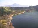
Due to the region's history and natural resources, tourism plays a major role in the regional economy. Cavite and Laguna are homes to various historical sites, such as the Rizal Shrine in Calamba City, tallest Jose Rizal Statue in the World, located in Calamba City and the Aguinaldo Shrine in Kawit, Cavite. San Pablo, Laguna is famous for its seven lakes, Pagsanjan for its majestic and world-famous waterfalls and Taal Lake in Batangas is a famous tourist destination. Tayabas City is known as the City of Festivals, Rest and Recreation Destination of Quezon and the Home of the Finest Lambanog. Minor Basilica of Saint Michael Archangel is the religious testaments of the Tayabenses and declared as National Cultural Treasures of the Philippines, the Casa Comunidad de Tayabas, the former office of the former President Manuel Luis Quezon and the place where Hermano Pule was sentenced to death, and the Malagonlong Bridge and the 9 other century-old Spanish arch type and National Cultural Treasure bridges. Their famous festivals which draws a lot of crowd since it was started like the Taytsinoy Festival, Mayohan Festival, Pa’yas Festival Hagisan Festival, Baliskog Festival, Angel Festival, Aguyod Festival and the Turumba Festival every Holy Week which made Tayabas the City of Festivals and their delectable cuisines like Budin, Yema Cake and Lambanog. Lucban is famous for the Kamay ni Hesus Shrine, a 50-foot statue of the Ascending Christ on top of a hill. Batangas is also famous for its scenic beaches in Nasugbu and Calatagan. Antipolo is another major tourist spot, found in Rizal. CALABARZON is also home to a multitude of baroque churches made during the Spanish Era.
The region is also home to a lot of mountains, such as Mount Makiling in Laguna, Mount Banahaw in Quezon and Mount Macolod in Batangas. Makiling and Banahaw are especially popular to tourists and mountain climbers. There is a legend surrounding Mt. Makiling regarding Maria Makiling, the mountain's so-called guardian fairy, while Mt. Banahaw is considered a Holy mountain, with pilgrims making the hike every Holy Week.
CALABARZON is also home to various theme parks, the most famous of which is Enchanted Kingdom, found in Santa Rosa, Laguna. Enchanted Kingdom is a 17-hectare (42-acre) theme park modeled after Knott's Berry Farm. Lemery, Batangas houses another theme park, Fantasy World.
Pasalubong also plays a major part of Calabarzon's tourism industry. Goods such as bibingka and cassava cake are sold to tourists, and shops usually line up roads. Vendors range from business franchises to street vendors who cook the goods on the spot. Souvenirs are also common, especially in tourist destinations such as Taal Lake. Shirts and keychains are commonly sold.
Official Seal
The seal was released on 2013, where the City Government of Calamba and the private Malaysian company AlloyMTD, started the construction of the regional government center in Brgy. Mapagong. The seal shows the map of Calabarzon on right, mountains depicting the mountain ranges of Sierra Madre and Mt. Makiling, and also a Philippine sun on the upper portion and Jose Rizal's face on the left portion of the seal, since Rizal, the Philippine national hero came from Calamba City; the regional government center.
See also
References
- 1 2 3 4 5 6 Census of Population (2015): Highlights of the Philippine Population 2015 Census of Population (Report). PSA. Retrieved 20 June 2016.
- ↑ "Philippines EIA". Emb.gov.ph. Retrieved 2012-10-29.
- ↑ Star: The mark of Sakay: The vilified hero of our war with America, retrieved March 9, 2013
- ↑ "Executive Order No. 246, s. 2003". Official Gazette of the Republic of the Philippines. Retrieved January 15, 2013.
- ↑ "PSGC Interactive; List of Provinces". Philippine Statistics Authority. Archived from the original on 21 January 2013. Retrieved 29 March 2016.
- ↑ GRDP by Region, National Statistical Coordination Board, retrieved March 10, 2013
- ↑ "PSGC Interactive; List of Cities". Philippine Statistics Authority. Archived from the original on 29 April 2011. Retrieved 30 March 2016.
- ↑ "Aquino declares Antipolo as Highly Urbanized City". GMA News Online. April 3, 2011. Retrieved 2014-07-09.
- ↑ "Los Banos, Laguna - Science and Nature City". Losbanos.gov.ph. Retrieved 2012-10-29.
- ↑ "Information for Prospective Students | University of the Philippines Los Baños". Old.uplb.edu.ph. Retrieved 2012-10-29.
- ↑ "Los Baños". Laguna Travel Guide. 2000-09-17. Retrieved 2012-10-29.
- ↑ "Population and Annual Growth Rates for The Philippines and Its Regions, Provinces, and Highly Urbanized Cities" (PDF). 2010 Census and Housing Population. National Statistics Office. Archived from the original (PDF) on 28 September 2013. Retrieved 9 August 2013.
- ↑ Quickstat on Region IVA (CALABARZON) - February 2013, National Statistics Office, retrieved March 10, 2013
- ↑ National Commission for Culture and Arts: Tagalog, National Commission for Culture and Arts
- ↑ A Review of the Agriculture Sector in CALABARZON National Statistics Office, Retrieved March 11, 2013
External links
![]() Media related to CALABARZON at Wikimedia Commons
Media related to CALABARZON at Wikimedia Commons

