Lafayette Parish, Louisiana
| Lafayette Parish, Louisiana | |
|---|---|
 Lafayette Parish Courthouse | |
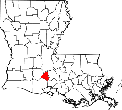 Location in the U.S. state of Louisiana | |
 Louisiana's location in the U.S. | |
| Founded | January 17, 1823 |
| Named for | Marquis de la Fayette |
| Seat | Lafayette |
| Largest city | Lafayette |
| Area | |
| • Total | 269 sq mi (697 km2) |
| • Land | 269 sq mi (697 km2) |
| • Water | 0.5 sq mi (1 km2), 0.2% |
| Population (est.) | |
| • (2015) | 240,098 |
| • Density | 825/sq mi (319/km²) |
| Congressional district | 3rd |
| Time zone | Central: UTC-6/-5 |
| Website |
www |
Lafayette Parish (French: Paroisse de Lafayette) is a parish located in the U.S. state of Louisiana. As of the 2010 census, the population was 221,578.[1] The parish seat is Lafayette.[2] The parish was founded in 1823.[3] It was named in honor of the Marquis de Lafayette, the French general who took part in the Continental Army in the American Revolutionary War and financially aided it.[4]
Lafayette Parish is part of the Lafayette, LA Metropolitan Statistical Area and Lafayette-Opelousas-Morgan City, LA Combined Statistical Area.
History
See History of Lafayette, Louisiana for main article.
Geography
According to the U.S. Census Bureau, the parish has a total area of 269 square miles (700 km2), of which 269 square miles (700 km2) is land and 0.5 square miles (1.3 km2) (0.2%) is water.[5] It is the fifth-smallest parish in Louisiana by land area and third-smallest by total area.
Major highways
Adjacent parishes
- St. Landry Parish (north)
- St. Martin Parish (east)
- Iberia Parish (southeast)
- Vermilion Parish (south)
- Acadia Parish (west)
National protected area
- Jean Lafitte National Historical Park and Preserve (part, in Lafayette)
Demographics
| Historical population | |||
|---|---|---|---|
| Census | Pop. | %± | |
| 1830 | 5,653 | — | |
| 1840 | 7,841 | 38.7% | |
| 1850 | 6,720 | −14.3% | |
| 1860 | 9,003 | 34.0% | |
| 1870 | 10,388 | 15.4% | |
| 1880 | 13,235 | 27.4% | |
| 1890 | 15,966 | 20.6% | |
| 1900 | 22,825 | 43.0% | |
| 1910 | 28,733 | 25.9% | |
| 1920 | 30,841 | 7.3% | |
| 1930 | 38,827 | 25.9% | |
| 1940 | 43,941 | 13.2% | |
| 1950 | 57,743 | 31.4% | |
| 1960 | 84,656 | 46.6% | |
| 1970 | 109,716 | 29.6% | |
| 1980 | 150,017 | 36.7% | |
| 1990 | 164,762 | 9.8% | |
| 2000 | 190,503 | 15.6% | |
| 2010 | 221,578 | 16.3% | |
| Est. 2015 | 240,098 | [6] | 8.4% |
| U.S. Decennial Census[7] 1790-1960[8] 1900-1990[9] 1990-2000[10] 2010-2013[1] | |||
This was an area of Cajun settlement and culture.[11] According to the 2000 US Census, there were 190,503 people, 72,372 households, and 48,851 families residing in the parish. The population density was 706 people per square mile (273/km²). There were 78,122 housing units at an average density of 290 per square mile (112/km²). The racial makeup of the parish was 73.36% White, 23.80% Black or African American, 0.28% Native American, 1.08% Asian, 0.03% Pacific Islander, 0.52% from other races, and 0.93% from two or more races. 1.74% of the population were Hispanic or Latino of any race. 14.37% reported speaking French or Cajun French at home, while 1.73% speak Spanish.
There were 72,372 households out of which 36.20% had children under the age of 18 living with them, 49.20% were married couples living together, 14.00% had a female householder with no husband present, and 32.50% were non-families. 25.40% of all households were made up of individuals and 6.90% had someone living alone who was 65 years of age or older. The average household size was 2.57 and the average family size was 3.12.
In the parish the population was spread out with 27.40% under the age of 18, 11.70% from 18 to 24, 31.20% from 25 to 44, 20.20% from 45 to 64, and 9.50% who were 65 years of age or older. The median age was 32 years. For every 100 females there were 94.40 males. For every 100 females age 18 and over, there were 91.40 males.
The median income for a household in the parish was $36,518, and the median income for a family was $45,158. Males had a median income of $36,428 versus $22,751 for females. The per capita income for the parish was $19,371. About 11.80% of families and 15.70% of the population were below the poverty line, including 18.20% of those under age 18 and 15.60% of those age 65 or over.
Politics
The parish voters often supported Democratic presidential candidates before the 1970s, but the majority of white conservatives have trended Republican since that time.[12] Before 1965 and passage of the Voting Rights Act by Congress, most African Americans were disenfranchised, as they had been since 1898, when Louisiana passed a new constitution establishing barriers to voter registration and voting. They were excluded from the political system. After regaining the power to register and vote, they tended to affiliate with and support national Democratic Party candidates.
The majority of the parish voted for the Republican Presidential candidates from 1992 to 2000, and did so by generally increasing margins. The results in 2004 gave Republican George W. Bush 64% of the vote and 57,732 votes while Democrat John F. Kerry won 35% of the vote and 31,210 votes. In the 2008 election Lafayette Parish cast the majority of its votes for Republican John McCain. He won 65% of the vote and 62,055 votes. Democrat Barack Obama was strongly supported by African Americans and won 34% of the vote, some 32,145 votes.[13]
Law Enforcement
Lafayette Parish Sheriff's Office
University of Louisiana at Lafayette Police Department
Education
Lafayette Parish School System operates public schools.
National Guard
The HQ and other units of the 256th IBCT reside in the city of Lafayette, Louisiana. This unit of over 3,500 Soldiers has deployed twice to Iraq, 2004-5 and 2010. This unit has also responded to disasters such as: Hurricane Katrina, Hurricane Gustav, Hurricane Isaac, and the Gulf of Mexico Oil Spill.
Communities
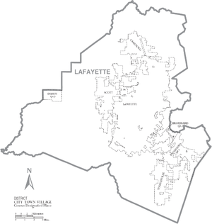
Cities
- Broussard
- Carencro
- Lafayette (parish seat)
- Scott
- Youngsville
Town
Census-designated places
Unincorporated communities
Prison
County
| Name | Address | Zip | Aged |
|---|---|---|---|
| Lafayette Parish Correctional Center | 916 Lafayette St, Lafayette, Louisiana | 70501 | 13+ |
Notable residents
- Lauren Daigle, (born 1991), Grammy-nominated CCM singer
- Jefferson Caffery, (1886-1974), U.S. Ambassador to El Salvador, Colombia, Cuba, Brazil, France and Egypt
- Benjamin Flanders, (1816-1896), politician, Alderman of New Orleans (1847-1852), founder of the Republican Party of Louisiana in 1864, appointed governor of Louisiana in 1867, retired in 1880s to his Ben Alva plantation here
- Jerry Luke LeBlanc (born 1956), former state legislator and vice president of administration and finance at the University of Louisiana at Lafayette
- Alexandre Mouton, (1804–1885), born in Attakapas, United States Senator and Governor of Louisiana.[14]
See also
- Lafayette Parish Sheriff's Office
- National Register of Historic Places listings in Lafayette Parish, Louisiana
References
- 1 2 "State & County QuickFacts". United States Census Bureau. Retrieved August 10, 2013.
- ↑ "Find a County". National Association of Counties. Retrieved 2011-06-07.
- ↑ "History". Lafayette County Sheriff's Office. Retrieved September 4, 2014.
- ↑ Gannett, Henry (1905). The Origin of Certain Place Names in the United States. Government Printing Office. p. 178.
- ↑ "2010 Census Gazetteer Files". United States Census Bureau. August 22, 2012. Retrieved September 1, 2014.
- ↑ "County Totals Dataset: Population, Population Change and Estimated Components of Population Change: April 1, 2010 to July 1, 2015". Retrieved July 2, 2016.
- ↑ "U.S. Decennial Census". United States Census Bureau. Retrieved September 1, 2014.
- ↑ "Historical Census Browser". University of Virginia Library. Retrieved September 1, 2014.
- ↑ "Population of Counties by Decennial Census: 1900 to 1990". United States Census Bureau. Retrieved September 1, 2014.
- ↑ "Census 2000 PHC-T-4. Ranking Tables for Counties: 1990 and 2000" (PDF). United States Census Bureau. Retrieved September 1, 2014.
- ↑ "American FactFinder". United States Census Bureau. Retrieved 2008-01-31.
- ↑ David Leip's Election Atlas
- ↑ The New York Times electoral map
- ↑ Who Was Who in America, Historical Volume, 1607-1896. Chicago: Marquis Who's Who. 1963.
External links
- Lafayette Consolidated Government
- Lafayette Economic Development Authority
- Lafayette Convention and Visitors Center
- Lafayette Public Library
- Lafayette Parish Clerk of Court
- Lafayette Parish American History and Genealogy Project
Geology
- Heinrich, P. V., and W. J. Autin, 2000, Baton Rouge 30 x 60 minute geologic quadrangle. Louisiana Geological Survey, Baton Rouge, Louisiana.
- Heinrich, P. V., J. Snead, and R. P. McCulloh, 2003, Crowley 30 x 60 minute geologic quadrangle. Louisiana Geological Survey, Baton Rouge, Louisiana.
 |
St. Landry Parish | | ||
| Acadia Parish | |
St. Martin Parish | ||
| ||||
| | ||||
| Vermilion Parish | Iberia Parish |
Municipalities and communities of Lafayette Parish, Louisiana, United States | ||
|---|---|---|
| Cities | | |
| Town | ||
| CDPs | ||
| Other unincorporated communities | ||
| Footnotes | ‡This populated place also has portions in an adjacent parish or parishes | |
Coordinates: 30°13′N 92°04′W / 30.21°N 92.06°W